File:WA in Australia map.png
Jump to navigation
Jump to search
No higher resolution available.
WA_in_Australia_map.png (200 × 186 pixels, file size: 11 KB, MIME type: image/png)
Captions
Captions
Add a one-line explanation of what this file represents
From en.wikipedia:
- 19:21, 22 Feb 2004 . . Morwen (11092 bytes)
- 04:46, 10 May 2003 . . Tim Starling (4050 bytes) (Created by me based on Geoscience Australia data)
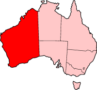
Description: Western Australia

|
File:Western Australia in Australia.svg is a vector version of this file. It should be used in place of this PNG file when not inferior.
File:WA in Australia map.png → File:Western Australia in Australia.svg
For more information, see Help:SVG. |
 |

|
Permission is granted to copy, distribute and/or modify this document under the terms of the GNU Free Documentation License, Version 1.2 or any later version published by the Free Software Foundation; with no Invariant Sections, no Front-Cover Texts, and no Back-Cover Texts. A copy of the license is included in the section entitled GNU Free Documentation License. |
| This file is licensed under the Creative Commons Attribution-Share Alike 3.0 Unported license. | ||
| ||
| This licensing tag was added to this file as part of the GFDL licensing update. |
File history
Click on a date/time to view the file as it appeared at that time.
| Date/Time | Thumbnail | Dimensions | User | Comment | |
|---|---|---|---|---|---|
| current | 12:59, 25 March 2005 | | 200 × 186 (11 KB) | Lukius~commonswiki (talk | contribs) | From en.wikipedia: # 19:21, 22 Feb 2004 . . Morwen (11092 bytes) # 04:46, 10 May 2003 . . Tim Starling (4050 bytes) (Created by me based on Geoscience Australia data) Description: Western Australia {{GFDL}} |
You cannot overwrite this file.
File usage on Commons
The following page uses this file:
File usage on other wikis
The following other wikis use this file:
- Usage on bn.wikipedia.org
- Usage on en.wikipedia.org
- Badgingarra National Park
- Brockman National Park
- Collier Range National Park
- Gloucester National Park
- Gooseberry Hill National Park
- Hassell National Park
- Moore River National Park
- Neerabup National Park
- Scott National Park
- Sir James Mitchell National Park
- Stokes National Park
- Tuart Forest National Park
- Walyunga National Park
- Warren National Park
- Windjana Gorge National Park
- Wolfe Creek Meteorite Crater National Park
- Kanowna, Western Australia
- Goat Paddock crater
- Buntine, Western Australia
- Namban
- Abrakurrie Cave
- Dalwallinu, Western Australia
- Montalivet Islands
- Cranbrook, Western Australia
- Narrikup, Western Australia
- Lesser stick-nest rat
- Poison Rocks
- Electoral district of Brown Hill
- Electoral district of Ivanhoe (Western Australia)
- Electoral district of Roebourne
- Austin Expedition of 1854
- Babakin, Western Australia
- Cervantes, Western Australia
- Canning Basin
- Burakin, Western Australia
- Amery, Western Australia
- Balingup, Western Australia
- Piawaning, Western Australia
- Bolgart, Western Australia
- Wonnerup, Western Australia
- Carrabin, Western Australia
- Bonnie Vale, Western Australia
- Serpentine, Western Australia
- Mundijong, Western Australia
- Western Power Corporation
- Elleker, Western Australia
- Marvel Loch, Western Australia
- Yellowdine, Western Australia
View more global usage of this file.