File:W.Va. TURNPIKE - THE ROAD HOME (7-05-06)=DURING THE RAIN AND FOG.jpg
Jump to navigation
Jump to search

Size of this preview: 800 × 598 pixels. Other resolutions: 320 × 239 pixels | 640 × 478 pixels | 1,024 × 765 pixels | 1,280 × 956 pixels | 2,294 × 1,714 pixels.
Original file (2,294 × 1,714 pixels, file size: 647 KB, MIME type: image/jpeg)
Captions
Captions
Add a one-line explanation of what this file represents
Summary
[edit]%3DDURING_THE_RAIN_AND_FOG.jpg&action=edit§ion=1)
| Description |
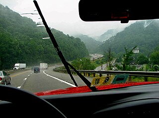
English: A DRIVE IN THE MOUNTAINS ON THE WEST VIRGINIA TURNPIKE (I-77/I-64) BETWEEN BECKLEY, WEST VIRGINIA AND CHARLESTON, WEST VIRGINIA. ALWAYS A "WHITE-KNUCKLE" DRIVE FOR MANY OUT-OF-STATERS. |
| Date | |
| Source | Own work |
| Author | HARRY W. McCORMACK (TEABERRYEAGLE) |
http://maps.live.com/#JnE9eXAuQkVDS0xFWSUyYytXViUyYytVU0ElN2Vzc3QuMCU3ZXBnLjEmYmI9MzcuOTE4MjY4ODMwNjEzMyU3ZS04MS4xMjkyMjY2ODQ1NzAzJTdlMzcuODg5NDg2MTA0OTMxOSU3ZS04MS4yMDE0OTYxMjQyNjc2 ... TRAVELING NORTH FROM BECKLEY ON US-19 WILL ALSO DRIVE ACROSS THE FAMOUS "NEW RIVER GORGE BRIDGE"
Licensing
[edit]%3DDURING_THE_RAIN_AND_FOG.jpg&action=edit§ion=2)
I, the copyright holder of this work, hereby publish it under the following license:
This file is licensed under the Creative Commons Attribution-Share Alike 3.0 Unported license.
- You are free:
- to share – to copy, distribute and transmit the work
- to remix – to adapt the work
- Under the following conditions:
- attribution – You must give appropriate credit, provide a link to the license, and indicate if changes were made. You may do so in any reasonable manner, but not in any way that suggests the licensor endorses you or your use.
- share alike – If you remix, transform, or build upon the material, you must distribute your contributions under the same or compatible license as the original.
File history
Click on a date/time to view the file as it appeared at that time.
| Date/Time | Thumbnail | Dimensions | User | Comment | |
|---|---|---|---|---|---|
| current | 14:50, 26 November 2008 | | 2,294 × 1,714 (647 KB) | Erik Baas (talk | contribs) | Border removed. == Summary == {{Information |Description={{en|1=A DRIVE IN THE MOUNTAINS ON THE WEST VIRGINIA TURNPIKE (I-77/I-64) BETWEEN BECKLEY, WEST VIRGINIA AND CHARLESTON, WEST VIRGINIA. ALWAYS A "WHITE-KNUCKLE" DRIVE FOR MANY OUT-OF-STATERS.}} |S |
| 16:07, 5 November 2008 |  | 2,380 × 1,804 (1.33 MB) | Teaberryeagle (talk | contribs) | {{Information |Description={{en|1=A DRIVE IN THE MOUNTAINS ON THE WEST VIRGINIA TURNPIKE (I-77/I-64) BETWEEN BECKLEY, WEST VIRGINIA AND CHARLESTON, WEST VIRGINIA. ALWAYS A "WHITE-KNUCKLE" DRIVE FOR MANY OUT-OF-STATERS.}} |Source=Own work by uploader |Aut |
You cannot overwrite this file.
File usage on Commons
There are no pages that use this file.
File usage on other wikis
The following other wikis use this file:
- Usage on fi.wiktionary.org
- Usage on www.wikidata.org
%3DDURING_THE_RAIN_AND_FOG.jpg&oldid=640760530)