File:W-INDIES.jpg
Jump to navigation
Jump to search
Size of this preview: 800 × 575 pixels. Other resolutions: 320 × 230 pixels | 640 × 460 pixels | 1,024 × 736 pixels | 1,280 × 920 pixels | 2,560 × 1,840 pixels | 3,500 × 2,516 pixels.
Original file (3,500 × 2,516 pixels, file size: 1.39 MB, MIME type: image/jpeg)
Captions
Captions
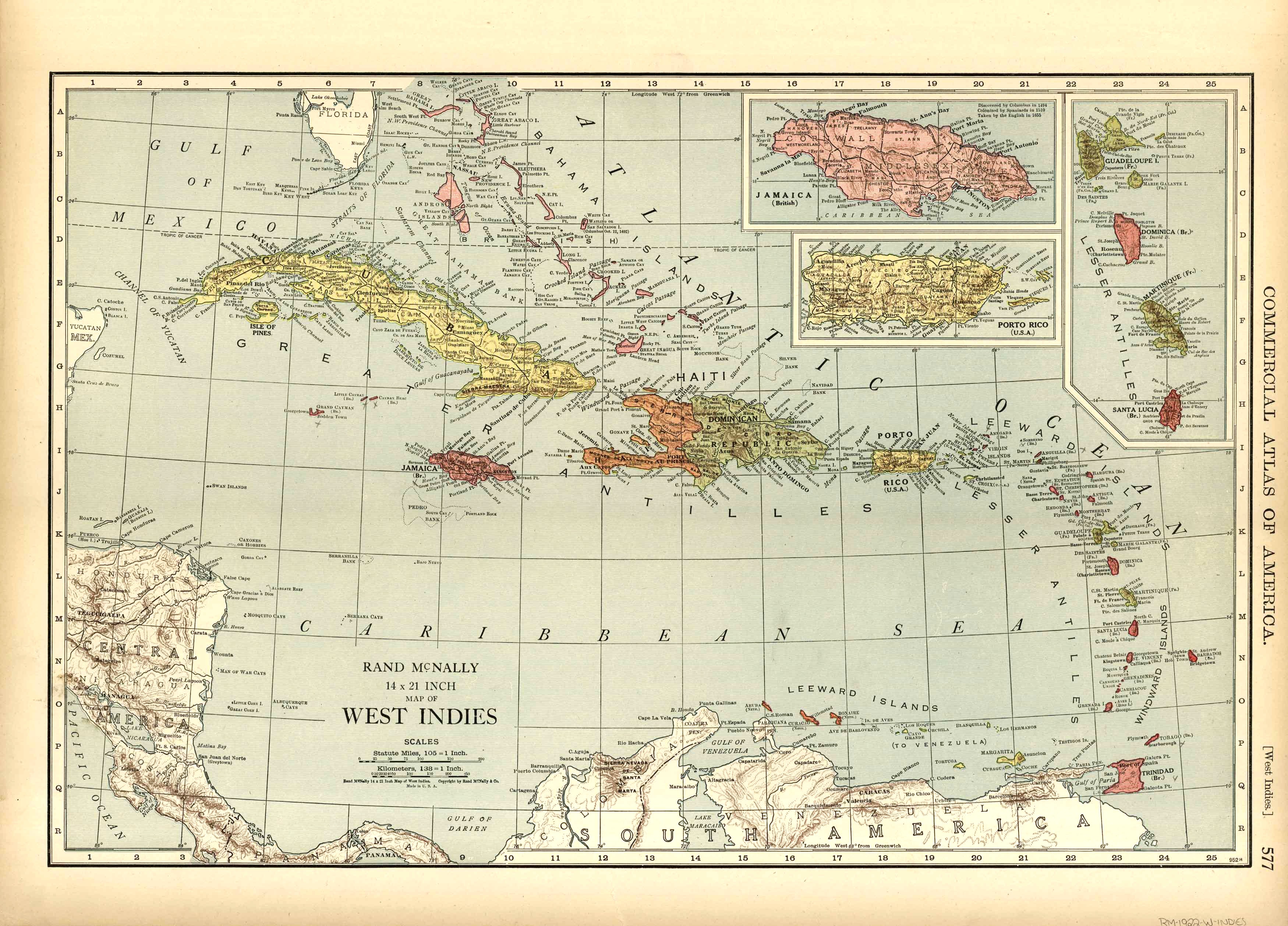
Map of the West Indies.
Summary
[edit]
| Description |
English: This map of the West Indies was produced by Rand McNally and Co. as part of its Commercial Atlas of America. The detail shown on each map is exceptional because of the map size. These maps were intended to be used by business for shipping, etc. Roads, railroads, and rivers are clearly shown. There is more detail on these maps than any others during this time period.
Printed Color, 19 x 12.5 inches. |
| Date | |
| Source | https://artsourceinternational.com/shop/antique-maps/map-of-the-west-indies-9/ |
| Author | Rand McNally and Co |
Licensing
[edit]
This work is in the public domain in the United States because it was published (or registered with the U.S. Copyright Office) before January 1, 1929.
Public domain works must be out of copyright in both the United States and in the source country of the work in order to be hosted on the Commons. If the work is not a U.S. work, the file must have an additional copyright tag indicating the copyright status in the source country.
Note: This tag should not be used for sound recordings. |
File history
Click on a date/time to view the file as it appeared at that time.
| Date/Time | Thumbnail | Dimensions | User | Comment | |
|---|---|---|---|---|---|
| current | 14:30, 8 November 2019 | | 3,500 × 2,516 (1.39 MB) | Poli.Pav (talk | contribs) | User created page with UploadWizard |
You cannot overwrite this file.
File usage on Commons
There are no pages that use this file.
File usage on other wikis
The following other wikis use this file:
- Usage on uk.wikipedia.org