File:Vulkangeschichte im Booser Doppelmaar.JPG
Jump to navigation
Jump to search

Size of this preview: 800 × 600 pixels. Other resolutions: 320 × 240 pixels | 640 × 480 pixels | 1,024 × 768 pixels | 1,280 × 960 pixels | 2,560 × 1,920 pixels | 4,000 × 3,000 pixels.
Original file (4,000 × 3,000 pixels, file size: 2.09 MB, MIME type: image/jpeg)
Captions
Captions
Add a one-line explanation of what this file represents
Summary
[edit]
| Description |
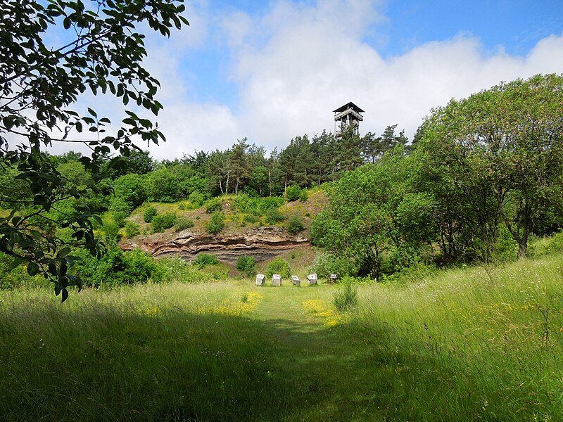
Deutsch: Das Booser Doppelmaar liegt in der Vulkaneifel von Rheinland-Pfalz (innerhalb des LSG „Rhein-Ahr-Eifel“, CDDA-Nr. 323834). Hier kann man im östlichen Maar das verwitterte Erdprofil eines Vulkans studieren. Dieses Geotop erklärt anhand von Schautafeln, wie die vorhandenen Gesteine durch vulkanische Vorgänge entstanden sind. Ein Rundweg führt entlang beider Maare und ist mit weiteren Hinweistafeln versehen. |
| Date | 21 June 2013, 10:22:45 |
| Source | Own work |
| Author | Annett Deistung |
Licensing
[edit]
I, the copyright holder of this work, hereby publish it under the following license:
This file is licensed under the Creative Commons Attribution-Share Alike 3.0 Unported license.
- You are free:
- to share – to copy, distribute and transmit the work
- to remix – to adapt the work
- Under the following conditions:
- attribution – You must give appropriate credit, provide a link to the license, and indicate if changes were made. You may do so in any reasonable manner, but not in any way that suggests the licensor endorses you or your use.
- share alike – If you remix, transform, or build upon the material, you must distribute your contributions under the same or compatible license as the original.
This image was uploaded as part of Wiki Loves Earth 2014.
|
File history
Click on a date/time to view the file as it appeared at that time.
| Date/Time | Thumbnail | Dimensions | User | Comment | |
|---|---|---|---|---|---|
| current | 22:43, 29 June 2014 | | 4,000 × 3,000 (2.09 MB) | TochterWofflebens (talk | contribs) | User created page with UploadWizard |
You cannot overwrite this file.
File usage on Commons
The following page uses this file: