File:Vuillemin and Migeon, Nouveau plan de Paris en 20 arrondissements, 1869 - David Rumsey.jpg
Jump to navigation
Jump to search
Size of this preview: 761 × 599 pixels. Other resolutions: 305 × 240 pixels | 609 × 480 pixels | 975 × 768 pixels | 1,280 × 1,008 pixels | 2,560 × 2,017 pixels | 5,177 × 4,078 pixels.
Original file (5,177 × 4,078 pixels, file size: 23.56 MB, MIME type: image/jpeg)
Captions
Captions
Add a one-line explanation of what this file represents
Summary
[edit]
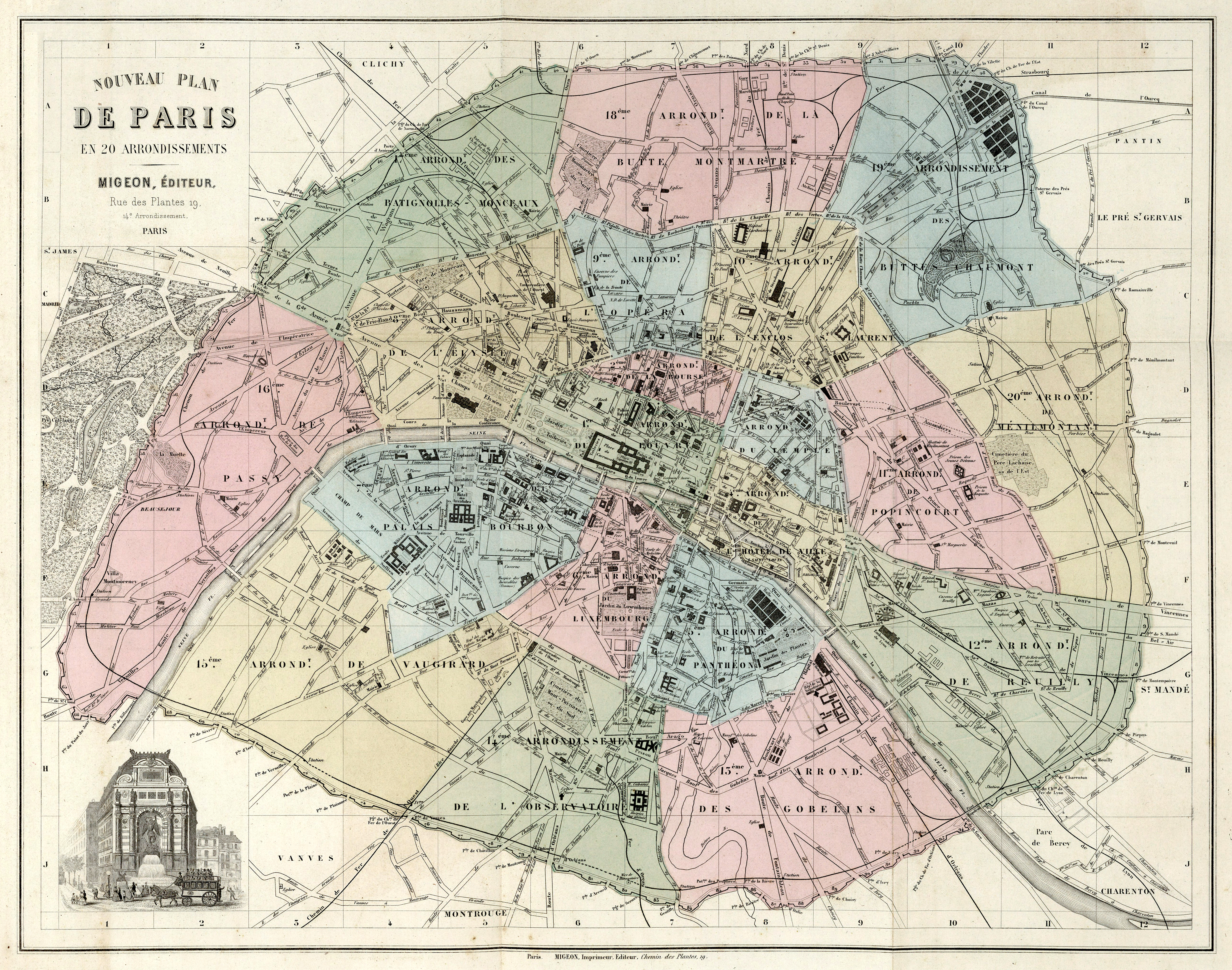
| Author |
A. Vuillemin and J. Migeon |
| Title |
Nouveau Plan de Paris en 20 Arrondissements. |
| Date | 1869 |
| Dimensions | height: 41 cm (16.1 in); width: 51 cm (20 in) |
| Collection | David Rumsey Historical Map Collection |
| Notes | Color maps, each accompanied by vignettes of local scenes, coats-of-arms, personages, animals, human activities, crops, etc. Provides one page of text and one facing map for each department and colony. Text includes statistics and distance and direction from Paris. |
| Source/Photographer | David Rumsey Historical Map Collection |
Licensing
[edit]
|
This work is in the public domain in its country of origin and other countries and areas where the copyright term is the author's life plus 100 years or fewer. | |
| This file has been identified as being free of known restrictions under copyright law, including all related and neighboring rights. | |
File history
Click on a date/time to view the file as it appeared at that time.
| Date/Time | Thumbnail | Dimensions | User | Comment | |
|---|---|---|---|---|---|
| current | 15:27, 7 September 2014 | | 5,177 × 4,078 (23.56 MB) | Paris 16 (talk | contribs) | |
| 11:56, 7 September 2014 |  | 5,766 × 4,870 (7.75 MB) | Paris 16 (talk | contribs) |
You cannot overwrite this file.
File usage on Commons
The following 2 pages use this file: