File:Volcan Putana Chili.jpg
From Wikimedia Commons, the free media repository
Jump to navigation
Jump to search

Size of this preview: 800 × 600 pixels. Other resolutions: 320 × 240 pixels | 640 × 480 pixels | 1,024 × 768 pixels | 1,280 × 960 pixels | 2,560 × 1,920 pixels | 2,816 × 2,112 pixels.
Original file (2,816 × 2,112 pixels, file size: 4.24 MB, MIME type: image/jpeg)
File information
Structured data
Captions
Captions
Add a one-line explanation of what this file represents
Summary
[edit]| DescriptionVolcan Putana Chili.jpg |
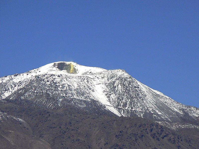
Français : Stratovolcan Putana (ou Jorgencal) 5890 m, situé à la Frontière Chilo - Bolivienne, (photo prise du coté chilien) Région II, province d'El Loa, Chili; On voit nettement des dépots de soufre dans la gueule du cratère. La neige rend bien visible le chemin qui mène au sommet
Español: Estratovolcán Putana (o Jorgencal) 5890 m.s.n.d.m., ubicado en la frontera de Chilo - Boliviana, (foto tomada en el lado chileno) Región II, provincia de El Loa, Chile; Los depósitos de azufre son claramente visibles en la boca del cráter. La nieve hace visible el camino a la cumbre
Deutsch: Stratovolcan Putana (oder Jorgencal) 5890 m, an der chilenisch-bolivianischen Grenze gelegen, (Aufnahme auf der chilenischen Seite) Region II, Provinz El Loa, Chile; Schwefelablagerungen sind in der Kratermündung deutlich sichtbar. Der Schnee macht den Weg zum Gipfel sichtbar |
| Date | |
| Source | Own work |
| Author | Bachelot Pierre J-P |
| Camera location | 22° 31′ 56″ S, 68° 02′ 42.19″ W | View this and other nearby images on: OpenStreetMap |
|---|
Licensing
[edit]This file is licensed under the Creative Commons Attribution-Share Alike 3.0 Unported, 2.5 Generic, 2.0 Generic and 1.0 Generic license.
Attribution: Bachelot Pierre J-P
- You are free:
- to share – to copy, distribute and transmit the work
- to remix – to adapt the work
- Under the following conditions:
- attribution – You must give appropriate credit, provide a link to the license, and indicate if changes were made. You may do so in any reasonable manner, but not in any way that suggests the licensor endorses you or your use.
- share alike – If you remix, transform, or build upon the material, you must distribute your contributions under the same or compatible license as the original.
| Annotations InfoField | This image is annotated: View the annotations at Commons |
810
869
306
194
2816
2112
Cratère sur lequel on voit du soufre
1271
1123
517
429
2816
2112
Sentier menant au sommet
File history
Click on a date/time to view the file as it appeared at that time.
| Date/Time | Thumbnail | Dimensions | User | Comment | |
|---|---|---|---|---|---|
| current | 16:38, 24 October 2012 |  | 2,816 × 2,112 (4.24 MB) | Bpierreb (talk | contribs) | User created page with UploadWizard |
You cannot overwrite this file.
File usage on Commons
The following page uses this file:
File usage on other wikis
The following other wikis use this file:
- Usage on en.wikipedia.org
- Usage on fa.wikipedia.org
- Usage on fr.wikipedia.org
- Usage on www.wikidata.org