File:Vockeroder Tor, Klassizistisches Tor, Sieglitzer Berg, Deich.jpg
Jump to navigation
Jump to search
Size of this preview: 800 × 389 pixels. Other resolutions: 320 × 156 pixels | 640 × 311 pixels | 1,024 × 498 pixels | 1,280 × 623 pixels | 2,560 × 1,245 pixels | 6,783 × 3,300 pixels.
Original file (6,783 × 3,300 pixels, file size: 6.28 MB, MIME type: image/jpeg)
Captions
Captions
Add a one-line explanation of what this file represents
Summary
[edit]
| Description |
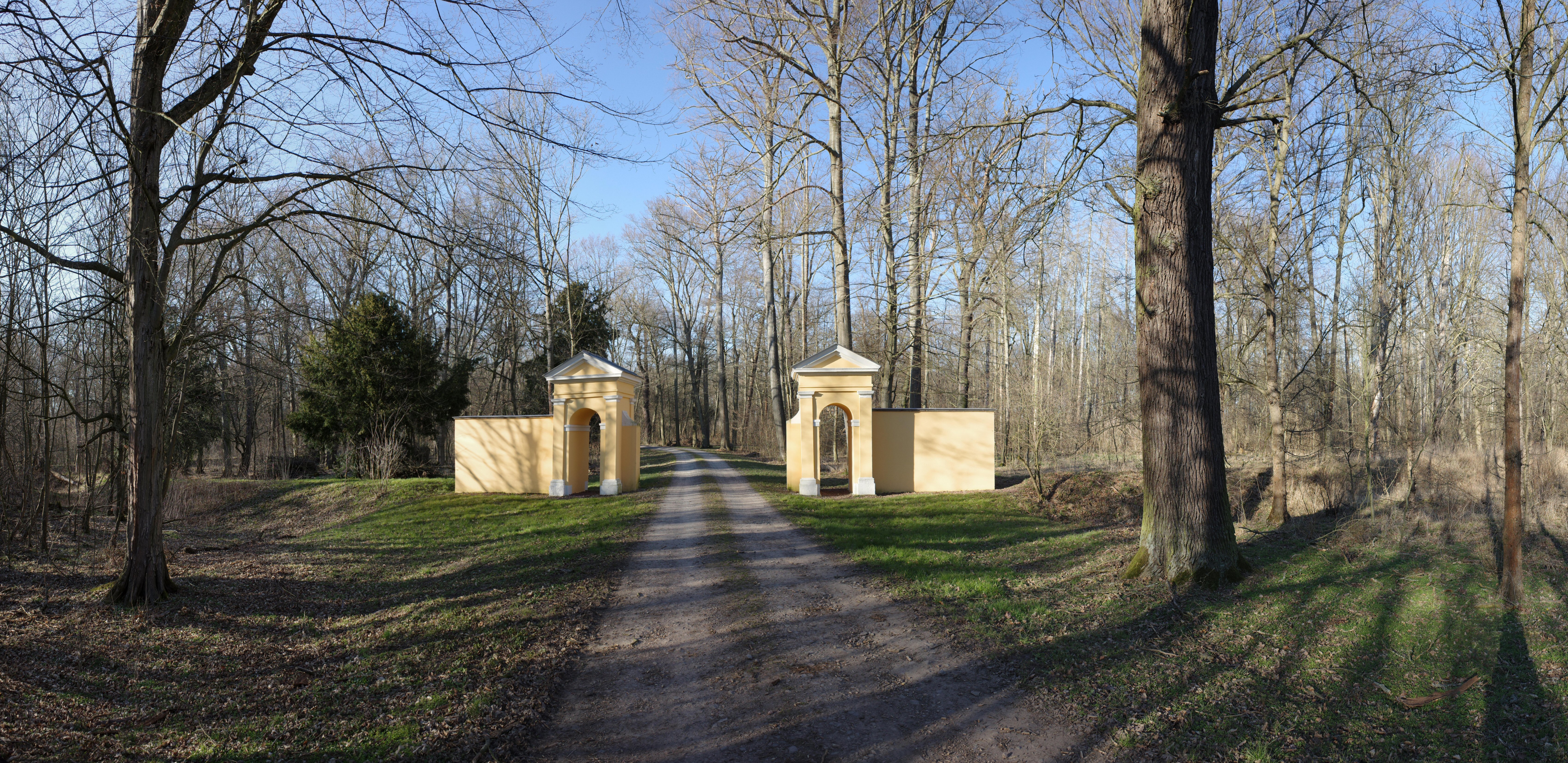
Deutsch: Oranienbaum-Wörlitz, Ortsteil Vockerode, Sieglitzer Berg. Deich mit dem Vockeroder Tor (Klassizistisches Tor). Der Deich ist die westliche und südliche Begrenzung des Landschaftsparks Sieglitzer Berg, nordwestlich von Vockerode in Elbnähe [1].
Deich:
Vockeroder Tor, Klassizistisches Tor:
|
||||
| Date | |||||
| Source | Own work | ||||
| Author | M_H.DE |
| Camera location | | View this and other nearby images on: OpenStreetMap |
|---|

|
NOTE: This image is a panorama consisting of multiple frames that were merged or stitched in software. As a result, this image necessarily underwent some form of digital manipulation. These manipulations may include blending, blurring, cloning, and colour and perspective adjustments. As a result of these adjustments, the image content may be slightly different from reality at the points where multiple images were combined. This manipulation is often required due to lens, perspective, and parallax distortions.
|
Licensing
[edit]
I, the copyright holder of this work, hereby publish it under the following license:
This file is licensed under the Creative Commons Attribution-Share Alike 4.0 International license.
- You are free:
- to share – to copy, distribute and transmit the work
- to remix – to adapt the work
- Under the following conditions:
- attribution – You must give appropriate credit, provide a link to the license, and indicate if changes were made. You may do so in any reasonable manner, but not in any way that suggests the licensor endorses you or your use.
- share alike – If you remix, transform, or build upon the material, you must distribute your contributions under the same or compatible license as the original.
File history
Click on a date/time to view the file as it appeared at that time.
| Date/Time | Thumbnail | Dimensions | User | Comment | |
|---|---|---|---|---|---|
| current | 19:13, 14 March 2022 | | 6,783 × 3,300 (6.28 MB) | M H.DE (talk | contribs) | {{Information |Description={{de|Oranienbaum-Wörlitz, Ortsteil Vockerode, Sieglitzer Berg. Deich mit dem Vockeroder Tor (Klassizistisches Tor). Der Deich ist die westliche und südliche Begrenzung des Landschaftsparks Sieglitzer Berg, nordwestlich von Vockerode in Elbnähe [https://sachsen-anhalt.de/fileadmin/Bibliothek/Landesaemter/LDA/Statische-Karte/index.html].}} Deich:{{Baudenkmal Sachsen-Anhalt|094 40448 018}} Vockeroder Tor, Klassizistisches Tor:{{Baudenkmal Sachsen-Anhalt|094 40448 007}... |
You cannot overwrite this file.
File usage on Commons
There are no pages that use this file.
File usage on other wikis
The following other wikis use this file:
- Usage on de.wikipedia.org