File:Viske Veddige.svg
Jump to navigation
Jump to search

Size of this PNG preview of this SVG file: 531 × 600 pixels. Other resolutions: 212 × 240 pixels | 425 × 480 pixels | 680 × 768 pixels | 907 × 1,024 pixels | 1,813 × 2,048 pixels | 2,612 × 2,950 pixels.
Original file (SVG file, nominally 2,612 × 2,950 pixels, file size: 1.14 MB)
Captions
Captions
Add a one-line explanation of what this file represents
| Description |
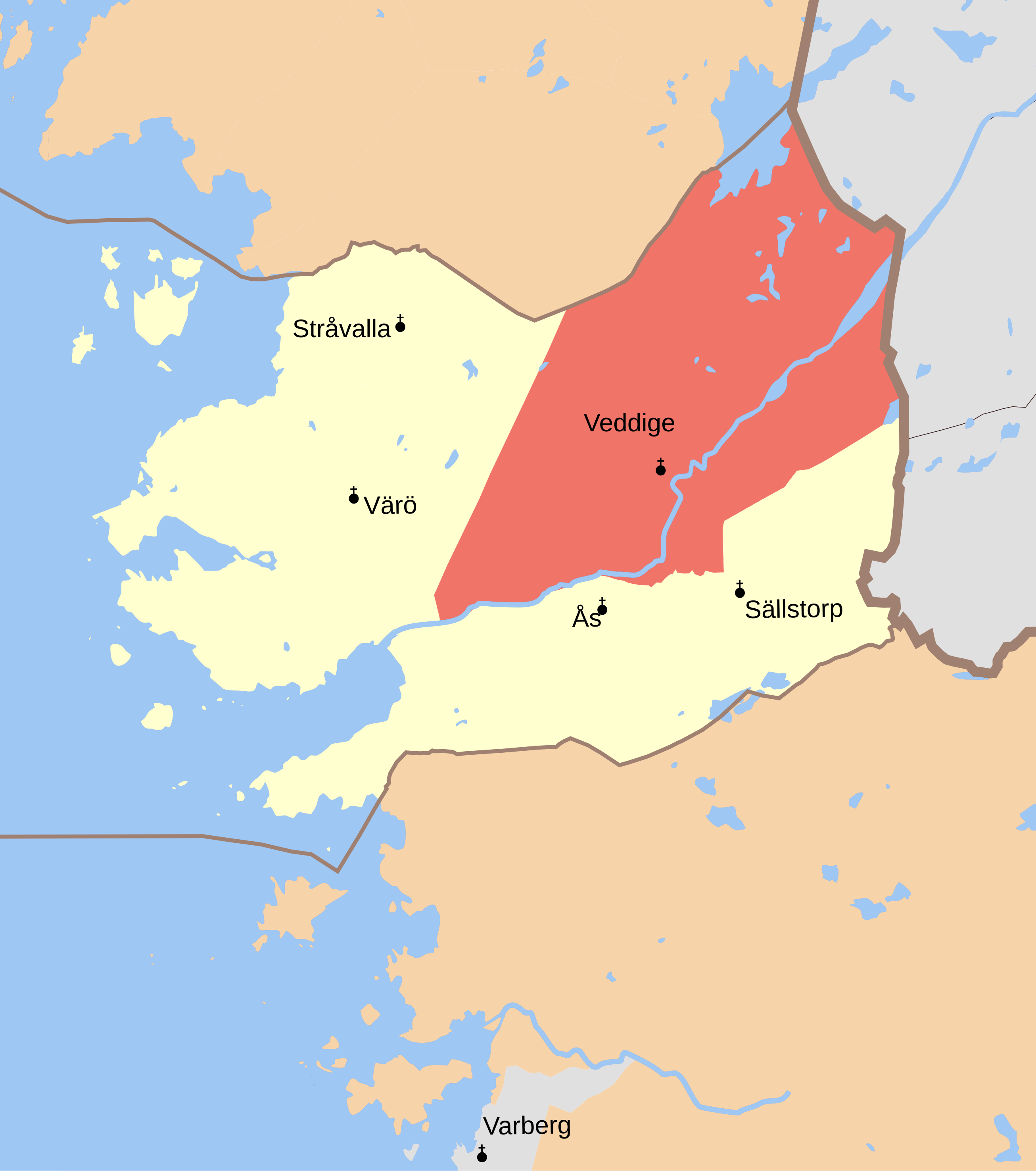
English: Map showing the borders of the civil parish of Veddige in the hundred of Viske, Halland County, Halland Region of Sweden. Circa 1850-1900. |
| Date | (UTC) |
| Source | |
| Author |
|
| This is a retouched picture, which means that it has been digitally altered from its original version. Modifications: Combined maps and cut out hundred of Vilske and marked Veddige parish. The original can be viewed here: GS Särö.svg:
|
This file is licensed under the Creative Commons Attribution-Share Alike 3.0 Unported license.
- You are free:
- to share – to copy, distribute and transmit the work
- to remix – to adapt the work
- Under the following conditions:
- attribution – You must give appropriate credit, provide a link to the license, and indicate if changes were made. You may do so in any reasonable manner, but not in any way that suggests the licensor endorses you or your use.
- share alike – If you remix, transform, or build upon the material, you must distribute your contributions under the same or compatible license as the original.
Original upload log
[edit]
This image is a derivative work of the following images:
- File:GS_Kungsbacka.svg licensed with Cc-by-3.0
- 2010-09-04T18:53:25Z Edaen 5950x4438 (719413 Bytes) {{Information |Description={{en|1=Map showing borders of parishes and hundreds in the vicinity of Kungsbacka, based on information from map by Topografiska Corpsen. '''Kongsbacka''' Geogr. längden är räknad från Stockhol
- File:GS_Varberg.svg licensed with Cc-by-3.0
- 2010-09-04T18:56:30Z Edaen 5963x4432 (612790 Bytes) {{Information |Description={{en|1=Map showing borders of parishes and hundreds in the vicinity of Varberg, based on information from map by Topografiska Corpsen. '''Warberg''' Grav. af Braese, Wennersten och Pettersson. Top
- File:GS_Särö.svg licensed with Cc-by-3.0
- 2010-09-05T16:52:47Z Edaen 5942x4388 (241265 Bytes) {{Information |Description={{en|1=Map showing borders of parishes and hundreds in the vicinity of Gothenburg, based on information from map by Topografiska Corpsen. '''Särö''' Grav. af G. Zintl. Topografiska Corpsens kart
Uploaded with derivativeFX
File history
Click on a date/time to view the file as it appeared at that time.
| Date/Time | Thumbnail | Dimensions | User | Comment | |
|---|---|---|---|---|---|
| current | 17:42, 5 September 2010 | | 2,612 × 2,950 (1.14 MB) | Edaen (talk | contribs) | {{Information |Description={{en|1=Map showing borders of parishes and hundreds in the vicinity of Kungsbacka, based on information from map by Topografiska Corpsen. <small>'''Kongsbacka''' Geogr. längden är räknad från Stockholms Observatorium, belä |
You cannot overwrite this file.
File usage on Commons
The following page uses this file:
File usage on other wikis
The following other wikis use this file:
- Usage on da.wikipedia.org
- Usage on sv.wikipedia.org
- Usage on www.wikidata.org