File:Villarino 1779.jpg
Original file (1,392 × 1,648 pixels, file size: 587 KB, MIME type: image/jpeg)
Captions
Captions
Summary
[edit]
| Description |
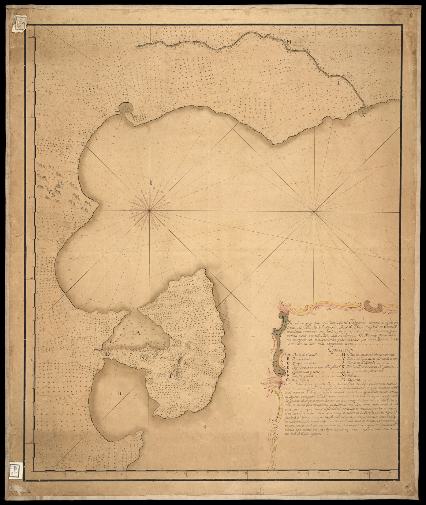
Español: Mapa de las exploraciones de 1779 elaborado por Basilio Villarino.
A. Puerto de San José. B. Puerto Nuevo. C. El mayor surgidero. D. Angostura de tierra entre Puerto Nuevo y San José. E. Campamento y pozos. F. Fuentes y salina. G. Otra salina. H. Pozo de agua salobre permanente. Y. Pozos de agua dulce y cerros de arena. J. Puerto de San Antonio. K. Río Negro nombrado por los indios Río Grande. L. Campamento y tolderías. M. Salina. N. Lagunas. |
| Date | |
| Source | https://journals.openedition.org/corpusarchivos/docannexe/image/1409/img-3.jpg |
| Author | Basilio Villarino |
Licensing
[edit]
|
This work is in the public domain in its country of origin and other countries and areas where the copyright term is the author's life plus 70 years or fewer. This work is in the public domain in the United States because it was published (or registered with the U.S. Copyright Office) before January 1, 1929. | |
| This file has been identified as being free of known restrictions under copyright law, including all related and neighboring rights. | |
File history
Click on a date/time to view the file as it appeared at that time.
| Date/Time | Thumbnail | Dimensions | User | Comment | |
|---|---|---|---|---|---|
| current | 02:57, 4 August 2020 | | 1,392 × 1,648 (587 KB) | MrFran55 (talk | contribs) | Uploaded a work by Basilio Villarino from https://journals.openedition.org/corpusarchivos/docannexe/image/1409/img-3.jpg with UploadWizard |
You cannot overwrite this file.
File usage on Commons
There are no pages that use this file.
File usage on other wikis
The following other wikis use this file:
- Usage on es.wikipedia.org