File:Village green, Condicote - geograph.org.uk - 1747669.jpg
Original file (4,000 × 3,000 pixels, file size: 4.53 MB, MIME type: image/jpeg)
Captions
Captions
Summary
[edit]
| Description |
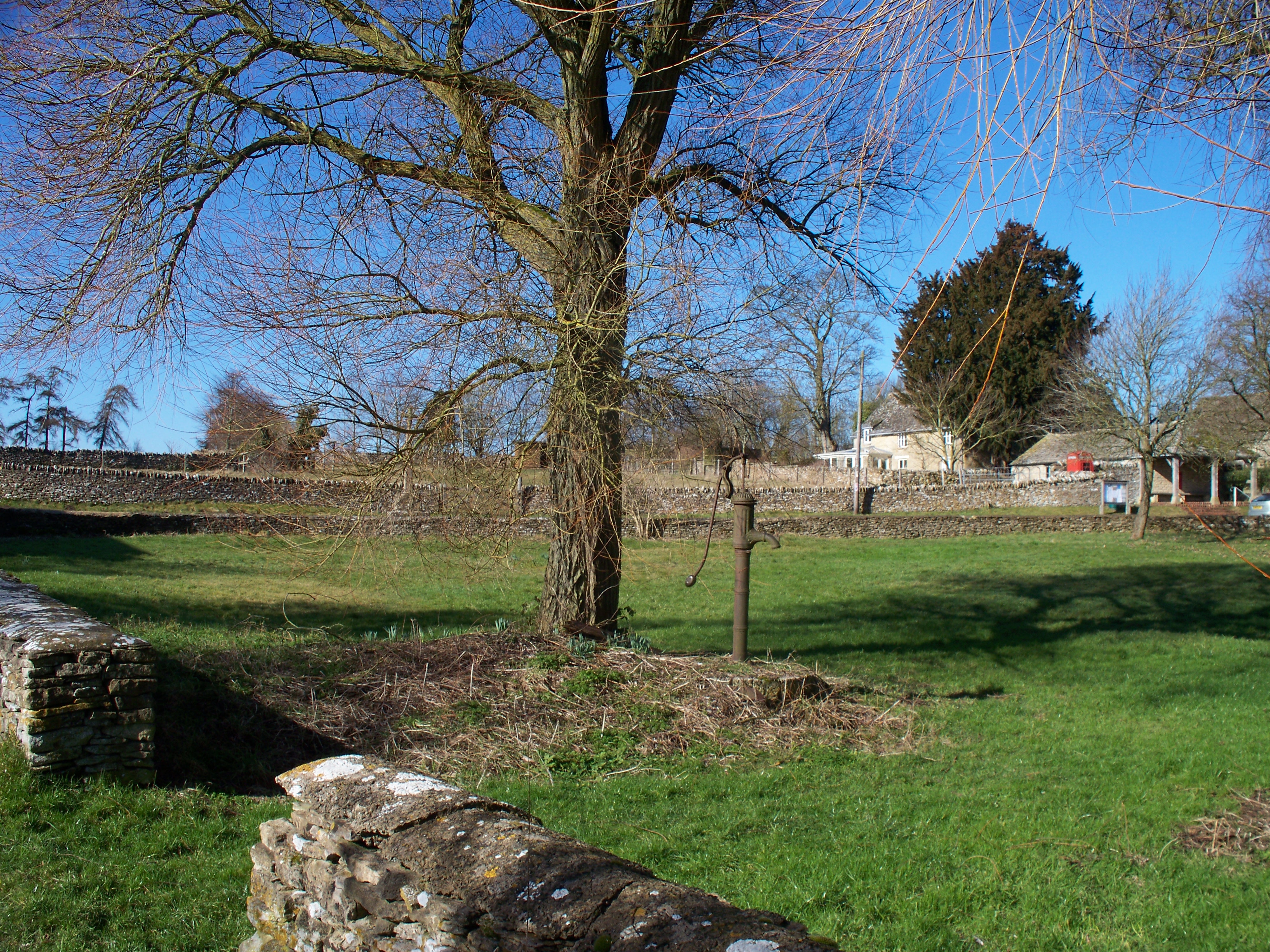
English: Village green, Condicote An attractive village in the centre of an area rich in history and historical remains.
"On the western side of the green is a spring marked by a cross of which the basethree steps and a socketsurvive from the late 14th century. A new shaft and finial-cross were added in 1864. The finial-cross was later destroyed and was replaced in 1888 by one from the western gable-end of the church. The reputation of the spring as a holy well is thought to be a possible cause for the location of Condicote Camp. Certainly the spring made possible the settlement of the village, whose chief supply it was until the mid-20th century. Beneath the base of the cross, perhaps contemporary with it, was a cistern or dip-well, which by 1868 was fitted with a pair of doors. The supply was evidently then in some danger of contamination, and before 1926 the cistern was sealed off and a pump took its place. From before 1700 until about the mid19th century the spring filled a pond on the south side of the green. By 1882 the pond also was replaced by a pump, and a pump still marked the site in 1960. A main water supply, however, was brought to the village in 1937." From: 'Parishes: Condicote', A History of the County of Gloucester: volume 6 (1965), pp. 63-72. |
| Date | |
| Source | From geograph.org.uk |
| Author | Michael Dibb |
| Attribution (required by the license) | Michael Dibb / Village green, Condicote / |
| Camera location | | View this and other nearby images on: OpenStreetMap |
|---|
_heading:292.00&language=en)
| Object location | | View this and other nearby images on: OpenStreetMap |
|---|
_heading:292.00&language=en)
Licensing
[edit]

|
This image was taken from the Geograph project collection. See this photograph's page on the Geograph website for the photographer's contact details. The copyright on this image is owned by Michael Dibb and is licensed for reuse under the Creative Commons Attribution-ShareAlike 2.0 license.
|
- You are free:
- to share – to copy, distribute and transmit the work
- to remix – to adapt the work
- Under the following conditions:
- attribution – You must give appropriate credit, provide a link to the license, and indicate if changes were made. You may do so in any reasonable manner, but not in any way that suggests the licensor endorses you or your use.
- share alike – If you remix, transform, or build upon the material, you must distribute your contributions under the same or compatible license as the original.
File history
Click on a date/time to view the file as it appeared at that time.
| Date/Time | Thumbnail | Dimensions | User | Comment | |
|---|---|---|---|---|---|
| current | 20:50, 5 March 2011 | | 4,000 × 3,000 (4.53 MB) | GeographBot (talk | contribs) | == {{int:filedesc}} == {{Information |description={{en|1=Village green, Condicote An attractive village in the centre of an area rich in history and historical remains. "On the western side of the green is a spring marked by a cross of which the base |
You cannot overwrite this file.
File usage on Commons
There are no pages that use this file.