File:Viktoriasee Südufer 1897 2.png
Jump to navigation
Jump to search

Size of this preview: 777 × 600 pixels. Other resolutions: 311 × 240 pixels | 622 × 480 pixels | 995 × 768 pixels | 1,280 × 988 pixels | 2,560 × 1,977 pixels | 4,297 × 3,318 pixels.
Original file (4,297 × 3,318 pixels, file size: 3.27 MB, MIME type: image/png)
Captions
Captions
Add a one-line explanation of what this file represents
| Description |
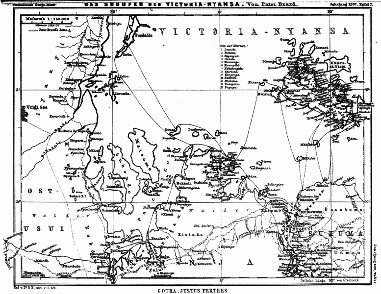
English: Map of the south western banks of the Lake Victoria (then "Lake Victoria-Nyansa") in the northwestern zoning area of the then colony "German East Africa") with the travel routes of Pater Brard and other travellers of the 1890s, map from 1897, in contemporary Tanzania
Deutsch: Karte des südwestlichen Uferbereichs des Viktoriasees (damals "Viktoria-Nyansa-See") im nordwestlichen Grenzgebiet der damaligen Kolonie Deutsch-Ostafrika mit der Reiseroute des Paters Brard und anderer Reisender aus den 1890ern, Karte von 1897; im heutigen Tansania Original caption: " Das Südufer des Victoria-Nyansa " |
||||
| Date | |||||
| Source | Dr.A.Petermann's Mitteilungen aus Justus Perthes Geographischer Anstalt (Gotha), vol.43, 1897 | ||||
| Author |
Pater Brard (tavels and templates), Carl Schmidt (drawing and autography), B. Hassenstein (edit), Justus Perthes Geographische Anstalt zu Gotha (publishing company) |
||||
| Permission (Reusing this file) |
|
||||
| Other versions |
|
||||

File history
Click on a date/time to view the file as it appeared at that time.
| Date/Time | Thumbnail | Dimensions | User | Comment | |
|---|---|---|---|---|---|
| current | 12:31, 29 June 2016 | | 4,297 × 3,318 (3.27 MB) | Katharinaiv (talk | contribs) | {{Information |Description ={{en|1=Map of the south western banks of the Lake Victoria (then "Lake Victoria-Nyansa") in the northwestern zoning area of the then colony "German East Africa") with the travel routes of ''Pater'' Brard and other travell... |
You cannot overwrite this file.
File usage on Commons
The following 3 pages use this file: