File:View of downtown Seattle from Beacon Hill, 1952 (48843327732).jpg
Jump to navigation
Jump to search
Size of this preview: 767 × 600 pixels. Other resolutions: 307 × 240 pixels | 614 × 480 pixels | 983 × 768 pixels | 1,280 × 1,001 pixels | 2,560 × 2,001 pixels | 6,000 × 4,690 pixels.
Original file (6,000 × 4,690 pixels, file size: 4.85 MB, MIME type: image/jpeg)
Captions
Captions
Add a one-line explanation of what this file represents
Summary
[edit]| Description |
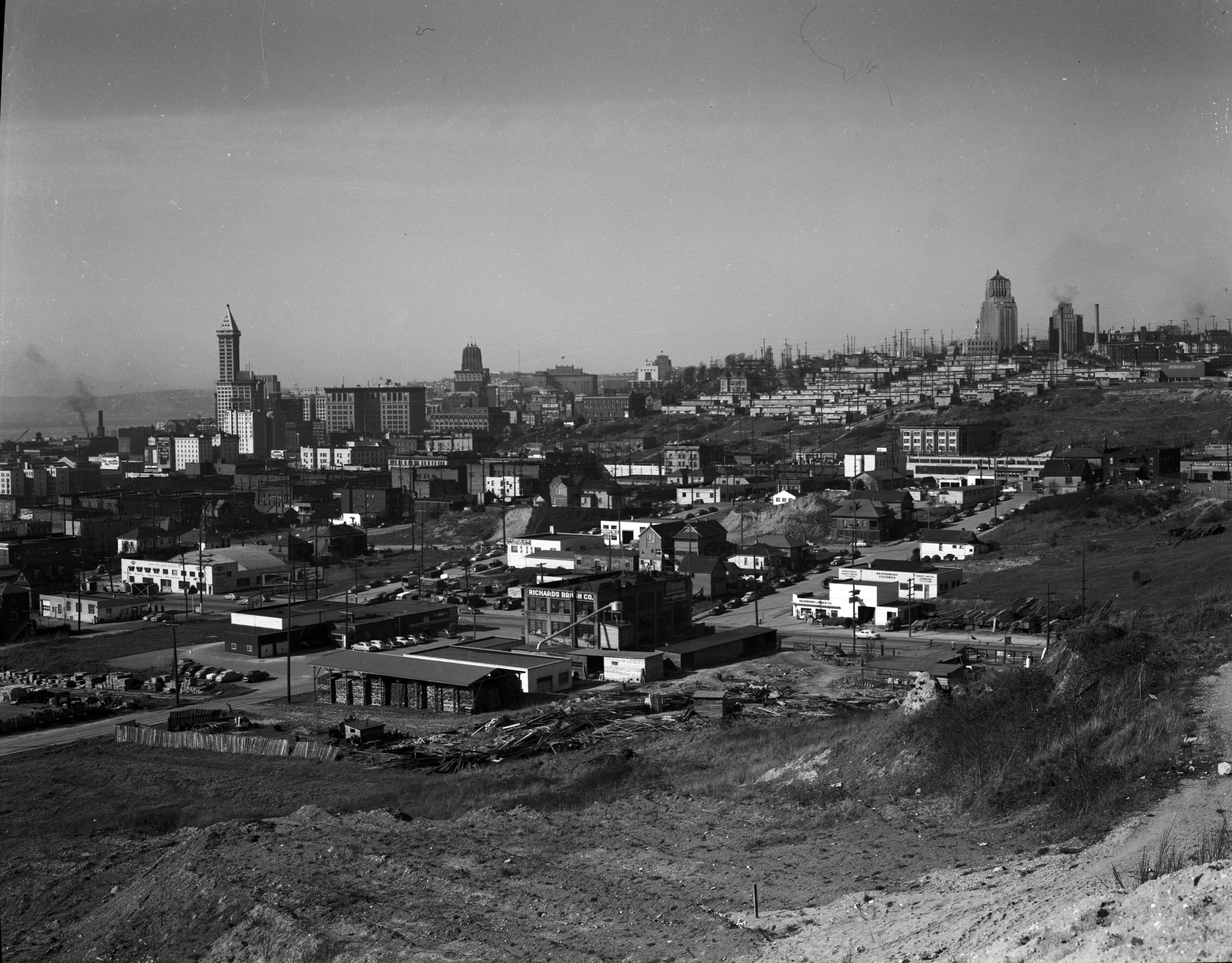
Taken during construction of Interstate 5. Item 43394, Engineering Department Photographic Negatives (Record Series 2613-07), Seattle Municipal Archives. English: View of downtown Seattle, Washington, U.S. from Beacon Hill, 1952 . |
||||||||||||||||||||
| Date | Taken on 6 March 1952 | ||||||||||||||||||||
| Source |
View of downtown from Beacon Hill, 1952 This image comes from the Seattle Municipal Archives, via Flickr.
|
||||||||||||||||||||
| Author | Seattle Municipal Archives from Seattle, WA | ||||||||||||||||||||
.jpg)
.jpg&action=edit§ion=1)
| Camera location | | View this and other nearby images on: OpenStreetMap |
|---|
.jpg¶ms=047.595051_N_-122.322120_E_globe:Earth_type:camera_source:Flickr_&language=en)
Licensing
[edit].jpg&action=edit§ion=2)
This file is licensed under the Creative Commons Attribution 2.0 Generic license.
- You are free:
- to share – to copy, distribute and transmit the work
- to remix – to adapt the work
- Under the following conditions:
- attribution – You must give appropriate credit, provide a link to the license, and indicate if changes were made. You may do so in any reasonable manner, but not in any way that suggests the licensor endorses you or your use.
| This image was originally posted to Flickr by Seattle Municipal Archives at https://flickr.com/photos/24256351@N04/48843327732 (archive). It was reviewed on 23 October 2019 by FlickreviewR 2 and was confirmed to be licensed under the terms of the cc-by-2.0. |
| Annotations | This image is annotated: View the annotations at Commons |
.jpg)
File history
Click on a date/time to view the file as it appeared at that time.
| Date/Time | Thumbnail | Dimensions | User | Comment | |
|---|---|---|---|---|---|
| current | 05:30, 23 October 2019 | 6,000 × 4,690 (4.85 MB) | Jmabel (talk | contribs) | High resolution | |
| 05:18, 23 October 2019 | 700 × 547 (86 KB) | Jmabel (talk | contribs) | Transferred from Flickr via #flickr2commons |
You cannot overwrite this file.
File usage on Commons
The following page uses this file:
.jpg&oldid=815556602)