File:View of Miribel from the top of Vierge du Mas Rillier.JPG
Jump to navigation
Jump to search
Size of this preview: 800 × 600 pixels. Other resolutions: 320 × 240 pixels | 640 × 480 pixels | 1,024 × 768 pixels | 1,280 × 960 pixels | 2,560 × 1,920 pixels | 4,320 × 3,240 pixels.
Original file (4,320 × 3,240 pixels, file size: 4.89 MB, MIME type: image/jpeg)
Captions
Captions
Add a one-line explanation of what this file represents
Summary
[edit]| Camera location | | View this and other nearby images on: OpenStreetMap |
|---|
| Description |
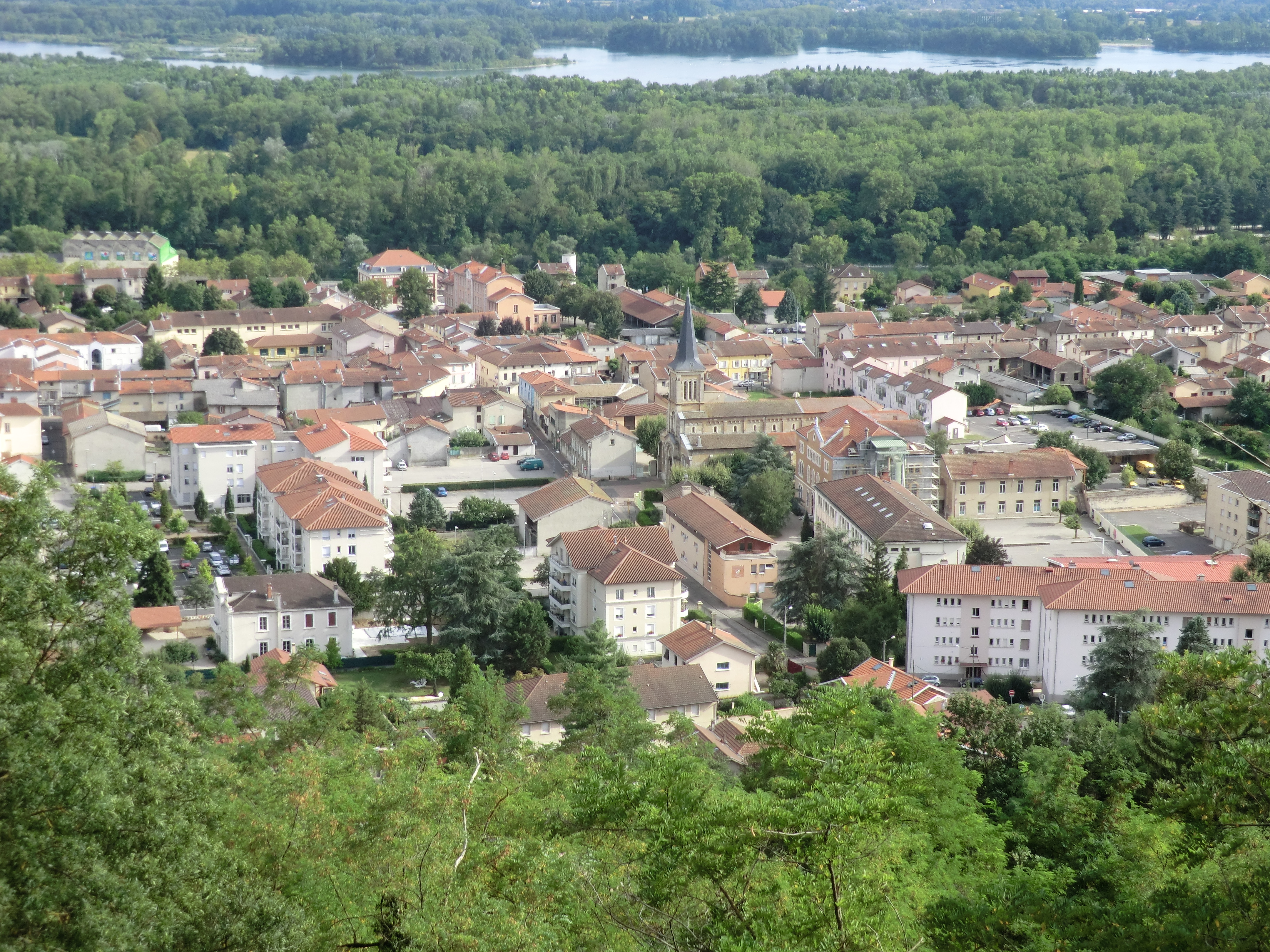
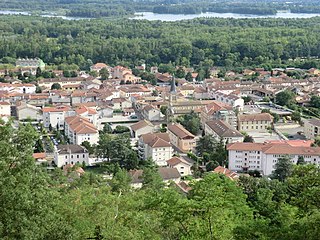
English: View of Miribel from the top of Vierge du Mas Rillier.
Français : Vue de Miribel depuis la Vierge du Mas Rillier. |
|||||||||||||||||
| Date | ||||||||||||||||||
| Source | Own work | |||||||||||||||||
| Author |
|
|||||||||||||||||
_en_juillet_2021.jpg)
Licensing
[edit]
I, the copyright holder of this work, hereby publish it under the following license:
| This file is made available under the Creative Commons CC0 1.0 Universal Public Domain Dedication. | |
| The person who associated a work with this deed has dedicated the work to the public domain by waiving all of their rights to the work worldwide under copyright law, including all related and neighboring rights, to the extent allowed by law. You can copy, modify, distribute and perform the work, even for commercial purposes, all without asking permission.
|
| Annotations | This image is annotated: View the annotations at Commons |
File history
Click on a date/time to view the file as it appeared at that time.
| Date/Time | Thumbnail | Dimensions | User | Comment | |
|---|---|---|---|---|---|
| current | 11:45, 15 August 2012 | | 4,320 × 3,240 (4.89 MB) | Benoît Prieur (talk | contribs) |
You cannot overwrite this file.
File usage on Commons
The following 12 pages use this file:
- Category:Buildings in Miribel (Ain)
- Category:Deaths in Miribel (Ain)
- Category:Food shops in Miribel (Ain)
- Category:Maps of Miribel (Ain)
- Category:Miribel (Ain)
- Category:Monuments historiques in Miribel (Ain)
- Category:People of Miribel (Ain)
- Category:Restaurants in Miribel (Ain)
- Category:Shops in Miribel (Ain)
- Category:Signs in Miribel (Ain)
- Category:Squares in Miribel (Ain)
- Category:Streets in Miribel (Ain)
File usage on other wikis
The following other wikis use this file:
- Usage on ar.wikipedia.org
- Usage on arz.wikipedia.org
- Usage on ast.wikipedia.org
- Usage on az.wikipedia.org
- Usage on ca.wikipedia.org
- Usage on ceb.wikipedia.org
- Usage on ce.wikipedia.org
- Usage on cs.wikipedia.org
- Usage on de.wikipedia.org
- Usage on de.wikivoyage.org
- Usage on diq.wikipedia.org
- Usage on eo.wikipedia.org
- Usage on es.wikipedia.org
- Usage on eu.wikipedia.org
- Usage on frp.wikipedia.org
- Usage on fr.wikipedia.org
- Miribel (Ain)
- Canton de Miribel
- Beynost
- Neyron
- Saint-Maurice-de-Beynost
- Thil (Ain)
- Tramoyes
- Communauté de communes de Miribel et du Plateau
- Émetteur de Tramoyes
- Modèle:Palette Communauté de communes de Miribel et du Plateau
- Canal de Miribel
- Vierge du Mas Rillier
- Carillon du Mas Rillier
- Calvaire-fontaine de Miribel
- Église Saint-Martin de Miribel
- Mémorial Hélène-et-Victor-Basch
- Viaduc Hélène-et-Victor-Basch
- Viaduc de la Côtière
- Viaduc de la Côtière (ferroviaire)
- Pont de Miribel
- Batterie de Sermenaz
- Les Échets
- Côtière liberté réseau intercommunal
- Mas Rillier
- Arboretum de Beynost
- Redoutes de Neyron
- Sermenaz
- Marais des Échets
- Sarrasinières
- Boisement humide de La Boisse
- Église Saint-Maurice de Saint-Maurice-de-Beynost
- La Sathonette
View more global usage of this file.