File:View of Horne Fire from Plane (d95e6800-41d9-40e5-90d7-ad443cdb1b5f).jpg
Jump to navigation
Jump to search
No higher resolution available.
View_of_Horne_Fire_from_Plane_(d95e6800-41d9-40e5-90d7-ad443cdb1b5f).jpg (640 × 480 pixels, file size: 89 KB, MIME type: image/jpeg)
Captions
Captions
Add a one-line explanation of what this file represents
| Camera location | | View this and other nearby images on: OpenStreetMap |
|---|
.jpg¶ms=045.526272_N_-090.744881_E_globe:Earth_type:camera_alt:190.91_source:exif_heading:289.69&language=en)

|
The categories of this image need checking. You can do so here.
|
.jpg&action=edit&withJS=MediaWiki:Catcheck.js)
Summary
[edit].jpg&action=edit§ion=1)
| English: View of Horne Fire from Plane | ||||
|---|---|---|---|---|
| Photographer |
English: NPS Photo |
|||
| Title |
English: View of Horne Fire from Plane |
|||
| Description |
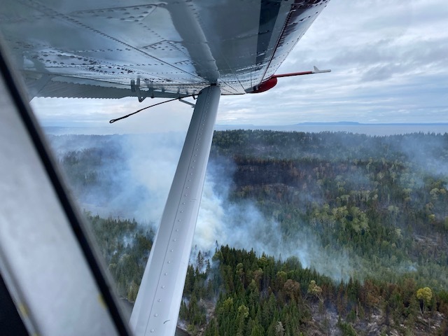
English: A wing of an aircraft with a wildfire burning on a forested island below. View of Horne Fire from aircraft monitoring fire. Sleeping Giant can be seen in the distance.
|
|||
| Depicted place |
English: Isle Royale National Park, Keweenaw County, Michigan |
|||
| Date | Taken on 27 August 2021 | |||
| Accession number | ||||
| Source |
English: NPGallery |
|||
| Permission (Reusing this file) |
|
|||
| NPS Unit Code | ISRO | |||
File history
Click on a date/time to view the file as it appeared at that time.
| Date/Time | Thumbnail | Dimensions | User | Comment | |
|---|---|---|---|---|---|
| current | 14:14, 16 January 2022 | | 640 × 480 (89 KB) | BMacZeroBot (talk | contribs) | Batch upload (Commons:Batch uploading/NPGallery) |
You cannot overwrite this file.
File usage on Commons
The following page uses this file:
.jpg)
.jpg&oldid=780152216)