File:View of Foel Lus - geograph.org.uk - 38400.jpg
Jump to navigation
Jump to search
No higher resolution available.
View_of_Foel_Lus_-_geograph.org.uk_-_38400.jpg (640 × 480 pixels, file size: 49 KB, MIME type: image/jpeg)
Captions
Captions
Add a one-line explanation of what this file represents
Summary
[edit]
| Description |
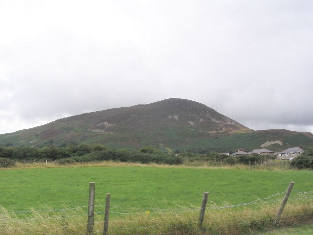
English: View of Foel Lus. This image shows Foel Lus (362m) which sits between the towns of Penmaenmawr and Dwygyfylchi. Although this image was taken from SH7377 looking south it was submitted as it shows the hill in all its glory which would not have been possible from a closer perspective. |
| Date | |
| Source | From geograph.org.uk |
| Author | Dave Smethurst |
| Attribution (required by the license) | Dave Smethurst / View of Foel Lus / |
| Camera location | | View this and other nearby images on: OpenStreetMap |
|---|
_heading:180.00&language=en)
| Object location | | View this and other nearby images on: OpenStreetMap |
|---|
_heading:180.00&language=en)
Licensing
[edit]

|
This image was taken from the Geograph project collection. See this photograph's page on the Geograph website for the photographer's contact details. The copyright on this image is owned by Dave Smethurst and is licensed for reuse under the Creative Commons Attribution-ShareAlike 2.0 license.
|
This file is licensed under the Creative Commons Attribution-Share Alike 2.0 Generic license.
Attribution: Dave Smethurst
- You are free:
- to share – to copy, distribute and transmit the work
- to remix – to adapt the work
- Under the following conditions:
- attribution – You must give appropriate credit, provide a link to the license, and indicate if changes were made. You may do so in any reasonable manner, but not in any way that suggests the licensor endorses you or your use.
- share alike – If you remix, transform, or build upon the material, you must distribute your contributions under the same or compatible license as the original.
File history
Click on a date/time to view the file as it appeared at that time.
| Date/Time | Thumbnail | Dimensions | User | Comment | |
|---|---|---|---|---|---|
| current | 18:34, 30 January 2010 | | 640 × 480 (49 KB) | GeographBot (talk | contribs) | == {{int:filedesc}} == {{Information |description={{en|1=View of Foel Lus. This image shows Foel Lus (362m) which sits between the towns of Penmaenmawr and Dwygyfylchi. Although this image was taken from SH7377 looking south it was submitted as it shows t |
You cannot overwrite this file.
File usage on Commons
There are no pages that use this file.