File:View from path 27 Alpe Logone - Alpe Erba.jpg
From Wikimedia Commons, the free media repository
Jump to navigation
Jump to search
![File:View from path 27 Alpe Logone - Alpe Erba.jpg](https://upload.wikimedia.org/wikipedia/commons/thumb/3/36/View_from_path_27_Alpe_Logone_-_Alpe_Erba.jpg/800px-View_from_path_27_Alpe_Logone_-_Alpe_Erba.jpg?20230523221651)
Size of this preview: 800 × 282 pixels. Other resolutions: 320 × 113 pixels | 640 × 226 pixels | 1,024 × 361 pixels | 1,280 × 451 pixels | 5,312 × 1,873 pixels.
Original file (5,312 × 1,873 pixels, file size: 5.2 MB, MIME type: image/jpeg)
File information
Structured data
Captions
Captions
Add a one-line explanation of what this file represents
Summary
[edit]DescriptionView from path 27 Alpe Logone - Alpe Erba.jpg |
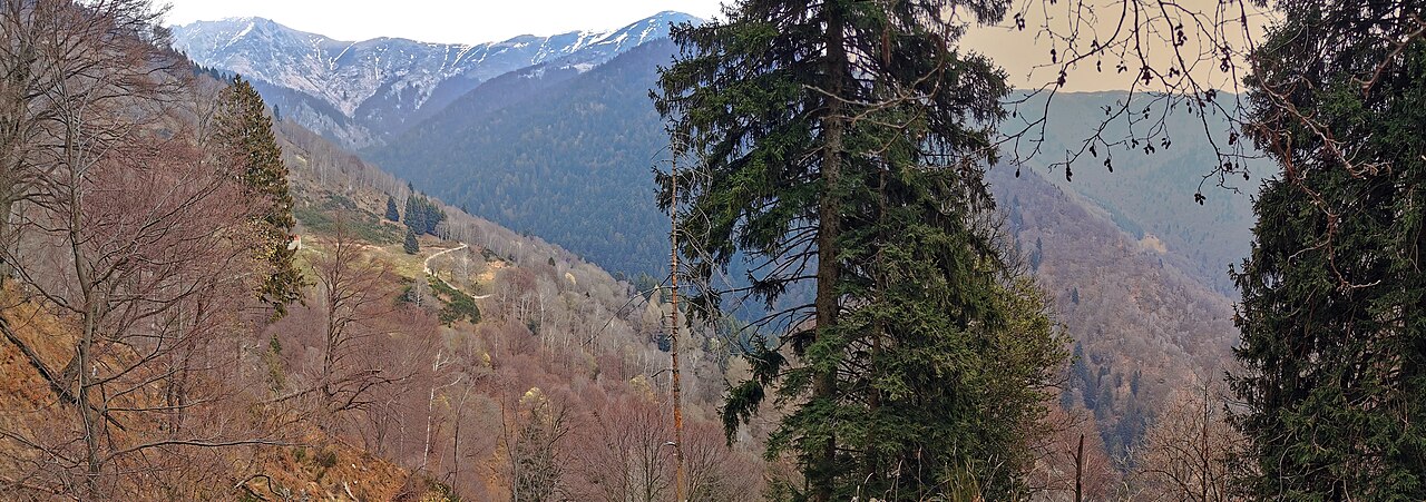
Italiano: Vista dal sentiero 27 Alpe Logone - Alpe Erba. In secondo piano tra i due alberi, si scorge l'Alpe Varoo. Sulla destra, scorcio sulla strada forestale Val Sanagra. |
Date | |
Source | Own work |
Author | Kaitu |
Camera location | 46° 04′ 38.34″ N, 9° 11′ 14.3″ E ![]() ![]() | View this and other nearby images on: OpenStreetMap | ![]() |
---|
Licensing
[edit]I, the copyright holder of this work, hereby publish it under the following license:
![w:en:Creative Commons](https://upload.wikimedia.org/wikipedia/commons/thumb/7/79/CC_some_rights_reserved.svg/90px-CC_some_rights_reserved.svg.png)
![attribution](https://upload.wikimedia.org/wikipedia/commons/thumb/1/11/Cc-by_new_white.svg/24px-Cc-by_new_white.svg.png)
![share alike](https://upload.wikimedia.org/wikipedia/commons/thumb/d/df/Cc-sa_white.svg/24px-Cc-sa_white.svg.png)
This file is licensed under the Creative Commons Attribution-Share Alike 4.0 International license.
- You are free:
- to share – to copy, distribute and transmit the work
- to remix – to adapt the work
- Under the following conditions:
- attribution – You must give appropriate credit, provide a link to the license, and indicate if changes were made. You may do so in any reasonable manner, but not in any way that suggests the licensor endorses you or your use.
- share alike – If you remix, transform, or build upon the material, you must distribute your contributions under the same or compatible license as the original.
Annotations InfoField | This image is annotated: View the annotations at Commons |
1069
664
903
551
5312
1873
Alpe Erba
2417
20
199
139
5312
1873
Bregagnino
863
40
193
113
5312
1873
Bregagno
File history
Click on a date/time to view the file as it appeared at that time.
Date/Time | Thumbnail | Dimensions | User | Comment | |
---|---|---|---|---|---|
current | 22:16, 23 May 2023 | ![]() | 5,312 × 1,873 (5.2 MB) | Kaitu (talk | contribs) | Uploaded own work with UploadWizard |
You cannot overwrite this file.
File usage on Commons
There are no pages that use this file.
Metadata
This file contains additional information such as Exif metadata which may have been added by the digital camera, scanner, or software program used to create or digitize it. If the file has been modified from its original state, some details such as the timestamp may not fully reflect those of the original file. The timestamp is only as accurate as the clock in the camera, and it may be completely wrong.
Camera manufacturer | HUAWEI |
---|---|
Camera model | VOG-L29 |
Date and time of data generation | 15:14, 19 March 2023 |
User comments | -
Projection: Cylindrical (1) FOV: 123 x 63 Ev: 11.96 |
Latitude | 46° 4′ 38.34″ N |
Longitude | 9° 11′ 14.3″ E |
Altitude | 1,241.9 meters above sea level |
JPEG file comment | -
Projection: Cylindrical (1) FOV: 123 x 63 Ev: 11.96 |
Orientation | Normal |
Horizontal resolution | 300 dpi |
Vertical resolution | 300 dpi |
Software used | GIMP 2.10.34 |
File change date and time | 23:24, 23 May 2023 |
Y and C positioning | Centered |
Exif version | 2.32 |
Date and time of digitizing | 15:14, 19 March 2023 |
Meaning of each component |
|
Supported Flashpix version | 1 |
Color space | sRGB |
GPS time (atomic clock) | 14:14 |
Speed unit | Kilometers per hour |
Speed of GPS receiver | 0.25281240498632 |
Reference for direction of image | True direction |
Direction of image | 61.959728698601 |
GPS date | 19 March 2023 |
GPS tag version | 0.0.3.2 |
Unique ID of original document | xmp.did:a946e953-ba76-46a7-9294-600a75ee9a47 |