File:View from Aruwaru Trig - Flickr - Geoff J Mckay.jpg
Original file (6,144 × 1,759 pixels, file size: 11.44 MB, MIME type: image/jpeg)
Captions
This image contains digital watermarking or credits in the image itself. The usage of visible watermarks is discouraged. If a non-watermarked version of the image is available, please upload it under the same file name and then remove this template. Ensure that removed information is present in the image description page and replace this template with {{Metadata from image}} or {{Attribution metadata from licensed image}}.
Caution: Before removing a watermark from a copyrighted image, please read the WMF's analysis of the legal ramifications of doing so, as well as Commons' proposed policy regarding watermarks. If the old version is still useful, for example if removing the watermark damages the image significantly, upload the new version under a different title so that both can be used. After uploading the non-watermarked version, replace this template with{{Superseded|new filename|version without watermarks}} .Bahasa Indonesia ∙ italiano ∙ eesti ∙ sicilianu ∙ Deutsch ∙ català ∙ magyar ∙ čeština ∙ română ∙ español ∙ português ∙ English ∙ hrvatski ∙ Plattdüütsch ∙ français ∙ Nederlands ∙ polski ∙ galego ∙ slovenščina ∙ suomi ∙ svenska ∙ Ελληνικά ∙ беларуская (тарашкевіца) ∙ български ∙ македонски ∙ русский ∙ українська ∙ മലയാളം ∙ ไทย ∙ 日本語 ∙ 中文 ∙ 中文(简体) ∙ 中文(繁體) ∙ עברית ∙ العربية ∙ فارسی ∙ +/− |
Summary
[edit]DescriptionView from Aruwaru Trig - Flickr - Geoff J Mckay.jpg |
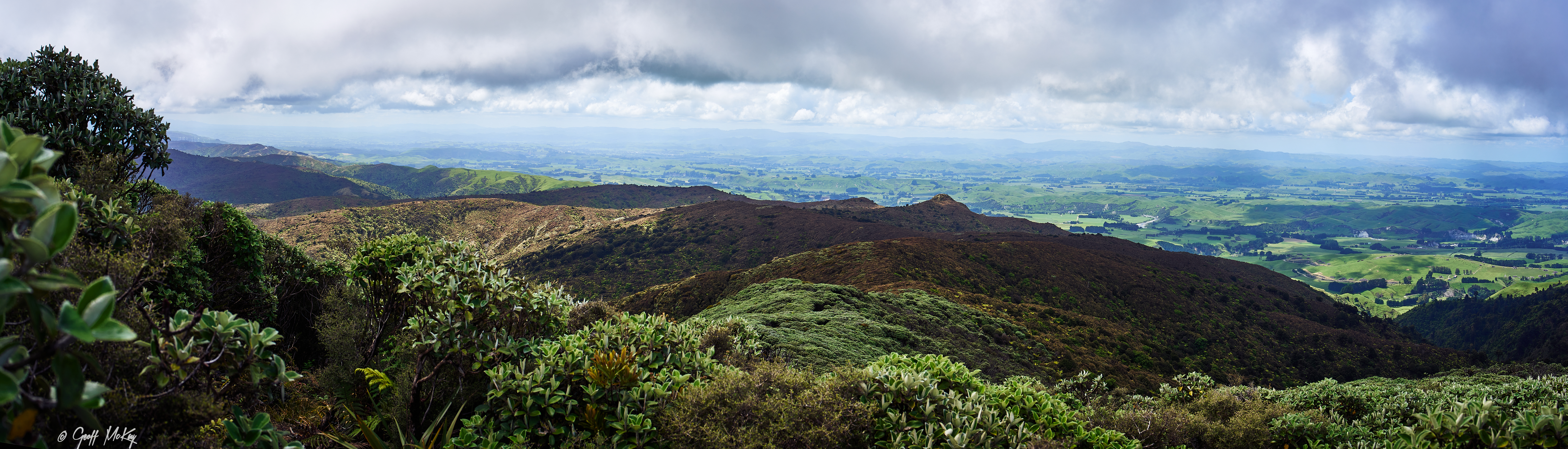
This is one of those "I've was there' photos taken by the Aruwaru Trig which is 767m above sea level and marks the boundary of the Manawatu-Wanganui and Wellington Districts in the Tararua Ranges. Looking NE-wards. I walked the Aruwaru Loop track. According to my gps covered 17.9km with elevation gain of 680m - a nice little workout me thinks. Hand-held pano of 8. |
Date | Taken on 12 December 2022, 11:53 |
Source | View from Aruwaru Trig |
Author | Geoff McKay from Palmerston North, New Zealand |
Flickr tags InfoField | kahuterawa valley , aotearoa , palmerston north , new zealand , manawatu , sony , ilce-7rm4 , manawatu-wanganui , sledge track , aruwaru trig , aruwaru loop , landscape , pano , panorama , samyang af 35mm f1.8 , tararuas |
Camera location | 40° 30′ 36.9″ S, 175° 37′ 31.37″ E | View this and other nearby images on: OpenStreetMap | -40.510251; 175.625381 |
---|
Licensing
[edit]- You are free:
- to share – to copy, distribute and transmit the work
- to remix – to adapt the work
- Under the following conditions:
- attribution – You must give appropriate credit, provide a link to the license, and indicate if changes were made. You may do so in any reasonable manner, but not in any way that suggests the licensor endorses you or your use.
This image was originally posted to Flickr by Geoff J Mckay at https://flickr.com/photos/129472387@N07/52559805386. It was reviewed on 28 December 2022 by FlickreviewR 2 and was confirmed to be licensed under the terms of the cc-by-2.0. |
28 December 2022
File history
Click on a date/time to view the file as it appeared at that time.
Date/Time | Thumbnail | Dimensions | User | Comment | |
---|---|---|---|---|---|
current | 12:39, 28 December 2022 | 6,144 × 1,759 (11.44 MB) | Red panda bot (talk | contribs) | In Flickr Explore: 2022-12-13 |
You cannot overwrite this file.
File usage on Commons
There are no pages that use this file.
Metadata
This file contains additional information such as Exif metadata which may have been added by the digital camera, scanner, or software program used to create or digitize it. If the file has been modified from its original state, some details such as the timestamp may not fully reflect those of the original file. The timestamp is only as accurate as the clock in the camera, and it may be completely wrong.
Camera manufacturer | SONY |
---|---|
Camera model | ILCE-7RM4 |
Author | Geoff McKay |
Exposure time | 1/320 sec (0.003125) |
F-number | f/8 |
ISO speed rating | 100 |
Date and time of data generation | 11:53, 12 December 2022 |
Lens focal length | 35 mm |
Headline | View from Aruwaru Trig |
Source | |
Credit/Provider | |
Image title |
|
Copyright holder |
|
City shown | |
Horizontal resolution | 300 dpi |
Vertical resolution | 300 dpi |
Software used | Capture One 22 Windows |
Exposure Program | Manual |
Exif version | 2.3 |
Date and time of digitizing | 11:53, 12 December 2022 |
APEX shutter speed | 8.321928 |
APEX aperture | 6 |
APEX brightness | 9.5953125 |
APEX exposure bias | 0 |
Maximum land aperture | 1.6953125 APEX (f/1.8) |
Metering mode | Pattern |
Light source | Other light source |
Flash | Flash did not fire, compulsory flash suppression |
File source | Digital still camera |
Scene type | A directly photographed image |
Custom image processing | Normal process |
Exposure mode | Manual exposure |
White balance | Manual white balance |
Digital zoom ratio | 1 |
Focal length in 35 mm film | 35 mm |
Scene capture type | Standard |
Contrast | Normal |
Saturation | Low saturation |
Sharpness | Hard |
Serial number of camera | 04470569 |
Lens used | SAMYANG AF 35mm F1.8 |
Writer | |
Special instructions | |
Category | |
Original transmission location code | |
Type of item | |
Keywords |
|
Contact information | geoff.mckay@xtra.co.nz
54 Churchilll Avenue Palmerston North, , 4410 New Zealand |
Province or state shown | |
Country shown | |
Sublocation of city shown | |
Code for country shown | |
IIM version | 4 |