File:View across fields - geograph.org.uk - 724647.jpg
Jump to navigation
Jump to search
Size of this preview: 450 × 600 pixels. Other resolutions: 180 × 240 pixels | 480 × 640 pixels.
Original file (480 × 640 pixels, file size: 165 KB, MIME type: image/jpeg)
Captions
Captions
Add a one-line explanation of what this file represents
Summary
[edit]
| Description |
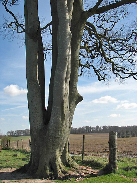
English: View across fields. This fine old tree has multiple trunks. It stands at a field edge, beside the footpath to Felbrigg Pond. See > 724639 for a full view of the tree. The history of Felbrigg estate dates back to the middle ages, when a member of the Norman family of Bigod took the name Felbrigg and built a manor house on the site of the present Hall, in the early 15th century. In around 1450 Felbrigg was acquired by John Wyndham, a wealthy merchant from the Norfolk town of Wymondham. The manor house was altered and added on to by following generations until a family member, "Mad Windham", almost ruined the estate and was forced to sell it in 1863, with all its contents. The estate was purchased by John Ketton, a Norwich merchant, whose daughter married a distant cousin of "Mad Windham". Their grandson, Robert Wyndham Ketton-Cremer (d. 1969) bequeathed the Felbrigg Hall and estate to the National Trust. See > 724631 for view of Felbrigg Hall. |
| Date | |
| Source | From geograph.org.uk |
| Author | Evelyn Simak |
| Attribution (required by the license) | Evelyn Simak / View across fields / |
| Camera location | | View this and other nearby images on: OpenStreetMap |
|---|
_heading:135.00&language=en)
| Object location | | View this and other nearby images on: OpenStreetMap |
|---|
_heading:135.00&language=en)
Licensing
[edit]

|
This image was taken from the Geograph project collection. See this photograph's page on the Geograph website for the photographer's contact details. The copyright on this image is owned by Evelyn Simak and is licensed for reuse under the Creative Commons Attribution-ShareAlike 2.0 license.
|
This file is licensed under the Creative Commons Attribution-Share Alike 2.0 Generic license.
Attribution: Evelyn Simak
- You are free:
- to share – to copy, distribute and transmit the work
- to remix – to adapt the work
- Under the following conditions:
- attribution – You must give appropriate credit, provide a link to the license, and indicate if changes were made. You may do so in any reasonable manner, but not in any way that suggests the licensor endorses you or your use.
- share alike – If you remix, transform, or build upon the material, you must distribute your contributions under the same or compatible license as the original.
File history
Click on a date/time to view the file as it appeared at that time.
| Date/Time | Thumbnail | Dimensions | User | Comment | |
|---|---|---|---|---|---|
| current | 06:15, 19 February 2011 | | 480 × 640 (165 KB) | GeographBot (talk | contribs) | == {{int:filedesc}} == {{Information |description={{en|1=View across fields This fine old tree has multiple trunks. It stands at a field edge, beside the footpath to Felbrigg Pond. See > 724639 for a full view of the tree. The history of Felbrigg esta |
You cannot overwrite this file.
File usage on Commons
There are no pages that use this file.