File:Vietnam nam tien map-es.svg
Jump to navigation
Jump to search

Size of this PNG preview of this SVG file: 422 × 599 pixels. Other resolutions: 169 × 240 pixels | 338 × 480 pixels | 541 × 768 pixels | 721 × 1,024 pixels | 1,442 × 2,048 pixels | 543 × 771 pixels.
Original file (SVG file, nominally 543 × 771 pixels, file size: 5.2 MB)
Captions
Captions
Add a one-line explanation of what this file represents
Summary
[edit]
| Description |
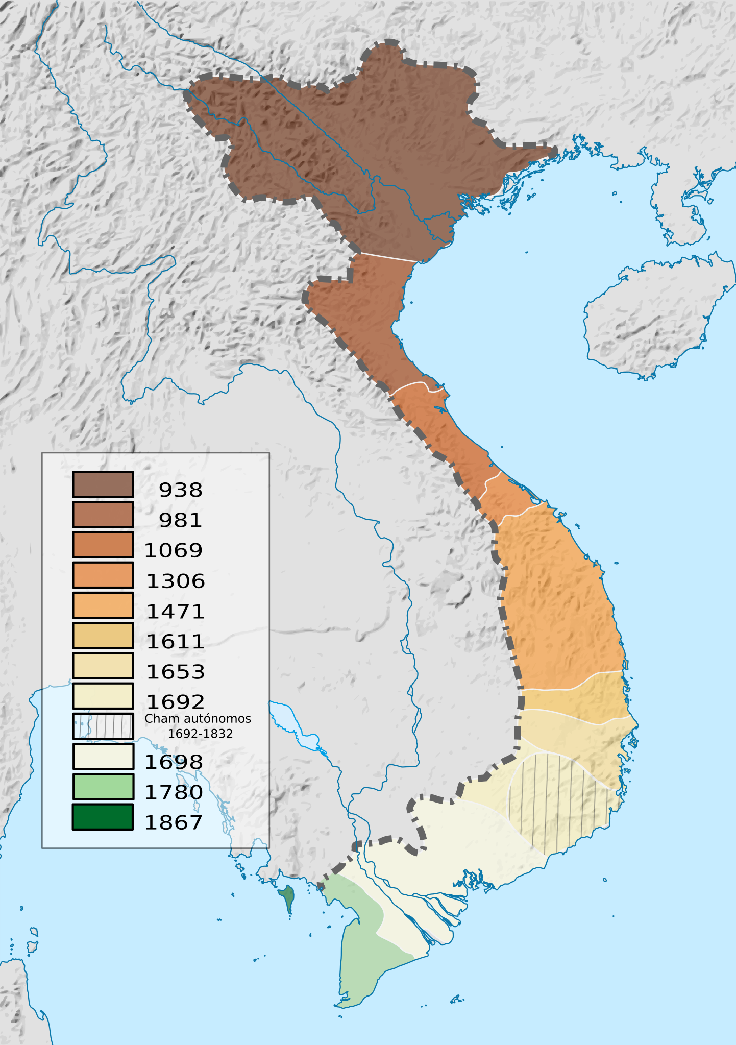
English: Map of the "Nam tien" - southward expansion of Vietnam (X - XIX w.) |
| Date | |
| Source | First Indochina War map 1946 to 1954 es.svg |
| Author |
|
Licensing
[edit]
This file is licensed under the Creative Commons Attribution-Share Alike 3.0 Unported license.
- You are free:
- to share – to copy, distribute and transmit the work
- to remix – to adapt the work
- Under the following conditions:
- attribution – You must give appropriate credit, provide a link to the license, and indicate if changes were made. You may do so in any reasonable manner, but not in any way that suggests the licensor endorses you or your use.
- share alike – If you remix, transform, or build upon the material, you must distribute your contributions under the same or compatible license as the original.
File history
Click on a date/time to view the file as it appeared at that time.
| Date/Time | Thumbnail | Dimensions | User | Comment | |
|---|---|---|---|---|---|
| current | 09:17, 14 December 2017 | | 543 × 771 (5.2 MB) | Rowanwindwhistler (talk | contribs) | Fake text added |
| 10:10, 19 July 2016 |  | 543 × 771 (5.15 MB) | Rowanwindwhistler (talk | contribs) | User created page with UploadWizard |
You cannot overwrite this file.
File usage on Commons
There are no pages that use this file.