File:Victorian brick bridge over the Soar - geograph.org.uk - 677122.jpg
Jump to navigation
Jump to search
No higher resolution available.
Victorian_brick_bridge_over_the_Soar_-_geograph.org.uk_-_677122.jpg (640 × 480 pixels, file size: 52 KB, MIME type: image/jpeg)
Captions
Captions
Add a one-line explanation of what this file represents
Summary
[edit]
| Description |
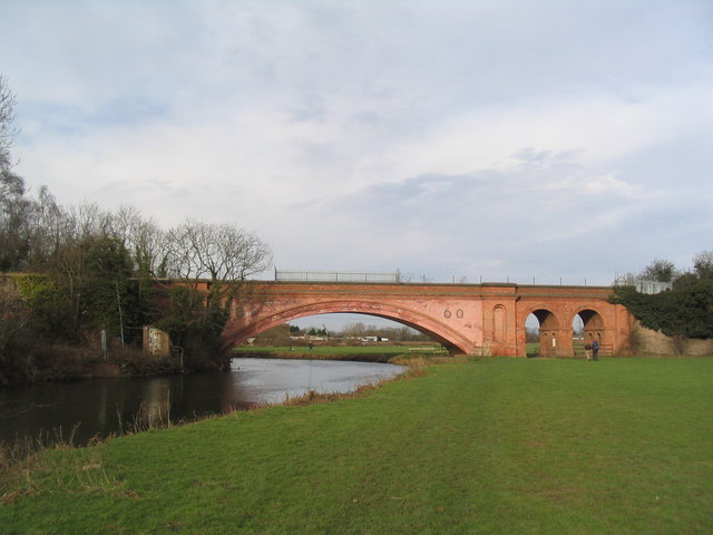
English: Victorian brick bridge over the Soar Has the date '1860' on it, and at the time was the largest brick span in Britain. The paler pink areas appear to be more recent cladding. The bridge used to carry rail trucks from the Mountsorrel granite quarries to the rail line at Barrow, but the granite chippings are now carried on a conveyor belt. |
| Date | |
| Source | From geograph.org.uk |
| Author | Tim Heaton |
| Attribution (required by the license) | Tim Heaton / Victorian brick bridge over the Soar / |
| Camera location | | View this and other nearby images on: OpenStreetMap |
|---|
_heading:337.00&language=en)
| Object location | | View this and other nearby images on: OpenStreetMap |
|---|
_heading:337.00&language=en)
Licensing
[edit]

|
This image was taken from the Geograph project collection. See this photograph's page on the Geograph website for the photographer's contact details. The copyright on this image is owned by Tim Heaton and is licensed for reuse under the Creative Commons Attribution-ShareAlike 2.0 license.
|
This file is licensed under the Creative Commons Attribution-Share Alike 2.0 Generic license.
Attribution: Tim Heaton
- You are free:
- to share – to copy, distribute and transmit the work
- to remix – to adapt the work
- Under the following conditions:
- attribution – You must give appropriate credit, provide a link to the license, and indicate if changes were made. You may do so in any reasonable manner, but not in any way that suggests the licensor endorses you or your use.
- share alike – If you remix, transform, or build upon the material, you must distribute your contributions under the same or compatible license as the original.
File history
Click on a date/time to view the file as it appeared at that time.
| Date/Time | Thumbnail | Dimensions | User | Comment | |
|---|---|---|---|---|---|
| current | 23:49, 7 February 2011 | | 640 × 480 (52 KB) | GeographBot (talk | contribs) | == {{int:filedesc}} == {{Information |description={{en|1=Victorian brick bridge over the Soar Has the date '1860' on it, and at the time was the largest brick span in Britain. The paler pink areas appear to be more recent cladding. The bridge used to carr |
You cannot overwrite this file.
File usage on Commons
There are no pages that use this file.