File:Victoria Tower and construction of the new Everton Stadium (geograph 7449307).jpg
Jump to navigation
Jump to search
Size of this preview: 800 × 533 pixels. Other resolutions: 320 × 213 pixels | 640 × 426 pixels | 1,024 × 682 pixels | 1,322 × 880 pixels.
Original file (1,322 × 880 pixels, file size: 217 KB, MIME type: image/jpeg)
Captions
Captions
Add a one-line explanation of what this file represents
Summary
[edit].jpg&action=edit§ion=1)
| Description |
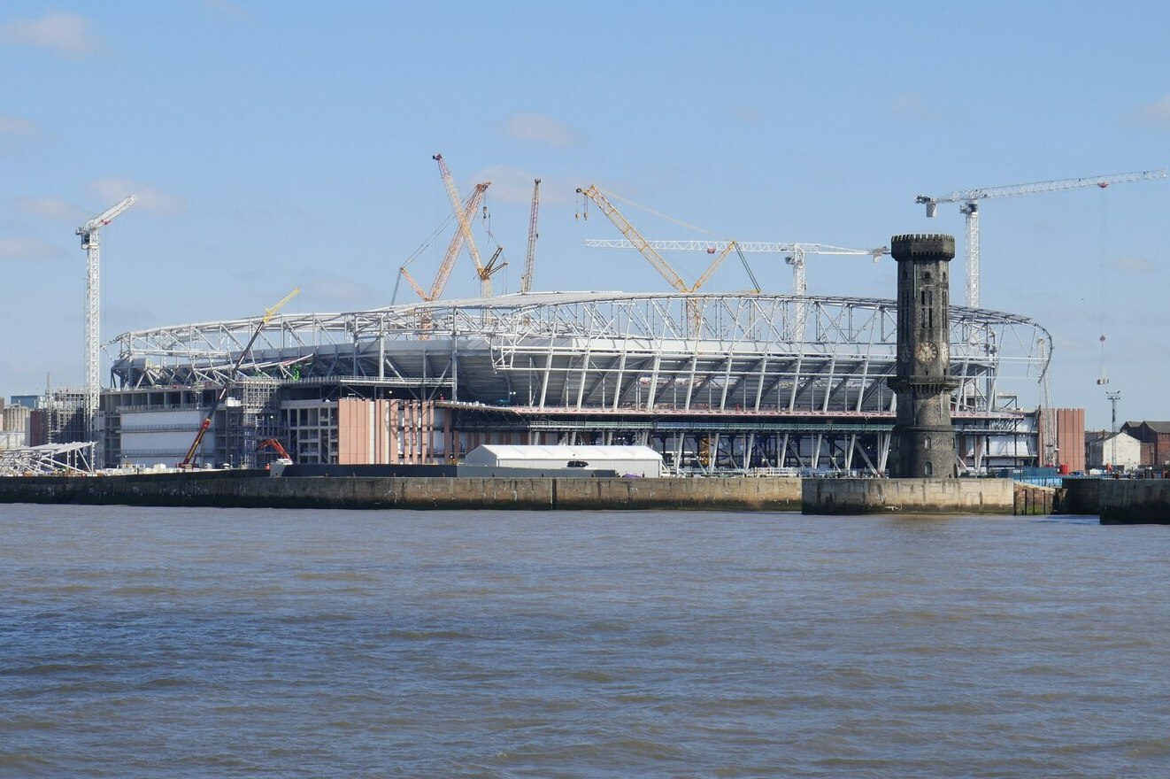
English: Victoria Tower and construction of the new Everton Stadium |
| Date | |
| Source | From geograph.org.uk |
| Author | James T M Towill |
| Permission (Reusing this file) |
Creative Commons Attribution Share-alike license 2.0 |
| Attribution (required by the license) | James T M Towill / Victoria Tower and construction of the new Everton Stadium / |
| Camera location | | View this and other nearby images on: OpenStreetMap |
|---|
.jpg¶ms=053.418975_N_-003.012151_E_globe:Earth_type:camera_source:geograph-osgb36(SJ32839183)_heading:45.00&language=en)
| Object location | | View this and other nearby images on: OpenStreetMap |
|---|
.jpg¶ms=053.422540_N_-003.004710_E_globe:Earth_class:object_type:object_source:geograph-osgb36(SJ33339222)_heading:45.00&language=en)
Licensing
[edit].jpg&action=edit§ion=2)

|
This image was taken from the Geograph project collection. See this photograph's page on the Geograph website for the photographer's contact details. The copyright on this image is owned by James T M Towill and is licensed for reuse under the Creative Commons Attribution-ShareAlike 2.0 license.
|
This file is licensed under the Creative Commons Attribution-Share Alike 2.0 Generic license.
Attribution: James T M Towill
- You are free:
- to share – to copy, distribute and transmit the work
- to remix – to adapt the work
- Under the following conditions:
- attribution – You must give appropriate credit, provide a link to the license, and indicate if changes were made. You may do so in any reasonable manner, but not in any way that suggests the licensor endorses you or your use.
- share alike – If you remix, transform, or build upon the material, you must distribute your contributions under the same or compatible license as the original.
File history
Click on a date/time to view the file as it appeared at that time.
| Date/Time | Thumbnail | Dimensions | User | Comment | |
|---|---|---|---|---|---|
| current | 14:06, 14 May 2023 | | 1,322 × 880 (217 KB) | Seth Whales (talk | contribs) | Cropped 17 % horizontally, 18 % vertically using CropTool with precise mode. |
| 14:06, 14 May 2023 |  | 1,600 × 1,067 (286 KB) | Seth Whales (talk | contribs) | == {{int:filedesc}} == {{Information |Description={{en|1=Victoria Tower and construction of the new Everton Stadium}} |Source=From [https://www.geograph.org.uk/photo/7449307 geograph.org.uk] |Date=2023-04-03 |Author=[https://www.geograph.org.uk/profile/24241 James T M Towill] |Permission=Creative Commons Attribution Share-alike license 2.0 |Other fields={{Credit line |Author=James T M Towill |License=[https://creativecommons.org/licenses/by-sa/2.0/ CC BY-SA 2.0] |Other=''Victoria Tower and... |
You cannot overwrite this file.
File usage on Commons
The following page uses this file:
File usage on other wikis
The following other wikis use this file:
- Usage on ar.wikipedia.org
- Usage on ban.wikipedia.org
- Usage on cs.wikipedia.org
- Usage on da.wikipedia.org
- Usage on de.wikipedia.org
- Usage on en.wikipedia.org
- Usage on es.wikipedia.org
- Usage on eu.wikipedia.org
- Usage on fa.wikipedia.org
- Usage on fi.wikipedia.org
- Usage on fr.wikipedia.org
- Usage on he.wikipedia.org
- Usage on hu.wikipedia.org
- Usage on ja.wikipedia.org
- Usage on ko.wikipedia.org
- Usage on mk.wikipedia.org
- Usage on nl.wikipedia.org
- Usage on no.wikipedia.org
- Usage on pl.wikipedia.org
- Usage on pt.wikipedia.org
- Usage on sk.wikipedia.org
- Usage on sr.wikipedia.org
- Usage on sv.wikipedia.org
- Usage on th.wikipedia.org
- Usage on tr.wikipedia.org
- Usage on uk.wikipedia.org
- Usage on uz.wikipedia.org
- Usage on vi.wikipedia.org
- Usage on www.wikidata.org
- Usage on zh.wikipedia.org
.jpg&oldid=936690310)