File:Viaductos De Los Túneles De La Font Roja (231386627).jpeg
From Wikimedia Commons, the free media repository
Jump to navigation
Jump to search
![File:Viaductos De Los Túneles De La Font Roja (231386627).jpeg](https://upload.wikimedia.org/wikipedia/commons/thumb/2/29/Viaductos_De_Los_T%C3%BAneles_De_La_Font_Roja_%28231386627%29.jpeg/800px-Viaductos_De_Los_T%C3%BAneles_De_La_Font_Roja_%28231386627%29.jpeg?20180804204041)
Size of this preview: 800 × 450 pixels. Other resolutions: 320 × 180 pixels | 640 × 360 pixels | 1,024 × 576 pixels | 1,280 × 720 pixels | 2,048 × 1,152 pixels.
Original file (2,048 × 1,152 pixels, file size: 863 KB, MIME type: image/jpeg)
File information
Structured data
Captions
Captions
Add a one-line explanation of what this file represents
Summary
[edit]Viaductos De Los Túneles De La Font Roja | |
---|---|
Photographer | |
Title |
Viaductos De Los Túneles De La Font Roja |
Description |
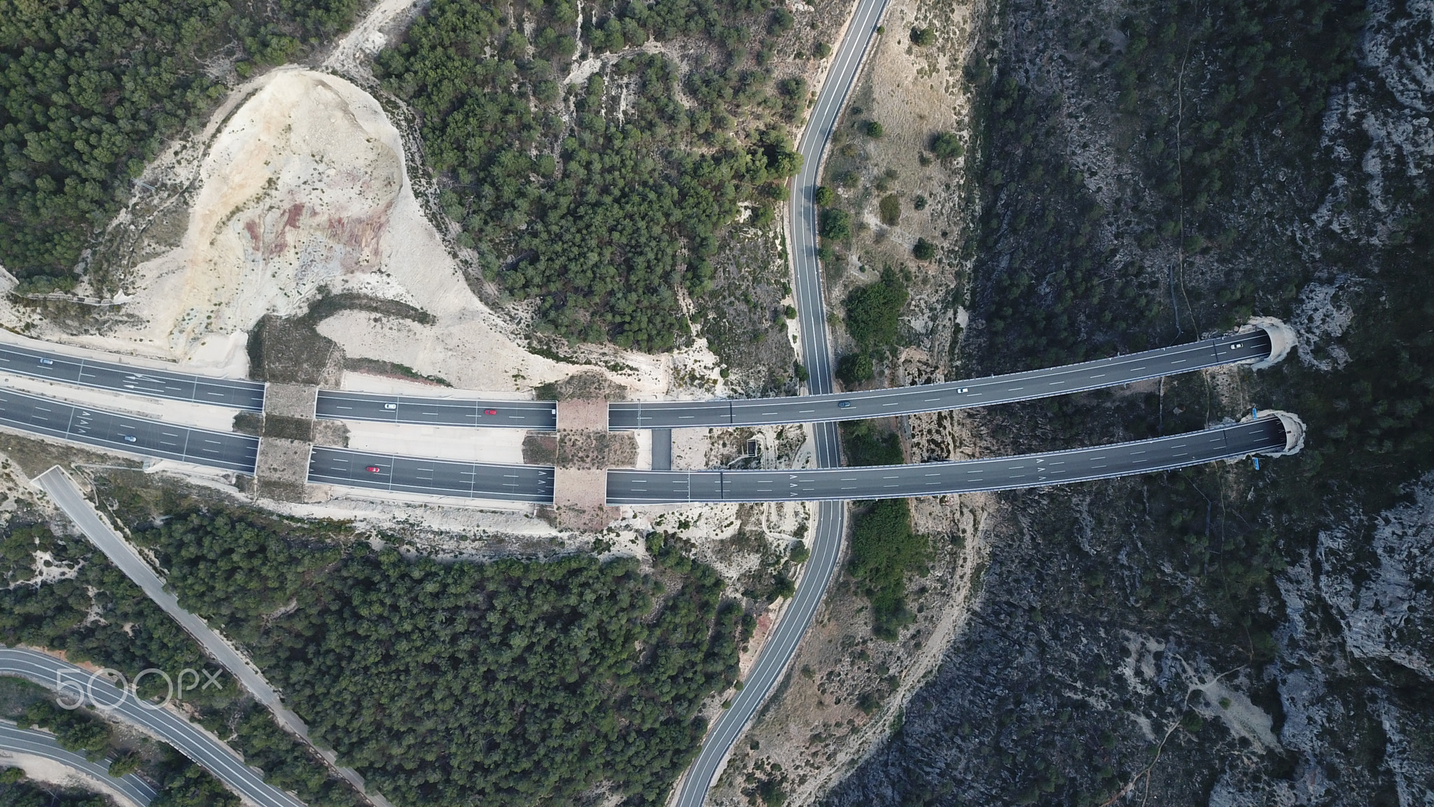
500px provided description: Visi?n cenital de los viaductos construidos para unir los T?neles de la Font Roja en la Autov?as A7 a su paso por Alcoy (Alicante). [#Barranco ,#Carretera ,#Puente ,#Alcoy ,#A7 ,#Cenital ,#Viaducto ,#T?neles ,#Autovia A7] |
Date | 10 October 2017, 15:30:43 (UTC) |
Source | Imported from 500px (archived version) by the Archive Team. (detail page) |
Permission (Reusing this file) |
![]() ![]() ![]() This file is licensed under the Creative Commons Attribution-Share Alike 3.0 Unported license.
|
Camera location | 38° 40′ 31.55″ N, 0° 27′ 51.64″ W ![]() | View this and other nearby images on: OpenStreetMap | ![]() |
---|
File history
Click on a date/time to view the file as it appeared at that time.
Date/Time | Thumbnail | Dimensions | User | Comment | |
---|---|---|---|---|---|
current | 20:40, 4 August 2018 | ![]() | 2,048 × 1,152 (863 KB) | Rodrigo.Argenton (talk | contribs) | Photo Viaductos De Los Túneles De La Font Roja imported from 500px with import-500px |
You cannot overwrite this file.
File usage on Commons
The following page uses this file:
Metadata
This file contains additional information such as Exif metadata which may have been added by the digital camera, scanner, or software program used to create or digitize it. If the file has been modified from its original state, some details such as the timestamp may not fully reflect those of the original file. The timestamp is only as accurate as the clock in the camera, and it may be completely wrong.
Image title | DCIM\100MEDIA\DJI_0226.JPG |
---|---|
Camera manufacturer | DJI |
Camera model | FC220 |
Exposure time | 2,743/1,000,000 sec (0.002743) |
F-number | f/2.2 |
ISO speed rating | 100 |
Date and time of data generation | 15:30, 10 October 2017 |
Lens focal length | 4.73 mm |
Latitude | 38° 40′ 30.97″ N |
Longitude | 0° 27′ 51.97″ W |
Altitude | 1,072.957 meters above sea level |
Orientation | Normal |
Horizontal resolution | 71.983 dpi |
Vertical resolution | 71.983 dpi |
Software used | v02.08.506 |
File change date and time | 15:30, 10 October 2017 |
Y and C positioning | Centered |
Exposure Program | Normal program |
Exif version | 2.3 |
Date and time of digitizing | 15:30, 10 October 2017 |
Meaning of each component |
|
Image compression mode | 3.2007253333333 |
APEX aperture | 2.27 |
APEX exposure bias | −0.65625 |
Maximum land aperture | 2.27 APEX (f/2.2) |
Subject distance | 0 meters |
Metering mode | Center weighted average |
Light source | Unknown |
Flash | Flash did not fire, No flash function |
Supported Flashpix version | 0.1 |
Color space | sRGB |
File source | Digital still camera |
Scene type | A directly photographed image |
Custom image processing | Normal process |
Exposure mode | Auto exposure |
White balance | Auto white balance |
Focal length in 35 mm film | 26 mm |
Scene capture type | Standard |
Scene control | None |
Contrast | Normal |
Saturation | Normal |
Sharpness | Normal |
Subject distance range | Unknown |
GPS tag version | 0.0.3.2 |