File:Versailles ky building.jpg
Jump to navigation
Jump to search

Size of this preview: 800 × 600 pixels. Other resolutions: 320 × 240 pixels | 640 × 480 pixels | 1,024 × 768 pixels | 1,280 × 960 pixels | 2,048 × 1,536 pixels.
Original file (2,048 × 1,536 pixels, file size: 536 KB, MIME type: image/jpeg)
Captions
Captions
Add a one-line explanation of what this file represents
|
This is an image of a place or building that is listed on the National Register of Historic Places in the United States of America. Its reference number is 75000844. |
| Camera location | | View this and other nearby images on: OpenStreetMap |
|---|
| Description |
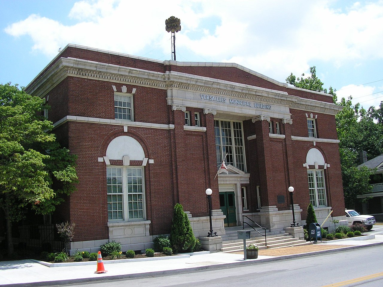
English: Front and northern side of City Hall in Versailles, Kentucky, United States, located at 196 S. Main Street (U.S. Route 62). It was built in 1920 as a post office and converted into a municipal building in 1968, and it is part of the Downtown Versailles Historic District, a historic district that is listed on the National Register of Historic Places. |
||||||||
| Date | Unknown date | ||||||||
| Source | Own work | ||||||||
| Author | W.marsh | ||||||||
| Permission (Reusing this file) |
I, W.marsh, the copyright holder of this work, hereby publishes it under the following licenses:
This file is licensed under the Creative Commons Attribution-Share Alike 2.5 Generic, 2.0 Generic and 1.0 Generic license. Attribution: I, W.marsh
You may select the license of your choice. |

File history
Click on a date/time to view the file as it appeared at that time.
| Date/Time | Thumbnail | Dimensions | User | Comment | |
|---|---|---|---|---|---|
| current | 21:49, 20 July 2007 | | 2,048 × 1,536 (536 KB) | W.marsh (talk | contribs) | {{Information |Description=Versailles, KY, USA |Source=self-made |Date= |Author= W.marsh }} |
You cannot overwrite this file.
File usage on Commons
There are no pages that use this file.
File usage on other wikis
The following other wikis use this file:
- Usage on de.wikipedia.org
- Usage on en.wikipedia.org
- Usage on pt.wikipedia.org