File:Verbreitungsgebiet der heutigen niederdeutschen Mundarten-2.PNG
Jump to navigation
Jump to search
Size of this preview: 600 × 600 pixels. Other resolutions: 240 × 240 pixels | 480 × 480 pixels | 768 × 768 pixels | 1,024 × 1,024 pixels | 1,304 × 1,304 pixels.
Original file (1,304 × 1,304 pixels, file size: 98 KB, MIME type: image/png)
Captions
Captions
Add a one-line explanation of what this file represents
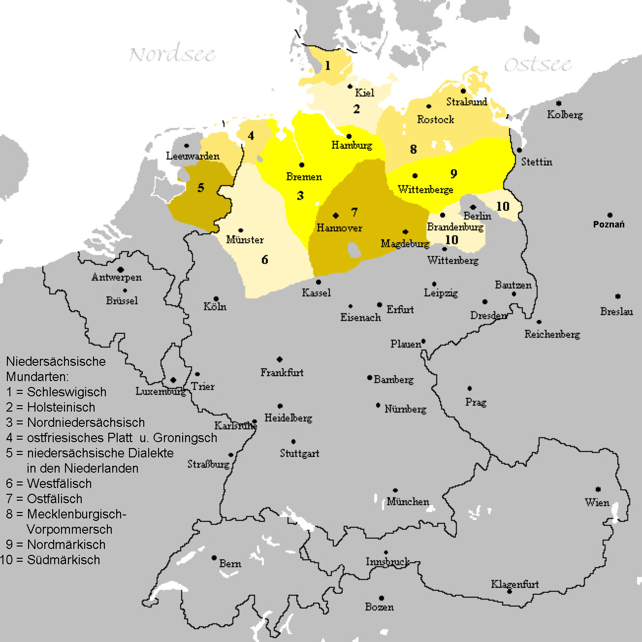
| Description | A map of Low German language with Low Franconian dialects excluded. The map shows the area of all Low Saxon dialects. |
| Date | (UTC) |
| Source | |
| Author |
|
| This is a retouched picture, which means that it has been digitally altered from its original version. Modifications: Dutch dialects erased to show Low German dialects only.. The original can be viewed here: Verbreitungsgebiet der heutigen niederdeutschen Mundarten.PNG:
|
| This work has been released into the public domain by its author, LingVista87. This applies worldwide. In some countries this may not be legally possible; if so: |
Original upload log
[edit]
This image is a derivative work of the following images:
- File:Verbreitungsgebiet_der_heutigen_niederdeutschen_Mundarten.PNG licensed with PD-user-de, PD-user-w
- 2008-08-08T10:33:32Z Gruna 1 652x652 (37059 Bytes) See previous version
- 2006-04-14T17:48:45Z Vonvon 652x652 (36806 Bytes) * created on de.wikipedia.org by [[:de:Benutzer:Postmann Michael]] on 31 December 2004 * Beschreibung:Darstellungskarte der niederdeutschen Mundarten seit 1945 (''Location Map of the Low Germanic languages'') * original licen
Uploaded with derivativeFX
File history
Click on a date/time to view the file as it appeared at that time.
| Date/Time | Thumbnail | Dimensions | User | Comment | |
|---|---|---|---|---|---|
| current | 22:54, 14 August 2019 | | 1,304 × 1,304 (98 KB) | Ulamm (talk | contribs) | Drente fällt doch schon unter die übrigen niedersächsischen Dialekte in den Niederlanden. |
| 22:47, 14 August 2019 |  | 1,304 × 1,304 (98 KB) | Ulamm (talk | contribs) | Ostfriesisches Platt und Groningsch sind etwas anderes als der (ausgestorbene) friesische Dialekt Ostfriesisch. Die Provinzen Groningen, Drente, Overijssel und Gelderland sind gleichermaßen alle Teile der Niederlande aber alle nicht Holland. Gniezno/Gnesen liegt nordnordöstlich von Wrocław/Breslau. Nordnordwestlich von Wrocław/Breslau liegt Poznań/Posen. | |
| 09:13, 26 November 2009 |  | 652 × 652 (34 KB) | LingVista87 (talk | contribs) | {{Information |Description=== A map of Low German language with Low Franconian dialects excluded. |Source=*File:Verbreitungsgebiet_der_heutigen_niederdeutschen_Mundarten.PNG |Date=2009-11-26 09:07 (UTC) |Author=*[[:File:Verbreitungsgebiet_der_heutig |
You cannot overwrite this file.
File usage on Commons
The following 2 pages use this file:
File usage on other wikis
The following other wikis use this file:
- Usage on af.wikipedia.org
- Usage on de.wikipedia.org
- Usage on de.wiktionary.org
- Usage on en.wikipedia.org
- Usage on fr.wikipedia.org
- Usage on hak.wikipedia.org
- Usage on pl.wikipedia.org
- Usage on vep.wikipedia.org