File:Veensgarth.jpg
Jump to navigation
Jump to search
No higher resolution available.
Veensgarth.jpg (640 × 421 pixels, file size: 64 KB, MIME type: image/jpeg)
Captions
Captions
Add a one-line explanation of what this file represents
Summary
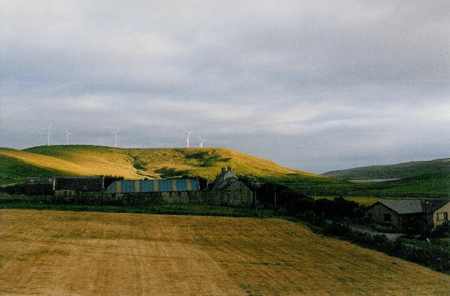
[edit]| Description |
Burra Dale from Veensgarth The windmills on Burra Dale. To the right of them lies Tingwall Loch. Tingwall airport is behind us and Veensgarth (or "Vikings Garth/farm") from this viewpoint. |
||
| Date | See image source page. | ||
| Source |
This image was taken from the Geograph project collection. See this photograph's page on the Geograph website for the photographer's contact details. The copyright on this image is owned by David Wyatt and is licensed for reuse under the Creative Commons Attribution-ShareAlike 2.0 license.
This file is licensed under the Creative Commons Attribution-Share Alike 2.0 Generic license. Attribution: David Wyatt
|
||
| Author | See above. | ||
| Permission (Reusing this file) |
See above. |

| Object location | | View this and other nearby images on: OpenStreetMap |
|---|
_region:GB-GBN_&language=en)
Licensing
[edit]
This file is licensed under the Creative Commons Attribution-Share Alike 2.0 Generic license.
- You are free:
- to share – to copy, distribute and transmit the work
- to remix – to adapt the work
- Under the following conditions:
- attribution – You must give appropriate credit, provide a link to the license, and indicate if changes were made. You may do so in any reasonable manner, but not in any way that suggests the licensor endorses you or your use.
- share alike – If you remix, transform, or build upon the material, you must distribute your contributions under the same or compatible license as the original.
File history
Click on a date/time to view the file as it appeared at that time.
| Date/Time | Thumbnail | Dimensions | User | Comment | |
|---|---|---|---|---|---|
| current | 17:22, 28 May 2008 | | 640 × 421 (64 KB) | MacRusgail (talk | contribs) | == Summary == {{Information| |Description=Burra Dale from Veensgarth The windmills on Burra Dale. To the right of them lies Tingwall Loch. Tingwall airport is behind us and Veensgarth (or "Vikings Garth/farm") from this viewpoint. |Source=This image was t |
You cannot overwrite this file.
File usage on Commons
There are no pages that use this file.
File usage on other wikis
The following other wikis use this file:
- Usage on en.wikipedia.org