File:Varsovio, Esperanto-Strato, 2.jpeg
From Wikimedia Commons, the free media repository
Jump to navigation
Jump to search
Size of this preview: 800 × 522 pixels. Other resolutions: 320 × 209 pixels | 640 × 418 pixels | 1,024 × 669 pixels | 1,280 × 836 pixels | 2,560 × 1,672 pixels | 4,288 × 2,800 pixels.
Original file (4,288 × 2,800 pixels, file size: 2.31 MB, MIME type: image/jpeg)
File information
Structured data
Captions
Summary
[edit]DescriptionVarsovio, Esperanto-Strato, 2.jpeg |
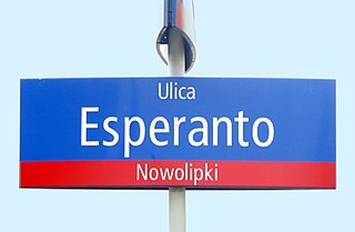
Esperanto: Varsovio (PL), stratnoma signo de Ulica Esperanto (Esperanto-Strato).
Deutsch: Warschau (PL), Straßenschild Ulica Esperanto (Esperantostraße).
Polski: Warszawa, tabliczka z nazwą ulicy Esperanto.
|
||||
Date | |||||
Source | Self-photographed | ||||
Author | Renardo la vulpo | ||||
Permission (Reusing this file) |
Renardo la vulpo, the copyright holder of this work, hereby publishes it under the following license: This file is licensed under the Creative Commons Attribution-Share Alike 4.0 International license. Attribution: Renardo la vulpo
|
Ĉi tiu dosiero estis alŝutita kadre de la konkurso Vikio Amas ZEOjn, organizita fare de Esperanto kaj Libera Scio. |
File history
Click on a date/time to view the file as it appeared at that time.
Date/Time | Thumbnail | Dimensions | User | Comment | |
---|---|---|---|---|---|
current | 19:24, 10 August 2018 | 4,288 × 2,800 (2.31 MB) | Renardo la vulpo (talk | contribs) | {{Information |Description = {{eo|1=Varsovio (PL), stratnoma signo de Ulica Esperanto (Esperanto-Strato).}} {{de|1=Warschau (PL), Straßenschild Ulica Esperanto (Esperantostraße).}} {{pl|1=Warszawa, tabliczka z nazwą ulicy Esperanto.}} {{ZEO-kodo|pl-050}} |Source = {{self-photographed}} |Author = {{U|Renardo la vulpo}} |Date = 2017-09-16 |Permission = {{self|cc-by-sa-4.0|author=Renardo la vulpo}} |other_vers... |
You cannot overwrite this file.
File usage on Commons
The following page uses this file:
Metadata
This file contains additional information such as Exif metadata which may have been added by the digital camera, scanner, or software program used to create or digitize it. If the file has been modified from its original state, some details such as the timestamp may not fully reflect those of the original file. The timestamp is only as accurate as the clock in the camera, and it may be completely wrong.
Camera manufacturer | Panasonic |
---|---|
Camera model | DMC-TZ61 |
Exposure time | 1/160 sec (0.00625) |
F-number | f/5.9 |
ISO speed rating | 250 |
Date and time of data generation | 13:52, 16 September 2017 |
Lens focal length | 57.7 mm |
Latitude | 52° 14′ 41.88″ N |
Longitude | 20° 58′ 49.75″ E |
Orientation | Normal |
Horizontal resolution | 180 dpi |
Vertical resolution | 180 dpi |
Software used | GIMP 2.8.22 |
File change date and time | 20:33, 10 August 2018 |
Y and C positioning | Co-sited |
Exposure Program | Normal program |
Exif version | 2.3 |
Date and time of digitizing | 13:52, 16 September 2017 |
Meaning of each component |
|
Image compression mode | 4 |
APEX exposure bias | 0 |
Maximum land aperture | 5.125 APEX (f/5.91) |
Metering mode | Pattern |
Light source | Unknown |
Flash | Flash did not fire, compulsory flash suppression |
Supported Flashpix version | 1 |
Color space | sRGB |
Sensing method | One-chip color area sensor |
File source | Digital still camera |
Scene type | A directly photographed image |
Custom image processing | Normal process |
Exposure mode | Auto exposure |
White balance | Auto white balance |
Digital zoom ratio | 0 |
Focal length in 35 mm film | 358 mm |
Scene capture type | Standard |
Scene control | High gain up |
Contrast | Normal |
Saturation | Normal |
Sharpness | Normal |
GPS time (atomic clock) | 11:47 |
Receiver status | Measurement in progress |
Measurement mode | 2-dimensional measurement |
Measurement precision | Fair (1.4) |
Geodetic survey data used | WGS-84 |
Name of GPS area | Foka |
GPS date | 16 September 2017 |
GPS tag version | 0.0.3.2 |
Image width | 4,896 px |
Image height | 3,672 px |
Name of GPS processing method | 14 bytes undefined data |