File:Valtatie 20 Finland Oulu Korvenkyla 20080524.jpg
Jump to navigation
Jump to search
Size of this preview: 800 × 600 pixels. Other resolutions: 320 × 240 pixels | 640 × 480 pixels | 1,024 × 768 pixels | 1,280 × 960 pixels | 2,560 × 1,920 pixels | 3,072 × 2,304 pixels.
Original file (3,072 × 2,304 pixels, file size: 1.95 MB, MIME type: image/jpeg)
Captions
Captions
Add a one-line explanation of what this file represents
| Description |
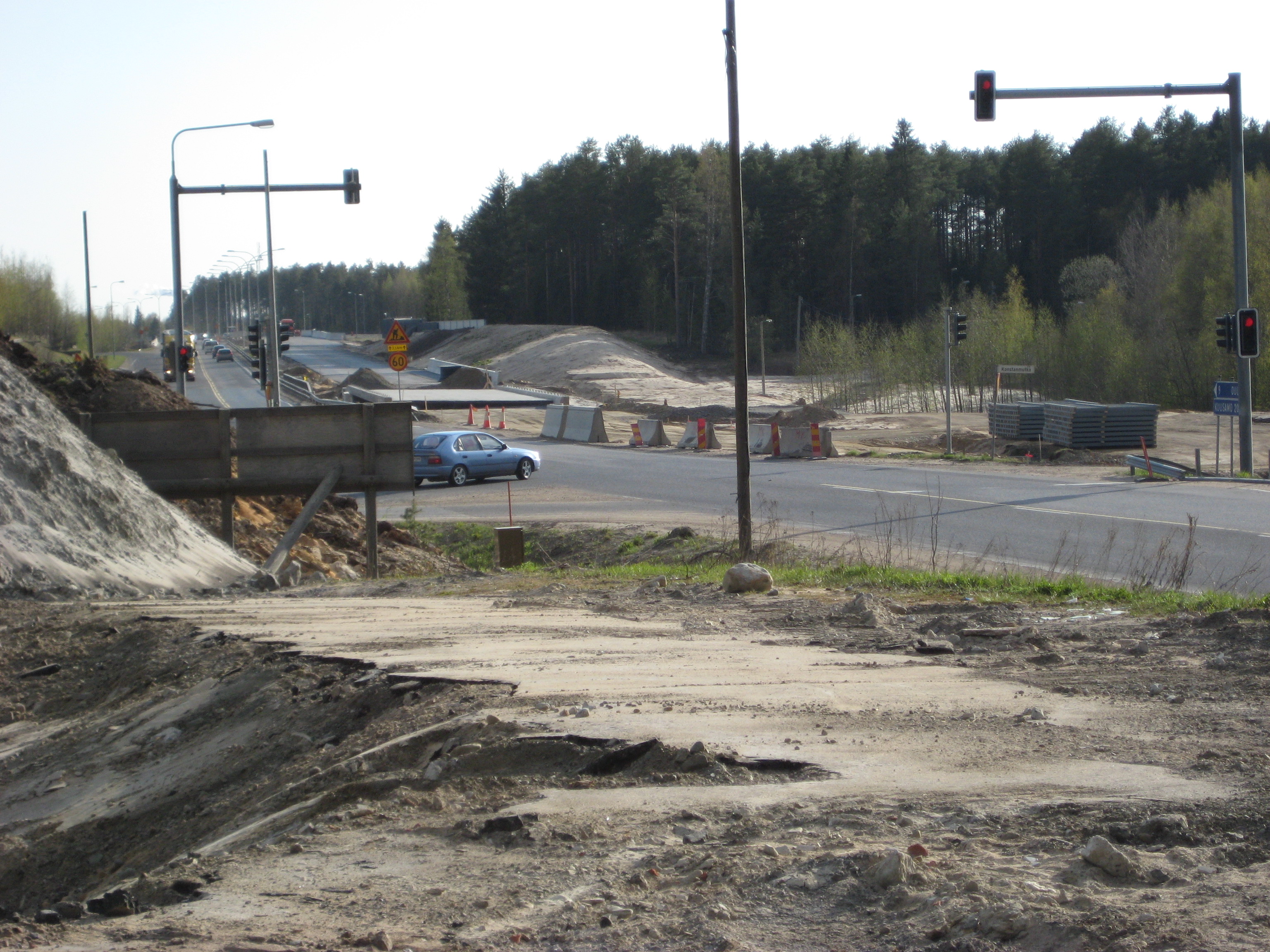
English: The crossroads of the national road 20 and national road 833 in Korvenkylä, Oulu, Finland, looking south-west (towards Oulu). As of May 2008, the national road 20 is being built to a four-lane road in Oulu between Hintta and Korvenkylä, and this cross-roads will be replaced with a new one, located about 1,5 kilometres north-east. The work is due to be completed by October 2008.
Suomi: Valtatien 20 ja seututien 833 risteys Oulun Korvenkylässä, lounaaseen (Ouluun päin) kuvattuna. Kuva on otettu toukokuussa 2008, jolloin valtatietä 20 rakennettiin nelikaistaiseksi Hintan ja Korvenkylän välillä. Myös seututien 833 risteys on rakenteilla uuteen paikkaan, noin 1,5 kilometriä koilliseen. Rakennustöiden on määrä valmistua lokakuussa 2008. |
| Date | |
| Source | Own work |
| Author | Antti Palsola (User:Apalsola) |
| Camera location | | View this and other nearby images on: OpenStreetMap |
|---|
I, the copyright holder of this work, hereby publish it under the following licenses:

|
Permission is granted to copy, distribute and/or modify this document under the terms of the GNU Free Documentation License, Version 1.2 or any later version published by the Free Software Foundation; with no Invariant Sections, no Front-Cover Texts, and no Back-Cover Texts. A copy of the license is included in the section entitled GNU Free Documentation License. |
This file is licensed under the Creative Commons Attribution-Share Alike 3.0 Unported, 2.5 Generic, 2.0 Generic and 1.0 Generic license.
- You are free:
- to share – to copy, distribute and transmit the work
- to remix – to adapt the work
- Under the following conditions:
- attribution – You must give appropriate credit, provide a link to the license, and indicate if changes were made. You may do so in any reasonable manner, but not in any way that suggests the licensor endorses you or your use.
- share alike – If you remix, transform, or build upon the material, you must distribute your contributions under the same or compatible license as the original.
You may select the license of your choice.
File history
Click on a date/time to view the file as it appeared at that time.
| Date/Time | Thumbnail | Dimensions | User | Comment | |
|---|---|---|---|---|---|
| current | 16:26, 25 May 2008 | | 3,072 × 2,304 (1.95 MB) | Apalsola (talk | contribs) | {{Information | Description = {{en|The crossroads of the national road 20 and national road 833 in Korvenkylä, Oulu, Finland, looking south-west (towards Oulu). As of May 2008, the national road 20 is being built to a four-lane road in Oulu between H |
You cannot overwrite this file.
File usage on Commons
There are no pages that use this file.
File usage on other wikis
The following other wikis use this file:
- Usage on www.wikidata.org