File:Vallika Smeulders Rondleiding slavernijverleden in Den Haag (cropped).jpg
Jump to navigation
Jump to search

Size of this preview: 280 × 598 pixels. Other resolutions: 112 × 240 pixels | 224 × 480 pixels | 359 × 768 pixels | 1,107 × 2,365 pixels.
Original file (1,107 × 2,365 pixels, file size: 731 KB, MIME type: image/jpeg)
Captions
Captions
Add a one-line explanation of what this file represents
Summary
[edit]| Description |
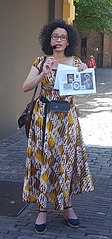
Nederlands: Vallika Smeulders geeft rondleiding in Den Haag bij Keti Koti viering 2018 |
| Date | 1 July 2018 (according to Exif data) |
| Source | Own work |
| Author | Caribiana |
| Camera location | | View this and other nearby images on: OpenStreetMap |
|---|

.jpg&action=edit§ion=1)
.jpg¶ms=052.080000_N_0004.314444_E_globe:Earth_type:camera__&language=en)
Licensing
[edit].jpg&action=edit§ion=2)
I, the copyright holder of this work, hereby publish it under the following license:
This file is licensed under the Creative Commons Attribution-Share Alike 4.0 International license.
- You are free:
- to share – to copy, distribute and transmit the work
- to remix – to adapt the work
- Under the following conditions:
- attribution – You must give appropriate credit, provide a link to the license, and indicate if changes were made. You may do so in any reasonable manner, but not in any way that suggests the licensor endorses you or your use.
- share alike – If you remix, transform, or build upon the material, you must distribute your contributions under the same or compatible license as the original.
| This file was uploaded via Mobile Android App (Commons mobile app) 2.12.3~dc08a5e88. |
File history
Click on a date/time to view the file as it appeared at that time.
| Date/Time | Thumbnail | Dimensions | User | Comment | |
|---|---|---|---|---|---|
| current | 20:19, 5 May 2021 | | 1,107 × 2,365 (731 KB) | Wouterhagens (talk | contribs) | File:Rondleiding slavernijverleden in Den Haag.jpg cropped 55 % horizontally, 63 % vertically using CropTool with lossless mode. |
You cannot overwrite this file.
File usage on Commons
The following 3 pages use this file:
File usage on other wikis
The following other wikis use this file:
- Usage on nl.wikipedia.org
- Usage on www.wikidata.org
.jpg&oldid=838876889)