File:Vallée de Gavarnie depuis la Hourquette d'Alans.jpg
Jump to navigation
Jump to search

Size of this preview: 800 × 357 pixels. Other resolutions: 320 × 143 pixels | 640 × 285 pixels | 1,024 × 456 pixels | 1,280 × 571 pixels | 2,560 × 1,141 pixels | 6,696 × 2,985 pixels.
Original file (6,696 × 2,985 pixels, file size: 2.81 MB, MIME type: image/jpeg)
Captions
Captions
Add a one-line explanation of what this file represents
Summary
[edit]
| Description |
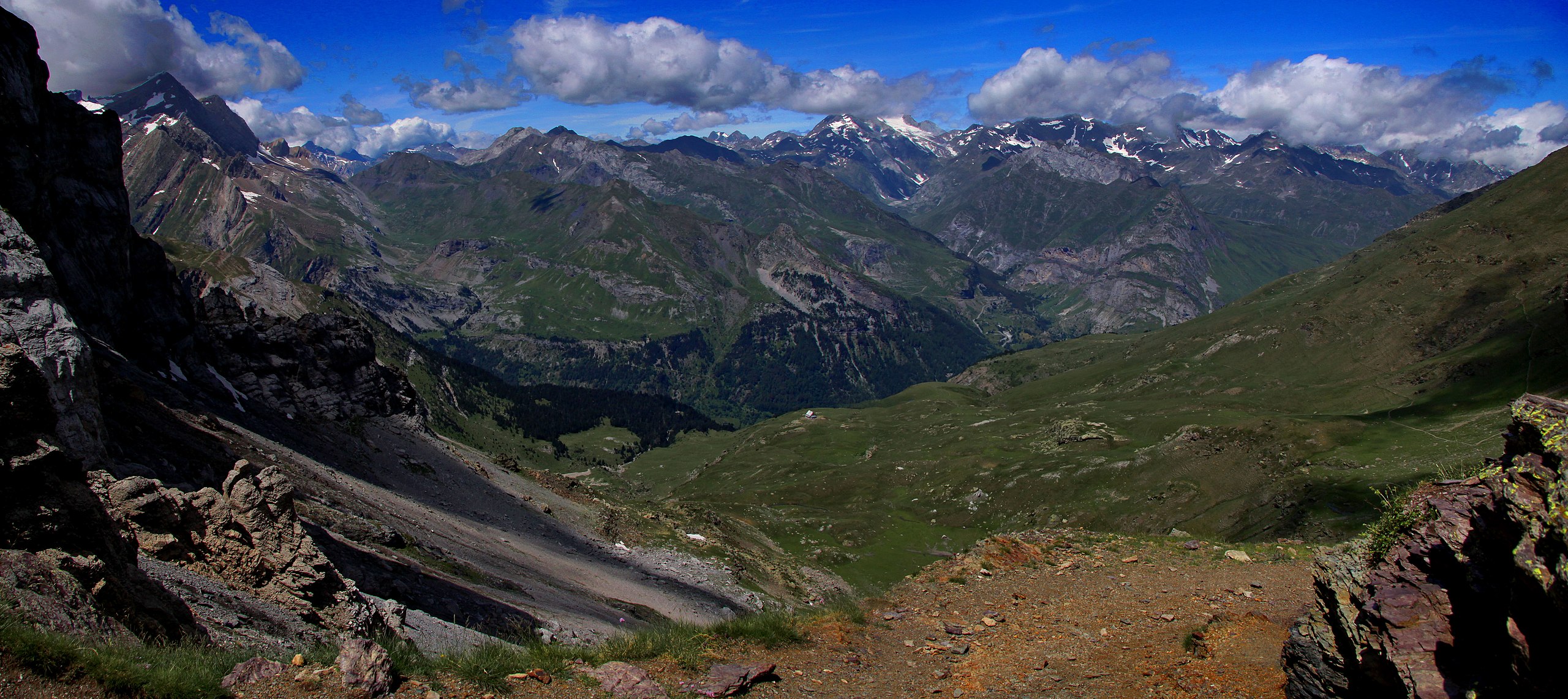
Français : Vallée de Gavarnie depuis la Hourquette d'Alans. De gauche à droite (voir photo): les Sarradets, la vallée des Pouey Aspé, la vallée des Espécières, la vallée d'Ossoue menant au Vignemale. À noter la nappe du Mont-Perdu coincée entre le socle et la nappe de Gavarnie au niveau du plateau de Bellevue. |
| Date | |
| Source | https://www.flickr.com/photos/84554176@N00/9614331591/ |
| Author | Guillaume Baviere |
| Camera location | | View this and other nearby images on: OpenStreetMap |
|---|
Licensing
[edit]
| This image was originally posted to Flickr. Its license was verified as "cc-by-sa-2.0" by the UploadWizard Extension at the time it was transferred to Commons. See the license information for further details. |
This file is licensed under the Creative Commons Attribution-Share Alike 2.0 Generic license.
- You are free:
- to share – to copy, distribute and transmit the work
- to remix – to adapt the work
- Under the following conditions:
- attribution – You must give appropriate credit, provide a link to the license, and indicate if changes were made. You may do so in any reasonable manner, but not in any way that suggests the licensor endorses you or your use.
- share alike – If you remix, transform, or build upon the material, you must distribute your contributions under the same or compatible license as the original.
| Annotations | This image is annotated: View the annotations at Commons |
File history
Click on a date/time to view the file as it appeared at that time.
| Date/Time | Thumbnail | Dimensions | User | Comment | |
|---|---|---|---|---|---|
| current | 21:22, 20 December 2018 | | 6,696 × 2,985 (2.81 MB) | Guérin Nicolas (talk | contribs) | User created page with UploadWizard |
You cannot overwrite this file.
File usage on Commons
There are no pages that use this file.
File usage on other wikis
The following other wikis use this file:
- Usage on fr.wikipedia.org
- Usage on uk.wikipedia.org