File:Us-luftbild 1945 wuerzburg stadtmitte no.7065.jpg
Jump to navigation
Jump to search
Size of this preview: 614 × 599 pixels. Other resolutions: 246 × 240 pixels | 492 × 480 pixels | 791 × 772 pixels.
Original file (791 × 772 pixels, file size: 391 KB, MIME type: image/jpeg)
Captions
Captions
Add a one-line explanation of what this file represents
Summary
[edit]| Description |
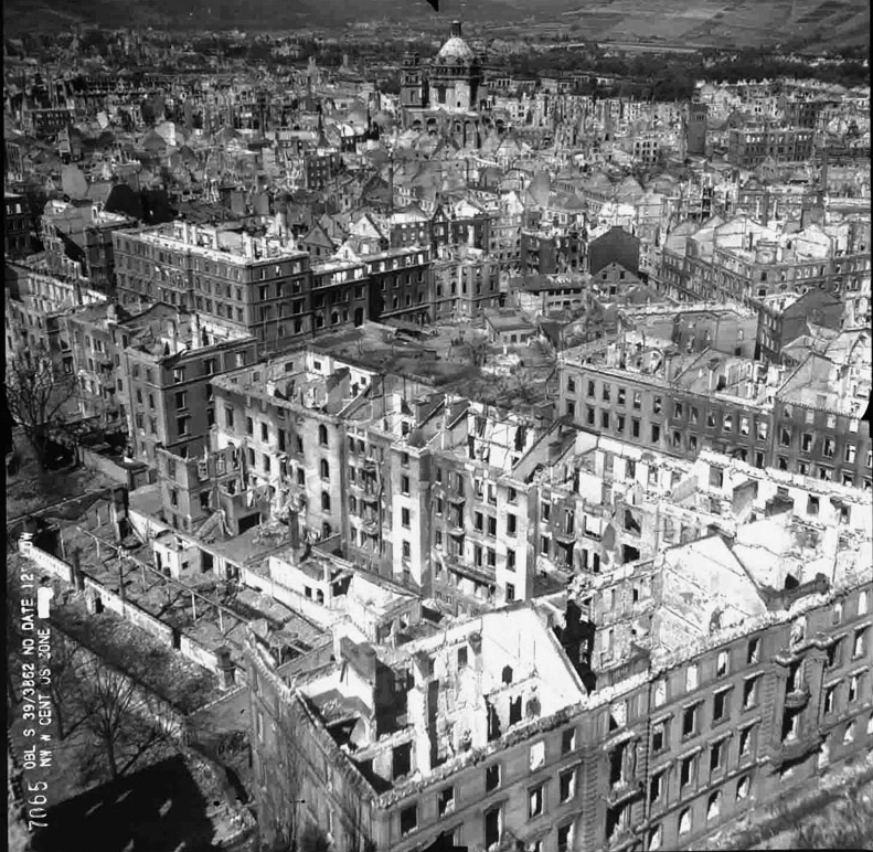
English: Aerial photo of the inner city of the destroyed Würzburg in autumn 1945, taken from the east
Deutsch: Luftaufnahme der Innenstadt des zerstörten Würzburgs im Herbst 1945, von Osten fotografiert |
||||
| Date | |||||
| Source | www.luftbilddatenbank.de | ||||
| Author | USAAF | ||||
| Permission (Reusing this file) |
|
||||
| Other versions |
|

| Annotations | This image is annotated: View the annotations at Commons |
File history
Click on a date/time to view the file as it appeared at that time.
| Date/Time | Thumbnail | Dimensions | User | Comment | |
|---|---|---|---|---|---|
| current | 08:01, 8 May 2011 | | 791 × 772 (391 KB) | Drdoht (talk | contribs) | {{Information |Description ={{en|1=Aerial photo of the inner city of the destroyed Würzburg in autumn 1945, taken from the east}} {{de|1=Luftaufnahme der Innenstadt des zerstörten Würzburgs im Herbst 1945, von Osten fotografiert}} |Source |
You cannot overwrite this file.
File usage on Commons
The following page uses this file:
File usage on other wikis
The following other wikis use this file:
- Usage on de.wikipedia.org
- Usage on en.wikipedia.org
- Usage on fr.wikipedia.org
- Usage on ja.wikipedia.org
- Usage on ru.wikipedia.org
- Usage on www.wikidata.org