File:Urmesstischblatt Preußen 1846 Detail Falkenberg.jpg
Jump to navigation
Jump to search
Size of this preview: 530 × 600 pixels. Other resolutions: 212 × 240 pixels | 424 × 480 pixels | 679 × 768 pixels | 1,101 × 1,246 pixels.
Original file (1,101 × 1,246 pixels, file size: 647 KB, MIME type: image/jpeg)
Captions
Captions
Add a one-line explanation of what this file represents
Summary
[edit]
| Description |
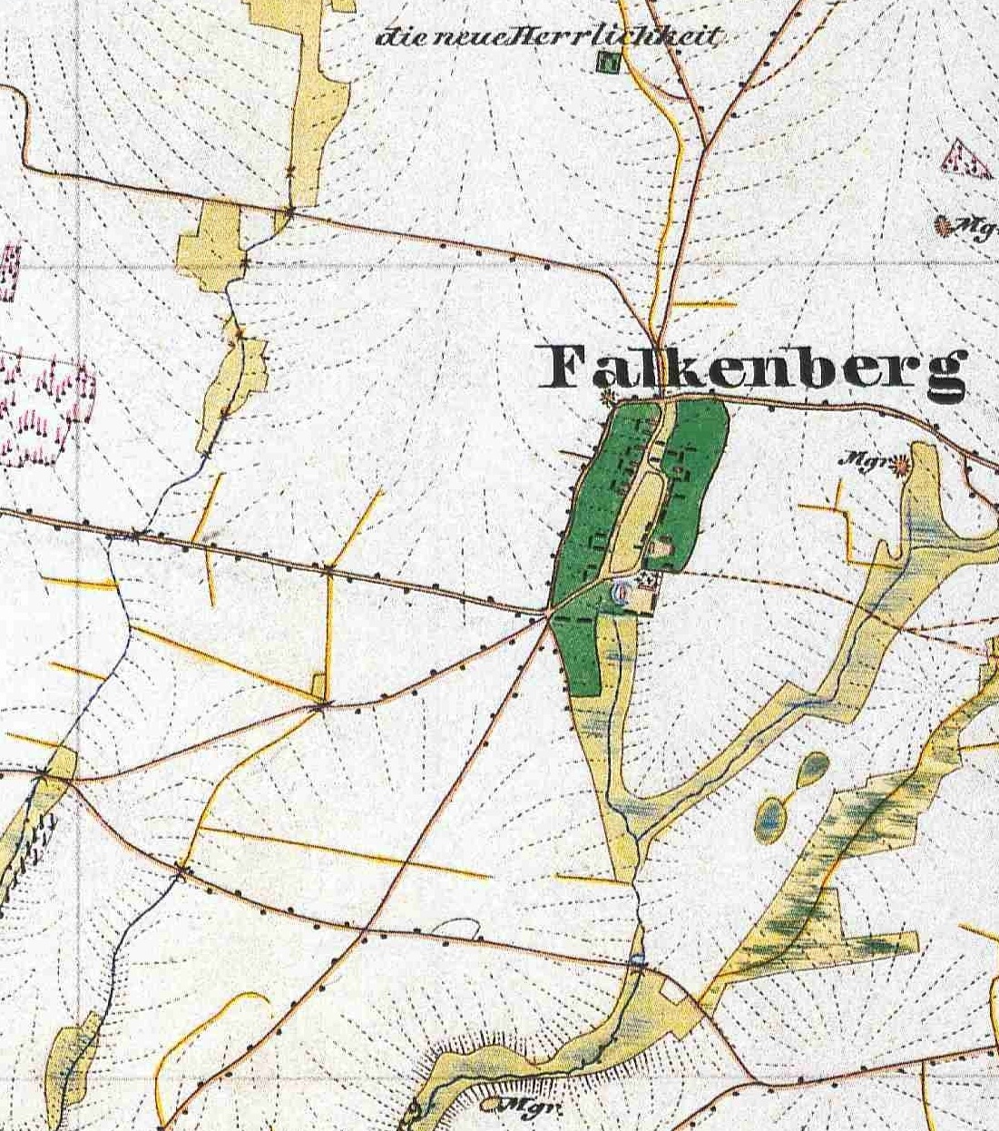
Deutsch: Falkenberg in einem Ausschnitt des unten angegebenen Urmesstischblatts von 1846. Das Dorf Falkenberg ist heute ein Ortsteil der Gemeinde Tauche im Landkreis Oder-Spree in Brandenburg. Der gewählte Kartenausschnitt gibt in etwa die Gemarkung Falkenberg wieder, die 421 Hektar (Stand 2014) umfasst.
English: Village Falkenberg, detail from the Urmesstischblatt (prototype planetable sheet at 1:25,000) Sheet 3850 Kossenblatt, drawn in 1846. Today, Falkenberg is a part of the municipality Tauche in the District Oder-Spree, Brandenburg, Germany. |
| Date | |
| Source | Urmesstischblatt, Preußische Kartenaufnahme 1:25.000, Blatt 3850 Kossenblatt, 1846 |
| Author | Heinemann, Lt. im 26. Inf. Rgt. (Leutnant im 26. Infanterie-Regiment) |
Licensing
[edit]
|
This work is in the public domain in its country of origin and other countries and areas where the copyright term is the author's life plus 70 years or fewer. | |
| This file has been identified as being free of known restrictions under copyright law, including all related and neighboring rights. | |
File history
Click on a date/time to view the file as it appeared at that time.
| Date/Time | Thumbnail | Dimensions | User | Comment | |
|---|---|---|---|---|---|
| current | 18:07, 21 November 2014 | | 1,101 × 1,246 (647 KB) | Lienhard Schulz (talk | contribs) | {{Information |description= {{de|Falkenberg in einem Ausschnitt des unten angegebenen Urmesstischblatts von 1846. Das Dorf Falkenberg ist heute ein Ortsteil der Gemeinde Tauche im [[:Category:Landkreis Oder-Sp... |
You cannot overwrite this file.
File usage on Commons
There are no pages that use this file.
File usage on other wikis
The following other wikis use this file: