File:Unopened Scott Way, West Wichel.jpg
Jump to navigation
Jump to search
Size of this preview: 800 × 450 pixels. Other resolutions: 320 × 180 pixels | 640 × 360 pixels | 1,024 × 576 pixels | 1,280 × 720 pixels | 2,560 × 1,440 pixels | 4,128 × 2,322 pixels.
Original file (4,128 × 2,322 pixels, file size: 1.99 MB, MIME type: image/jpeg)
Captions
Captions
Add a one-line explanation of what this file represents
Summary
[edit]
| Description |
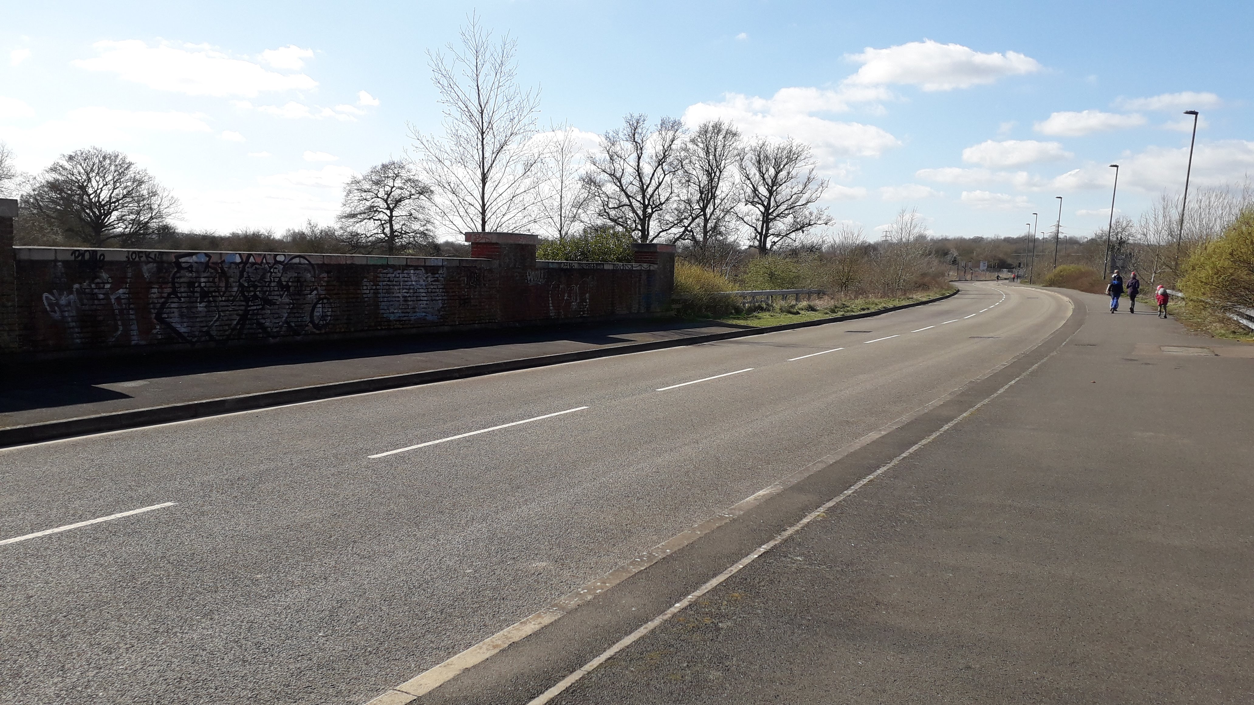
English: A view on Scott Way in Wichelstowe, Swindon. This road leads to nowhere and has sat unused for about 12 years.
Long construction delays largely due to the 2008 recession meant that Wichelstowe was left with a few 'ghost' junctions and roads, which were meant to be finished shortly after they were built but instead were left unused for over a decade. Scott Way runs for about 400 metres before coming to an abrupt stop just before the old Elcombe Lane. Eventually, the road will link up to Wootton Bassett via a tunnel under the M4. |
| Date | |
| Source | Own work |
| Author | Icantthinkofausernames |
| Camera location | | View this and other nearby images on: OpenStreetMap |
|---|
Licensing
[edit]
I, the copyright holder of this work, hereby publish it under the following license:
| This file is made available under the Creative Commons CC0 1.0 Universal Public Domain Dedication. | |
| The person who associated a work with this deed has dedicated the work to the public domain by waiving all of their rights to the work worldwide under copyright law, including all related and neighboring rights, to the extent allowed by law. You can copy, modify, distribute and perform the work, even for commercial purposes, all without asking permission.
|
File history
Click on a date/time to view the file as it appeared at that time.
| Date/Time | Thumbnail | Dimensions | User | Comment | |
|---|---|---|---|---|---|
| current | 19:03, 2 February 2024 | | 4,128 × 2,322 (1.99 MB) | Icantthinkofausernames (talk | contribs) | Uploaded own work with UploadWizard |
You cannot overwrite this file.
File usage on Commons
There are no pages that use this file.