File:University Hospital Center in Tangier (satellite view).jpg
Jump to navigation
Jump to search

Size of this preview: 800 × 450 pixels. Other resolutions: 320 × 180 pixels | 640 × 360 pixels | 1,024 × 576 pixels | 1,366 × 768 pixels.
Original file (1,366 × 768 pixels, file size: 450 KB, MIME type: image/jpeg)
Captions
Captions
Add a one-line explanation of what this file represents
Summary
[edit].jpg&action=edit§ion=1)
| Description |
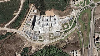
English: University Hospital Center Tangier-Tetouan-Al Hoceima, Morocco. |
| Date | |
| Source | NASA World Wind |
| Author | Flaspec |
Licensing
[edit].jpg&action=edit§ion=2)
| This image is in the public domain because it is a screenshot from NASA’s globe software World Wind using a public domain layer, such as Blue Marble, MODIS, Landsat, SRTM, USGS or GLOBE.
|
 |
File history
Click on a date/time to view the file as it appeared at that time.
| Date/Time | Thumbnail | Dimensions | User | Comment | |
|---|---|---|---|---|---|
| current | 21:14, 7 October 2021 | | 1,366 × 768 (450 KB) | Flaspec (talk | contribs) | Adjusted. |
| 22:02, 19 September 2021 |  | 1,215 × 744 (214 KB) | Flaspec (talk | contribs) | Uploaded a work by [User:Flaspec|Flaspec]] from NASA World Wind with UploadWizard |
You cannot overwrite this file.
File usage on Commons
There are no pages that use this file.
.jpg&oldid=596621920)