File:United States House of Representatives, Washington District simplified map.svg
Jump to navigation
Jump to search

Size of this PNG preview of this SVG file: 712 × 600 pixels. Other resolutions: 285 × 240 pixels | 570 × 480 pixels | 912 × 768 pixels | 1,215 × 1,024 pixels | 2,431 × 2,048 pixels | 743 × 626 pixels.
Original file (SVG file, nominally 743 × 626 pixels, file size: 674 KB)
Captions
Captions
Add a one-line explanation of what this file represents
Summary
[edit]
| Description |
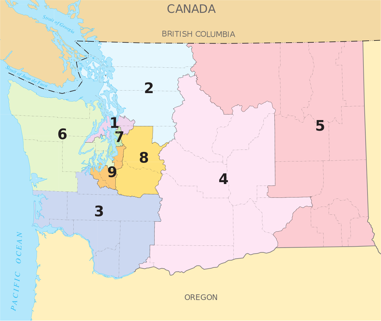
English: A map of the pre-2012 redistricting w:Congressional districts of Washington. |
|||
| Date | ||||
| Source | The map is from nationalatlas.gov, specifically the PDF Map of Washington's Congressional Districts. | |||
| Author | U.S. Government | |||
| Permission (Reusing this file) |
|
This map is based on File:United States House of Representatives, Washington District map.svg, but with larger district numbers, and county and town names stripped out in hopes of making something that scales down well.
Licensing
[edit]
This map was obtained from an edition of the National Atlas of the United States. Like almost all works of the U.S. federal government, works from the National Atlas are in the public domain in the United States.
Online access: NationalAtlas.gov | 1970 print edition: Library of Congress, Perry-Castañeda Library
|
File history
Click on a date/time to view the file as it appeared at that time.
| Date/Time | Thumbnail | Dimensions | User | Comment | |
|---|---|---|---|---|---|
| current | 00:33, 30 August 2009 | | 743 × 626 (674 KB) | RobLa (talk | contribs) | {{Information |Description={{en|1=A map of the w:Congressional districts of Washington.}} |Source=The map is from [http://nationalatlas.gov/printable/congress.html#wa nationalatlas.gov], specifically [http://nationalatlas.gov/printable/images/pdf/cong |
You cannot overwrite this file.
File usage on Commons
There are no pages that use this file.
File usage on other wikis
The following other wikis use this file:
- Usage on en.wikipedia.org