File:United Kingdom local elections, 2010.svg
Jump to navigation
Jump to search

Size of this PNG preview of this SVG file: 486 × 599 pixels. Other resolutions: 195 × 240 pixels | 389 × 480 pixels | 623 × 768 pixels | 830 × 1,024 pixels | 1,661 × 2,048 pixels | 2,165 × 2,670 pixels.
Original file (SVG file, nominally 2,165 × 2,670 pixels, file size: 488 KB)
Captions
Captions
Add a one-line explanation of what this file represents
Summary
[edit]
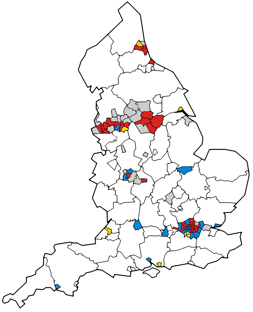
| Description | A map of England showing the results of the United Kingdom local elections, 2010. All the seats in the 32 London Boroughs were contested, as well as a third of the seats in 36 Metropolitan Boroughs and 20 unitary authorities. The results of district and borough councils are not shown. |
| Date | |
| Source | BlankMap-EnglandSubdivisions2009.png. |
| Author | Keith Edkins and Jolly Janner |
| SVG development | This vector image was created with Inkscape. |
Licensing
[edit]

|
Permission is granted to copy, distribute and/or modify this document under the terms of the GNU Free Documentation License, Version 1.2 or any later version published by the Free Software Foundation; with no Invariant Sections, no Front-Cover Texts, and no Back-Cover Texts. A copy of the license is included in the section entitled GNU Free Documentation License. Subject to disclaimers. |
File history
Click on a date/time to view the file as it appeared at that time.
| Date/Time | Thumbnail | Dimensions | User | Comment | |
|---|---|---|---|---|---|
| current | 23:30, 8 May 2010 | | 2,165 × 2,670 (488 KB) | Jolly Janner (talk | contribs) | Mathced party colours |
| 23:20, 8 May 2010 |  | 2,165 × 2,670 (488 KB) | Jolly Janner (talk | contribs) | Fixed Isle of Wight. | |
| 23:17, 8 May 2010 |  | 2,165 × 2,670 (488 KB) | Jolly Janner (talk | contribs) | {{Information |Description=A map of England showing the results of the United Kingdom local elections, 2010. All the seats in the 32 London Boroughs were contested, as well as a third of the |
You cannot overwrite this file.
File usage on Commons
There are no pages that use this file.
File usage on other wikis
The following other wikis use this file:
- Usage on en.wikipedia.org
- Usage on fr.wikipedia.org