File:Unitary Plan Wind Tunnel aerial.jpeg
Jump to navigation
Jump to search
No higher resolution available.
Unitary_Plan_Wind_Tunnel_aerial.jpeg (650 × 512 pixels, file size: 80 KB, MIME type: image/jpeg)
Captions
Captions
Add a one-line explanation of what this file represents
|
This is an image of a place or building that is listed on the National Register of Historic Places in the United States of America. Its reference number is 85002799. |
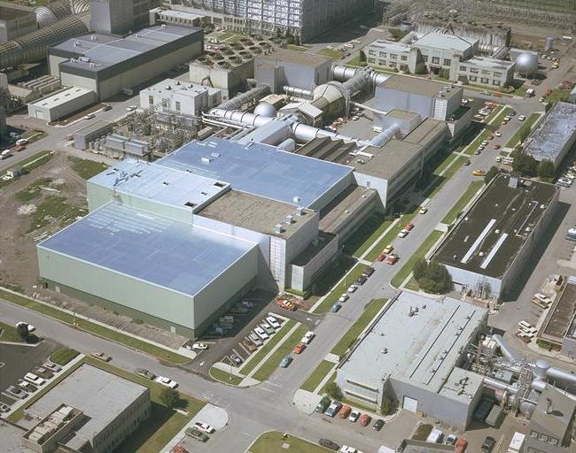
| Description | Aerial view of the Unitary Plan Wind Tunnel complex, NASA Ames Research Center, Mountain View, California, USA | |||||
| Date | ||||||
| Source | http://ails.arc.nasa.gov/Images/Ames/AC74-1400.html | |||||
| Author | Art Melliar, NASA | |||||
| Permission (Reusing this file) |
|

| Object location | | View this and other nearby images on: OpenStreetMap |
|---|
File history
Click on a date/time to view the file as it appeared at that time.
| Date/Time | Thumbnail | Dimensions | User | Comment | |
|---|---|---|---|---|---|
| current | 19:59, 13 March 2007 | | 650 × 512 (80 KB) | Holly Cheng (talk | contribs) | {{Information |Description=Aerial view of the w:Unitary Plan Wind Tunnel complex, NASA Ames Research Center, Mountain View, California, USA |Source=http://ails.arc.nasa.gov/Images/Ames/AC74-1400.html |Date=1974 |Author=Art Melliar, NASA |Permission={ |
You cannot overwrite this file.
File usage on Commons
There are no pages that use this file.
File usage on other wikis
The following other wikis use this file: