File:Umgebungskarte Lörrachs.png
Jump to navigation
Jump to search

Size of this preview: 800 × 434 pixels. Other resolutions: 320 × 174 pixels | 640 × 347 pixels | 1,024 × 556 pixels | 1,500 × 814 pixels.
Original file (1,500 × 814 pixels, file size: 938 KB, MIME type: image/png)
Captions
Captions
Add a one-line explanation of what this file represents
Summary
[edit]
| Description |
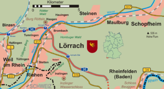
Deutsch: Umgebungskarte Lörrachs mit Eisenbahn und Hauptverkehrsstraßen |
| Date | |
| Source | Own work |
| Author | Wladyslaw |
| Permission (Reusing this file) |
Licensed under the GFDL by the author. |
Licensing
[edit]
Taxiarchos228 at the German-language Wikipedia, the copyright holder of this work, hereby publishes it under the following license:

|
Permission is granted to copy, distribute and/or modify this document under the terms of the GNU Free Documentation License, Version 1.2 or any later version published by the Free Software Foundation; with no Invariant Sections, no Front-Cover Texts, and no Back-Cover Texts. A copy of the license is included in the section entitled GNU Free Documentation License. |
| This file is licensed under the Creative Commons Attribution-Share Alike 3.0 Unported license. | ||
| Attribution: Taxiarchos228 | ||
| ||
| This licensing tag was added to this file as part of the GFDL licensing update. |
Original upload log
[edit]
The original description page was here. All following user names refer to de.wikipedia.
- 2007-12-17 19:25 Taxiarchos228 1500×814× (960481 bytes) {{Information |Beschreibung = |Quelle = |Urheber = |Datum = |Genehmigung = |Andere Versionen = |Anmerkungen = }}
- 2007-12-16 15:19 Taxiarchos228 1600×868× (1082014 bytes) {{Information |Beschreibung = |Quelle = |Urheber = |Datum = |Genehmigung = |Andere Versionen = |Anmerkungen = }}
- 2007-12-16 14:49 Taxiarchos228 1600×869× (1062592 bytes) {{Information |Beschreibung = |Quelle = |Urheber = |Datum = |Genehmigung = |Andere Versionen = |Anmerkungen = }}
- 2007-12-16 13:16 Taxiarchos228 1600×870× (1074152 bytes) {{Information |Beschreibung = |Quelle = |Urheber = |Datum = |Genehmigung = |Andere Versionen = |Anmerkungen = }}
- 2007-12-16 13:08 Taxiarchos228 1900×1031× (1418390 bytes) {{Information |Beschreibung = |Quelle = |Urheber = |Datum = |Genehmigung = |Andere Versionen = |Anmerkungen = }}
- 2007-12-15 17:43 Taxiarchos228 1866×1005× (1247329 bytes) {{Information |Beschreibung = Umgebungskarte Lörrachs mit Eisenbahn und Hauptverkehrsstraßen |Quelle = selbst erstellt auf Grundlage von [[:Bild:Grossraum Basel.png]] |Urheber = – [[Benutzer:Wladyslaw Sojka|Wladyslaw]] [[Benutzer Diskussion:Wladyslaw
File history
Click on a date/time to view the file as it appeared at that time.
| Date/Time | Thumbnail | Dimensions | User | Comment | |
|---|---|---|---|---|---|
| current | 08:33, 9 July 2010 | | 1,500 × 814 (938 KB) | Hektor von Hofmark (talk | contribs) | {{Information |Description={{de|Umgebungskarte Lörrachs mit Eisenbahn und Hauptverkehrsstraßen}} |Source=Transferred from [http://de.wikipedia.org de.wikipedia]<br/> (Original text : ''selbst erstellt auf Grundlage von de::Bild:Grossraum Basel.png |
You cannot overwrite this file.
File usage on Commons
There are no pages that use this file.
File usage on other wikis
The following other wikis use this file:
- Usage on azb.wikipedia.org
- Usage on de.wikipedia.org
- Usage on en.wikipedia.org