File:Umbria Plantation - Architectural drawing of front and east elevations.png
Jump to navigation
Jump to search

Size of this preview: 747 × 600 pixels. Other resolutions: 299 × 240 pixels | 598 × 480 pixels | 956 × 768 pixels | 1,245 × 1,000 pixels.
Original file (1,245 × 1,000 pixels, file size: 403 KB, MIME type: image/png)
Captions
Captions
Add a one-line explanation of what this file represents
| Description |
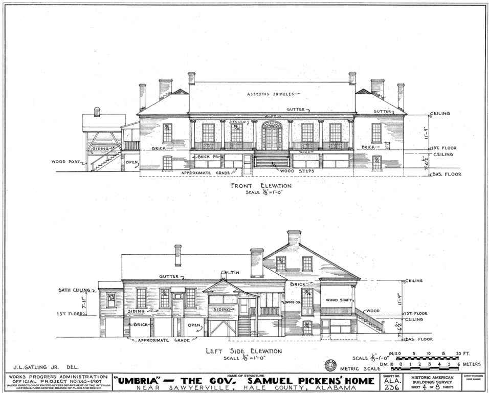
English: Governor Samuel Pickens House, best known as Umbria, State Route 14, Sawyerville vicinity, Hale, AL. ARCHITECTURAL DRAWINGS. |
|||||
| Date | 1930s | |||||
| Source |
|
|||||
| Author | J.L. Gatling | |||||
| Permission (Reusing this file) |
|


File history
Click on a date/time to view the file as it appeared at that time.
| Date/Time | Thumbnail | Dimensions | User | Comment | |
|---|---|---|---|---|---|
| current | 01:36, 31 January 2011 | | 1,245 × 1,000 (403 KB) | Altairisfar (talk | contribs) | {{Information |Description={{en|'''Governor Samuel Pickens House''', best known as '''Umbria''', State Route 14, Sawyerville vicinity, Hale, AL. ARCHITECTURAL DRAWINGS.}} |Source={{LOC-image|id=hhh.al0232}} |Date=1930s |Author=J.L. Gatling |Permission= {{ |
You cannot overwrite this file.
File usage on Commons
There are no pages that use this file.