File:Uldale Force - geograph.org.uk - 1220925.jpg
Jump to navigation
Jump to search
No higher resolution available.
Uldale_Force_-_geograph.org.uk_-_1220925.jpg (640 × 427 pixels, file size: 100 KB, MIME type: image/jpeg)
Captions
Captions
Add a one-line explanation of what this file represents
Summary
[edit]
| Description |
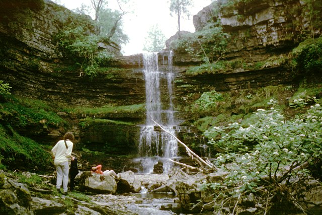
English: Uldale Force This waterfall must mark the end of many walks up the River Rawthey as the valley is hemmed in by steep sides and the slimy overhanging rocks are quite unclimbable. This particular walk had come up from Rawthey bridge through the limestone gorge of the river, looking for sites of speleological interest, and by this stage, the limestone was well below us, so we had no incentive to struggle out of the valley to continue above the force. |
| Date | |
| Source | From geograph.org.uk |
| Author | Andy Waddington |
| Attribution (required by the license) | Andy Waddington / Uldale Force / |
| Camera location | | View this and other nearby images on: OpenStreetMap |
|---|
_heading:135.00&language=en)
| Object location | | View this and other nearby images on: OpenStreetMap |
|---|
_heading:135.00&language=en)
Licensing
[edit]

|
This image was taken from the Geograph project collection. See this photograph's page on the Geograph website for the photographer's contact details. The copyright on this image is owned by Andy Waddington and is licensed for reuse under the Creative Commons Attribution-ShareAlike 2.0 license.
|
This file is licensed under the Creative Commons Attribution-Share Alike 2.0 Generic license.
Attribution: Andy Waddington
- You are free:
- to share – to copy, distribute and transmit the work
- to remix – to adapt the work
- Under the following conditions:
- attribution – You must give appropriate credit, provide a link to the license, and indicate if changes were made. You may do so in any reasonable manner, but not in any way that suggests the licensor endorses you or your use.
- share alike – If you remix, transform, or build upon the material, you must distribute your contributions under the same or compatible license as the original.
File history
Click on a date/time to view the file as it appeared at that time.
| Date/Time | Thumbnail | Dimensions | User | Comment | |
|---|---|---|---|---|---|
| current | 11:26, 26 February 2011 | | 640 × 427 (100 KB) | GeographBot (talk | contribs) | == {{int:filedesc}} == {{Information |description={{en|1=Uldale Force This waterfall must mark the end of many walks up the River Rawthey as the valley is hemmed in by steep sides and the slimy overhanging rocks are quite unclimbable. This particular walk |
You cannot overwrite this file.
File usage on Commons
There are no pages that use this file.