File:Uebersicht dinder wiki.gif
Jump to navigation
Jump to search
No higher resolution available.
Uebersicht_dinder_wiki.gif (378 × 491 pixels, file size: 206 KB, MIME type: image/gif)
Captions
Captions
Add a one-line explanation of what this file represents
Summary
[edit]
| Description |
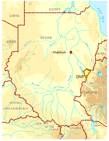
Deutsch: Übersichtskarte des Sudans mit eingetragenen Grenzen des Dinder National Parks.
|
| Date | 1 November 2006 (upload date) |
| Source | Basisdaten: Höheninformationen (GTOPO) von der GLCF (http://glcf.umiacs.umd.edu/index.shtml), Grenzen von ESRI, weitere topographische Informationen abdigitalisiert von verschiedenen Karten der Technischen Fachhochschule Berlin. |
| Author | Sven Oehm |
| Permission (Reusing this file) |
Weiterverwendung nur auf Anfrage! Es wird darauf hingewiesen, dass die internationalen Grenzverläufe keinen Anspruch auf Genauigkeit oder Forderungen jeglicher Art erheben. |
Licensing
[edit]
I, the copyright holder of this work, hereby publish it under the following licenses:

|
Permission is granted to copy, distribute and/or modify this document under the terms of the GNU Free Documentation License, Version 1.2 or any later version published by the Free Software Foundation; with no Invariant Sections, no Front-Cover Texts, and no Back-Cover Texts. A copy of the license is included in the section entitled GNU Free Documentation License. |
| This file is licensed under the Creative Commons Attribution-Share Alike 3.0 Unported license. | ||
| ||
| This licensing tag was added to this file as part of the GFDL licensing update. |
This file is licensed under the Creative Commons Attribution 2.5 Generic license.
- You are free:
- to share – to copy, distribute and transmit the work
- to remix – to adapt the work
- Under the following conditions:
- attribution – You must give appropriate credit, provide a link to the license, and indicate if changes were made. You may do so in any reasonable manner, but not in any way that suggests the licensor endorses you or your use.
You may select the license of your choice.
File history
Click on a date/time to view the file as it appeared at that time.
| Date/Time | Thumbnail | Dimensions | User | Comment | |
|---|---|---|---|---|---|
| current | 16:03, 1 November 2006 | | 378 × 491 (206 KB) | Sven.oehm~commonswiki (talk | contribs) | {{Information |Description=Übersichtskarte des Sudans mit eingetragenen Grenzen des Dinder National Parks. |Source=Basisdaten: Höheninformationen (GTOPO) von der GLCF (http://glcf.umiacs.umd.edu/index.shtml), Grenzen von ESRI, weitere topographische Inf |
You cannot overwrite this file.
File usage on Commons
There are no pages that use this file.
File usage on other wikis
The following other wikis use this file:
- Usage on ar.wikipedia.org
- Usage on de.wikipedia.org
- Usage on hy.wikipedia.org
- Usage on pt.wikipedia.org
- Usage on ru.wikipedia.org