File:US National Football League Teams Location-en.svg
Jump to navigation
Jump to search

Size of this PNG preview of this SVG file: 787 × 600 pixels. Other resolutions: 315 × 240 pixels | 630 × 480 pixels | 1,008 × 768 pixels | 1,280 × 976 pixels | 2,560 × 1,951 pixels | 900 × 686 pixels.
Original file (SVG file, nominally 900 × 686 pixels, file size: 122 KB)
Captions
Captions
Add a one-line explanation of what this file represents
Summary
[edit]| Description |
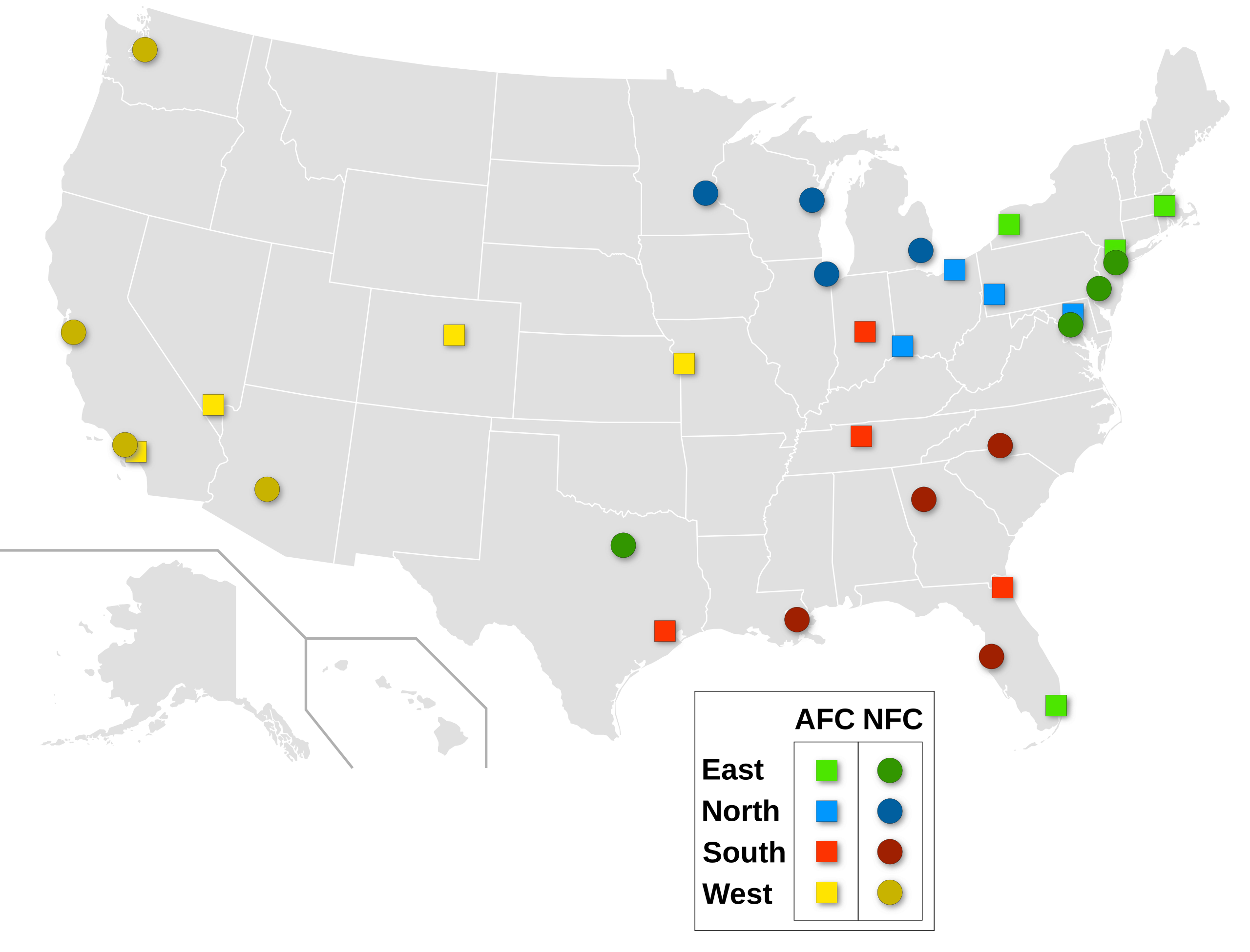
English: United States National Football League teams location. Français : Localisation des équipes de la National Football League (ligue nationale de football américain des États-Unis). |
||
| Date | |||
| Source |
Own work
|
||
| Author | Sémhur | ||
| Other versions |
|
||
| Attribution (required by the license) | © Sémhur / Wikimedia Commons / | ||
| SVG | W3C-validity not checked.
|
||
| Atelier graphique |

| Camera location | | View this and other nearby images on: OpenStreetMap |
|---|
Licensing
[edit]
I, the copyright holder of this work, hereby publish it under the following licenses:
| Copyleft: This work of art is free; you can redistribute it and/or modify it according to terms of the Free Art License. You will find a specimen of this license on the Copyleft Attitude site as well as on other sites. |
This file is licensed under the Creative Commons Attribution-Share Alike 3.0 Unported, 2.5 Generic, 2.0 Generic and 1.0 Generic license.
- You are free:
- to share – to copy, distribute and transmit the work
- to remix – to adapt the work
- Under the following conditions:
- attribution – You must give appropriate credit, provide a link to the license, and indicate if changes were made. You may do so in any reasonable manner, but not in any way that suggests the licensor endorses you or your use.
- share alike – If you remix, transform, or build upon the material, you must distribute your contributions under the same or compatible license as the original.
You may select the license of your choice.
File history
Click on a date/time to view the file as it appeared at that time.
| Date/Time | Thumbnail | Dimensions | User | Comment | |
|---|---|---|---|---|---|
| current | 06:28, 9 September 2022 | | 900 × 686 (122 KB) | Spesh531 (talk | contribs) | Moved location of teams to accurate locations (some were a few counties away, such as SF 49ers). Both LA and NY icons surround the actual location, so as to not completely overlap the icons. Used more detailed map from original source blank map |
| 04:35, 25 January 2020 |  | 900 × 686 (121 KB) | GalaxyFighter55 (talk | contribs) | Raiders officially move to Las Vegas | |
| 04:25, 14 March 2017 |  | 900 × 686 (121 KB) | Playhouse76 (talk | contribs) | Reverted to version as of 04:24, 14 March 2017 (UTC) | |
| 04:25, 14 March 2017 |  | 844 × 643 (121 KB) | Playhouse76 (talk | contribs) | Reverted to version as of 19:26, 28 August 2016 (UTC) | |
| 04:24, 14 March 2017 |  | 900 × 686 (121 KB) | Playhouse76 (talk | contribs) | Moved the Chargers location from San Diego to Los Angeles | |
| 19:26, 28 August 2016 |  | 844 × 643 (121 KB) | Sémhur (talk | contribs) | Removed light upon symbols; NFC symbols a bit darkest; symbols size a bit larger (125%) | |
| 08:58, 18 January 2016 |  | 844 × 643 (99 KB) | CASportsFan (talk | contribs) | Moving the Rams circle to Los Angeles | |
| 15:28, 6 December 2007 |  | 844 × 643 (169 KB) | Sémhur (talk | contribs) | == Description == {{Information |Description=United States National Football League teams location. |Source=Own work, from : * Image:Blank_US_Map.svg by Theshibboleth under license GFDL * Image:NFL teams locations.PNG by [ |
You cannot overwrite this file.
File usage on Commons
The following 5 pages use this file:
File usage on other wikis
The following other wikis use this file:
- Usage on ar.wikipedia.org
- Usage on ast.wikipedia.org
- Usage on ca.wikipedia.org
- Usage on da.wikipedia.org
- Usage on el.wikipedia.org
- Usage on en.wikipedia.org
- Usage on es.wikipedia.org
- Usage on eu.wikipedia.org
- Usage on fi.wikipedia.org
- Usage on fr.wikipedia.org
- Usage on gl.wikipedia.org
- Usage on he.wikipedia.org
- Usage on id.wikipedia.org
- Usage on it.wikipedia.org
- Usage on ja.wikipedia.org
- Usage on nl.wikipedia.org
- Usage on nl.wikibooks.org
- Usage on no.wikipedia.org
- Usage on pt.wikipedia.org
- Usage on ro.wikipedia.org
- Usage on sv.wikipedia.org
- Usage on th.wikipedia.org
- Usage on zh.wikipedia.org