File:USGS Kīlauea multimediaFile-2481 (2018-07-22).jpg
Jump to navigation
Jump to search

Size of this preview: 800 × 600 pixels. Other resolutions: 320 × 240 pixels | 640 × 480 pixels | 1,024 × 768 pixels | 1,280 × 960 pixels | 2,560 × 1,920 pixels | 4,032 × 3,024 pixels.
Original file (4,032 × 3,024 pixels, file size: 7.34 MB, MIME type: image/jpeg)
Captions
Captions
Add a one-line explanation of what this file represents
Summary
[edit].jpg&action=edit§ion=1)
| Description |
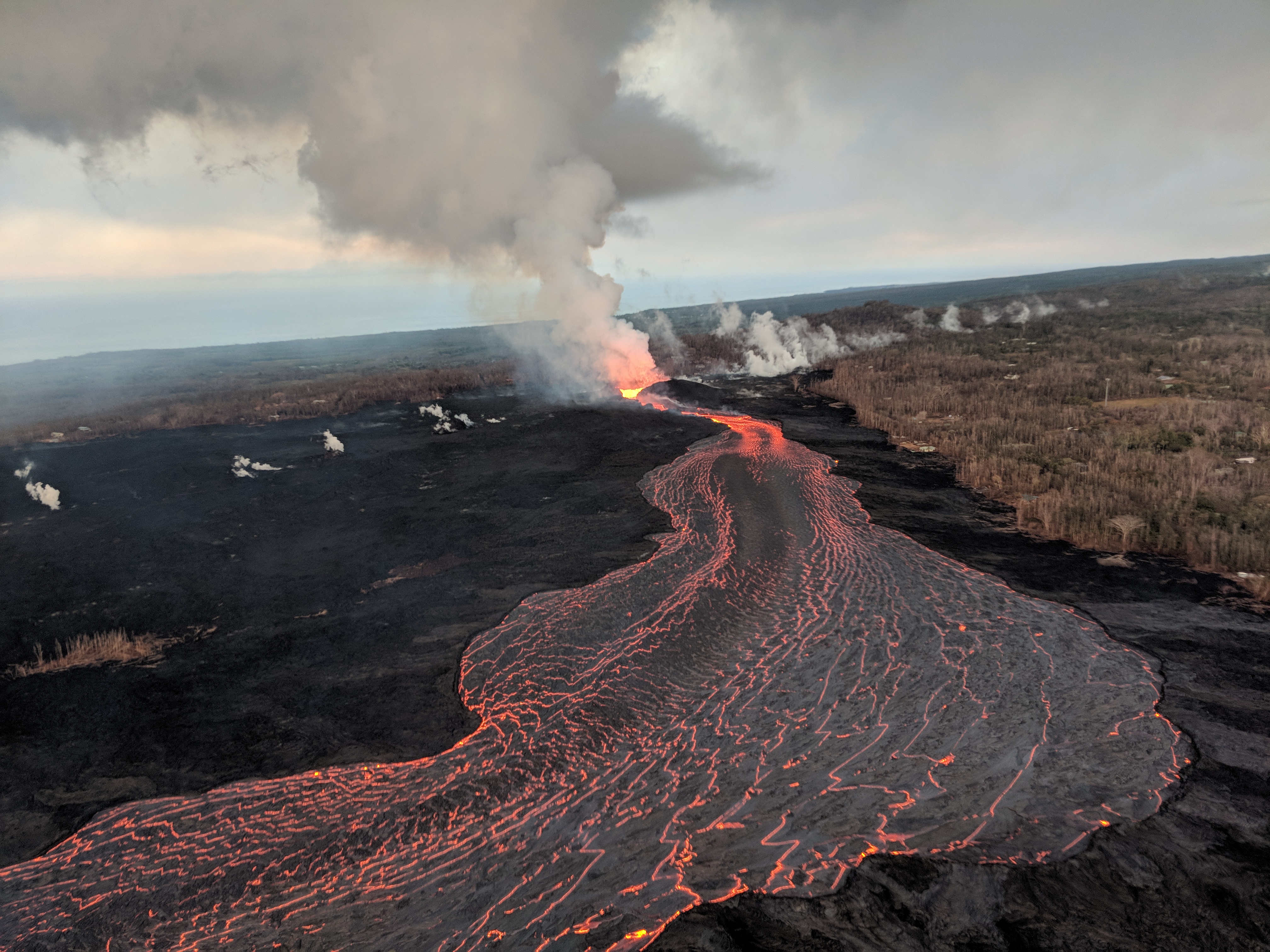
Kīlauea's 2018 lower Puna eruption. Fissure 8 on Kīlauea's lower East Rift Zone continues to erupt, feeding a channel that carries lava to the coast. This aerial image captured during HVO's early morning overflight, shows the erupting vent (center) and near-vent part of the channel. |
| Date | |
| Source |
https://volcanoes.usgs.gov/volcanoes/kilauea/multimedia_chronology.html https://volcanoes.usgs.gov/observatories/hvo/multimedia_uploads/multimediaFile-2481.jpg |
| Author | United States Geological Survey |
Licensing
[edit].jpg&action=edit§ion=2)
This image is in the public domain in the United States because it only contains materials that originally came from the United States Geological Survey, an agency of the United States Department of the Interior. For more information, see the official USGS copyright policy.
|
File history
Click on a date/time to view the file as it appeared at that time.
| Date/Time | Thumbnail | Dimensions | User | Comment | |
|---|---|---|---|---|---|
| current | 12:42, 14 November 2018 | | 4,032 × 3,024 (7.34 MB) | Batholith (talk | contribs) | == {{int:filedesc}} == {{Information |description= {{en|Lava channel from Fissure 8 in Kīlauea 2018 eruptions. {{cquote|Fissure 8 on Kīlauea's lower East Rift Zone continues to erupt, feeding a channel that carries lava to the coast. This aerial image captured during HVO's early morning overflight, shows the erupting vent (center) and near-vent part of the channel. |author=USGS}} }} |date=2018-07-22 |source=https://volcanoes.usgs.gov/volcanoes/kilauea/multimedia_chronology.h... |
You cannot overwrite this file.
File usage on Commons
The following page uses this file:
.jpg&oldid=912608714)