File:USGS Kīlauea multimediaFile-2185 (2018-06-06).jpg
Jump to navigation
Jump to search

Size of this preview: 800 × 600 pixels. Other resolutions: 320 × 240 pixels | 640 × 480 pixels | 1,024 × 768 pixels | 1,280 × 960 pixels | 2,560 × 1,920 pixels | 4,032 × 3,024 pixels.
Original file (4,032 × 3,024 pixels, file size: 9.05 MB, MIME type: image/jpeg)
Captions
Captions
Add a one-line explanation of what this file represents
Summary
[edit].jpg&action=edit§ion=1)
| Object location | | View this and other nearby images on: OpenStreetMap |
|---|
.jpg¶ms=019.506611_N_-154.817796_E_globe:Earth_class:object_type:object_region:US_&language=en)
Licensing
[edit].jpg&action=edit§ion=2)
This image is in the public domain in the United States because it only contains materials that originally came from the United States Geological Survey, an agency of the United States Department of the Interior. For more information, see the official USGS copyright policy.
|
File history
Click on a date/time to view the file as it appeared at that time.
| Date/Time | Thumbnail | Dimensions | User | Comment | |
|---|---|---|---|---|---|
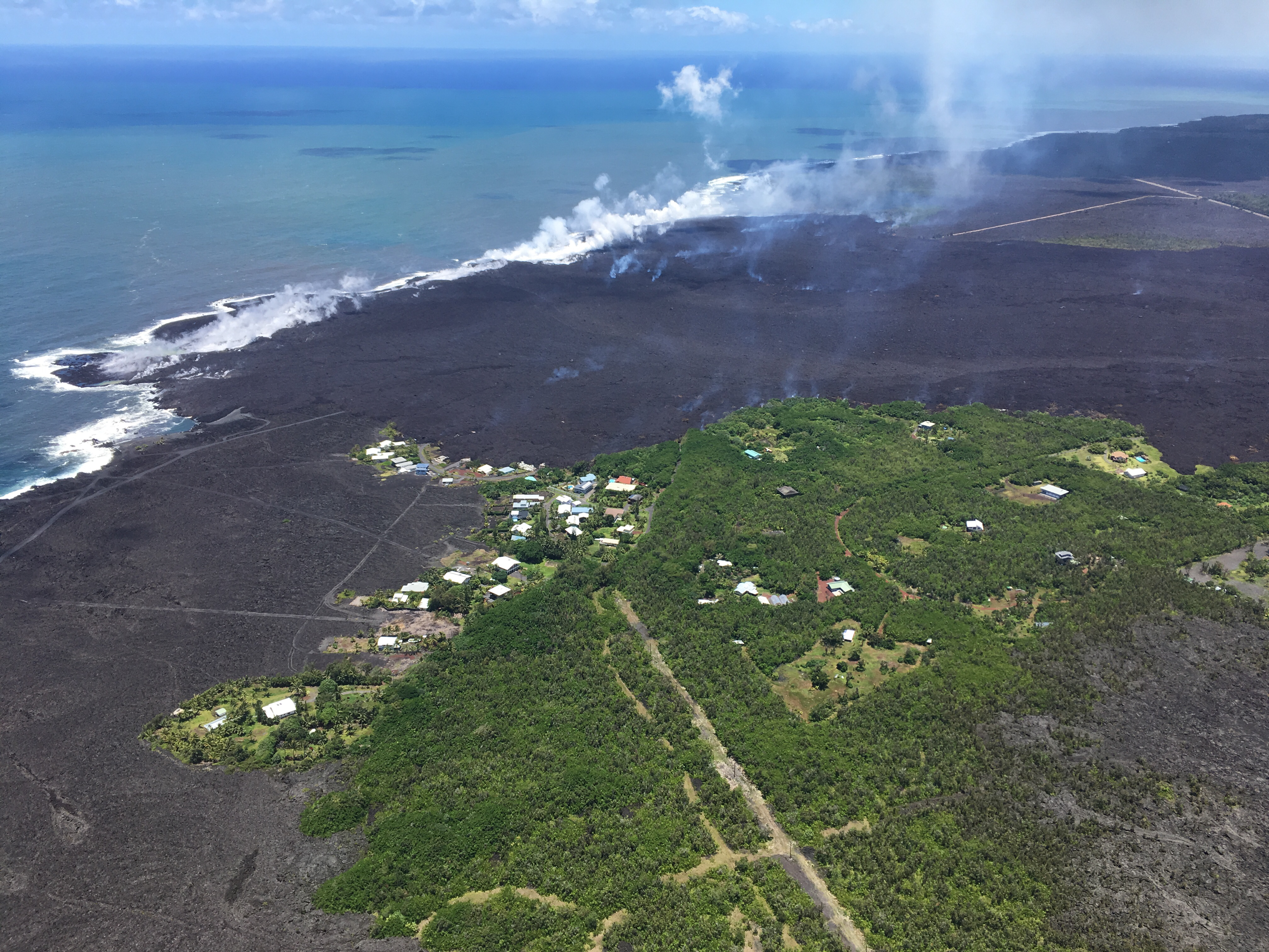
| current | 13:42, 14 November 2018 | | 4,032 × 3,024 (9.05 MB) | Batholith (talk | contribs) | == {{int:filedesc}} == {{Information |description= {{cquote|Views from HVO's helicopter overflight at 1PM HST, show the remains of the Kapoho Beach Lots subdivision and the fissure 8 flow front. The northern flow margin in this area was unchanged from HVO's morning flight and appeared to have stopped advancing at the time of the flight.|author=USGS}} |date=2018-06-06 |source=https://volcanoes.usgs.gov/volcanoes/kilauea/multimedia_chronology.html<br/>https://volcanoes.... |
You cannot overwrite this file.
File usage on Commons
The following page uses this file:
.jpg&oldid=911670937)