File:U.S. Route 60 Virginia Beach Terminus (24906675810).jpg
Jump to navigation
Jump to search

Size of this preview: 600 × 600 pixels. Other resolutions: 240 × 240 pixels | 480 × 480 pixels | 768 × 768 pixels | 1,024 × 1,024 pixels | 2,484 × 2,484 pixels.
Original file (2,484 × 2,484 pixels, file size: 4.8 MB, MIME type: image/jpeg)
Captions
Captions
Add a one-line explanation of what this file represents
Summary
[edit].jpg&action=edit§ion=1)
| Description |
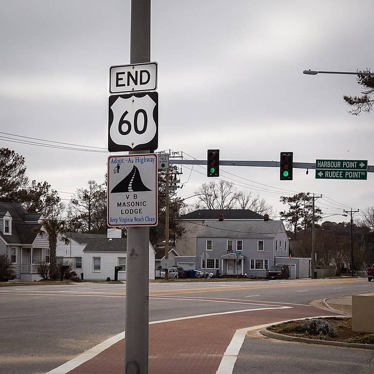
English: Eastern Terminus U.S. Highway 60 U.S. Route 60 runs from this point in Virginia Beach, VA, about 2,670 miles (4,300 km) to south western Arizona. |
| Date | |
| Source | https://www.flickr.com/photos/mobili/24906675810/ |
| Author | Mobilus In Mobili |
| Permission (Reusing this file) |
At the time of upload, the image license was automatically confirmed using the Flickr API. For more information see Flickr API detail. |
| Flickr sets |
|
| Flickr pools |
|
| Flickr tags |
|
| Camera location | | View this and other nearby images on: OpenStreetMap |
|---|
.jpg¶ms=036.829433_N_-075.973567_E_globe:Earth_type:camera_alt:9.7_source:exif_&language=en)
Licensing
[edit].jpg&action=edit§ion=2)
This file is licensed under the Creative Commons Attribution-Share Alike 2.0 Generic license.
- You are free:
- to share – to copy, distribute and transmit the work
- to remix – to adapt the work
- Under the following conditions:
- attribution – You must give appropriate credit, provide a link to the license, and indicate if changes were made. You may do so in any reasonable manner, but not in any way that suggests the licensor endorses you or your use.
- share alike – If you remix, transform, or build upon the material, you must distribute your contributions under the same or compatible license as the original.
| This image was originally posted to Flickr by Mobilus In Mobili at https://flickr.com/photos/52257493@N00/24906675810. It was reviewed on 15 March 2017 by FlickreviewR and was confirmed to be licensed under the terms of the cc-by-sa-2.0. |
File history
Click on a date/time to view the file as it appeared at that time.
| Date/Time | Thumbnail | Dimensions | User | Comment | |
|---|---|---|---|---|---|
| current | 20:13, 15 March 2017 | | 2,484 × 2,484 (4.8 MB) | Fæ (talk | contribs) | Mobilus In Mobili, Set 72157662127250564, ID 24906675810, Original title U.S. Route 60 Virginia Beach Terminus |
You cannot overwrite this file.
File usage on Commons
The following page uses this file:
File usage on other wikis
The following other wikis use this file:
- Usage on en.wikipedia.org
- Usage on fr.wikipedia.org
- Usage on ko.wikipedia.org
.jpg&oldid=782522646)