File:Tysons Tower Tysons VA 2017 02 12 02.jpg
Jump to navigation
Jump to search

Size of this preview: 460 × 600 pixels. Other resolutions: 184 × 240 pixels | 368 × 480 pixels | 589 × 768 pixels | 785 × 1,024 pixels | 1,570 × 2,048 pixels | 2,629 × 3,429 pixels.
Original file (2,629 × 3,429 pixels, file size: 1.74 MB, MIME type: image/jpeg)
Captions
Captions
Add a one-line explanation of what this file represents
Summary
[edit]
| Description |
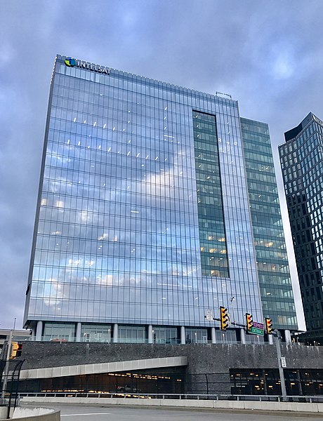
English: Tysons Tower is a 330-foot (100 m) high-rise office building, completed in 2014, in the Tysons Corner Center complex in Tysons, Virginia. Photographed from Westpark Drive on February 12, 2017 by Quercus montana |
| Date | |
| Source | Own work |
| Author | Quercus montana |
| Camera location | | View this and other nearby images on: OpenStreetMap |
|---|
| Object location | | View this and other nearby images on: OpenStreetMap |
|---|
Licensing
[edit]
I, the copyright holder of this work, hereby publish it under the following license:
This file is licensed under the Creative Commons Attribution-Share Alike 4.0 International license.
- You are free:
- to share – to copy, distribute and transmit the work
- to remix – to adapt the work
- Under the following conditions:
- attribution – You must give appropriate credit, provide a link to the license, and indicate if changes were made. You may do so in any reasonable manner, but not in any way that suggests the licensor endorses you or your use.
- share alike – If you remix, transform, or build upon the material, you must distribute your contributions under the same or compatible license as the original.
File history
Click on a date/time to view the file as it appeared at that time.
| Date/Time | Thumbnail | Dimensions | User | Comment | |
|---|---|---|---|---|---|
| current | 15:50, 15 February 2017 | | 2,629 × 3,429 (1.74 MB) | Quercus montana (talk | contribs) | Version of photo with slight edits. |
| 15:46, 15 February 2017 |  | 3,024 × 4,032 (1.94 MB) | Quercus montana (talk | contribs) | User created page with UploadWizard |
You cannot overwrite this file.
File usage on Commons
The following page uses this file:
File usage on other wikis
The following other wikis use this file:
- Usage on ar.wikipedia.org
- Usage on azb.wikipedia.org
- Usage on az.wikipedia.org
- Usage on cs.wikipedia.org
- Usage on da.wikipedia.org
- Usage on en.wikipedia.org
- Intelsat
- List of companies headquartered in Northern Virginia
- List of tallest buildings in Virginia
- List of tallest buildings in Tysons, Virginia
- Wikipedia:WikiProject University of Virginia/Truth and Evidence in Academic Research/Listeria/SNAC but no gender
- List of tallest buildings in the Washington metropolitan area
- Usage on es.wikipedia.org
- Usage on fr.wikipedia.org
- Usage on he.wikipedia.org
- Usage on hu.wikipedia.org
- Usage on it.wikipedia.org
- Usage on pl.wikipedia.org
- Usage on ru.wikipedia.org
- Usage on uk.wikipedia.org
- Usage on www.wikidata.org