File:Tyrrhenian Sea (MODIS 2020-07-01).jpg
Jump to navigation
Jump to search

Size of this preview: 775 × 599 pixels. Other resolutions: 310 × 240 pixels | 621 × 480 pixels | 993 × 768 pixels | 1,280 × 990 pixels | 2,560 × 1,980 pixels | 4,441 × 3,435 pixels.
Original file (4,441 × 3,435 pixels, file size: 1.68 MB, MIME type: image/jpeg)
Captions
Captions
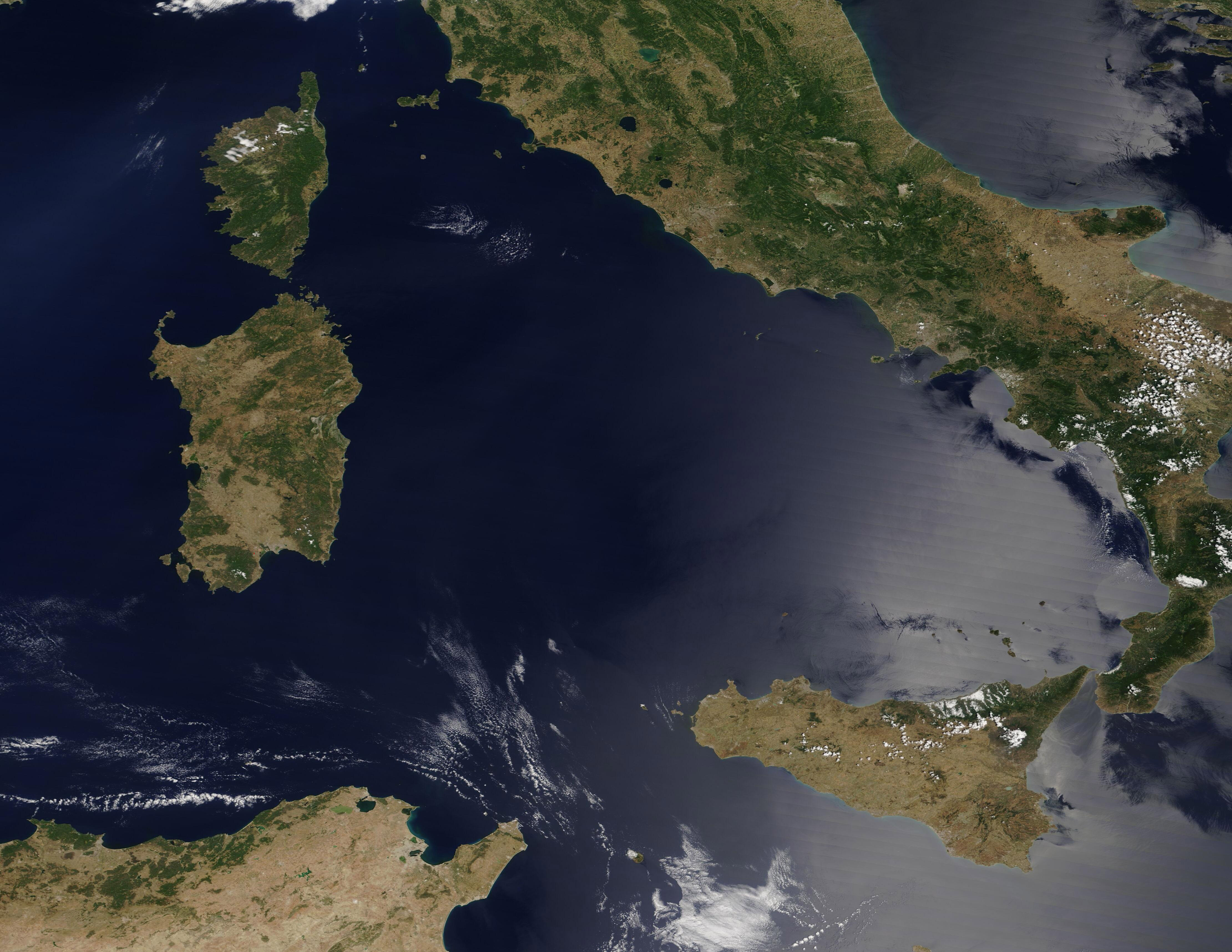
The skies over the Tyrrhenian Sea were clear and cloud-free on June 29, 2020, when the Moderate Resolution Imaging Spectroradiometer (MODIS) on board NASA’s Terra satellite acquired a true-color image of the region.
Summary
[edit].jpg&action=edit§ion=1)
| Description |
English: The skies over the Tyrrhenian Sea were clear and cloud-free on June 29, 2020, when the Moderate Resolution Imaging Spectroradiometer (MODIS) on board NASA’s Terra satellite acquired a true-color image of the region.
With a surface area of 106,200 square miles (275,057 sq. km), the Tyrrhenian Sea spans an area slightly larger than the state of Colorado. Bordered by the islands of Corsica and Sardinia in the west and Sicily in the south, the eastern coastline runs along the coast of Italy, from Elba Island to Calabria. The Italian coastline varies greatly, from sandy beaches to rocky outcroppings, and contains many bays and capes. Eight Aeolian Islands and the small island of Ustica are found in the southern part of the sea, north of Sicily. |
||
| Date | Taken on 29 June 2020 | ||
| Source |
|
||
| Author | MODIS Land Rapid Response Team, NASA GSFC |
| This media is a product of the Terra mission Credit and attribution belongs to the mission team, if not already specified in the "author" row |
Licensing
[edit].jpg&action=edit§ion=2)
| This file is in the public domain in the United States because it was solely created by NASA. NASA copyright policy states that "NASA material is not protected by copyright unless noted". (See Template:PD-USGov, NASA copyright policy page or JPL Image Use Policy.) | ||
 |
Warnings:
|
File history
Click on a date/time to view the file as it appeared at that time.
| Date/Time | Thumbnail | Dimensions | User | Comment | |
|---|---|---|---|---|---|
| current | 03:00, 17 February 2024 | | 4,441 × 3,435 (1.68 MB) | OptimusPrimeBot (talk | contribs) | #Spacemedia - Upload of http://modis.gsfc.nasa.gov/gallery/images/image07012020_250m.jpg via Commons:Spacemedia |
You cannot overwrite this file.
File usage on Commons
There are no pages that use this file.
.jpg&oldid=909381094)