File:Typhoon Nesat 06 jun 2005 0140Z.jpg
Jump to navigation
Jump to search
Size of this preview: 600 × 600 pixels. Other resolutions: 240 × 240 pixels | 480 × 480 pixels | 768 × 768 pixels | 1,024 × 1,024 pixels | 2,048 × 2,048 pixels | 4,000 × 4,000 pixels.
Original file (4,000 × 4,000 pixels, file size: 2.07 MB, MIME type: image/jpeg)
Captions
Captions
Add a one-line explanation of what this file represents
Summary
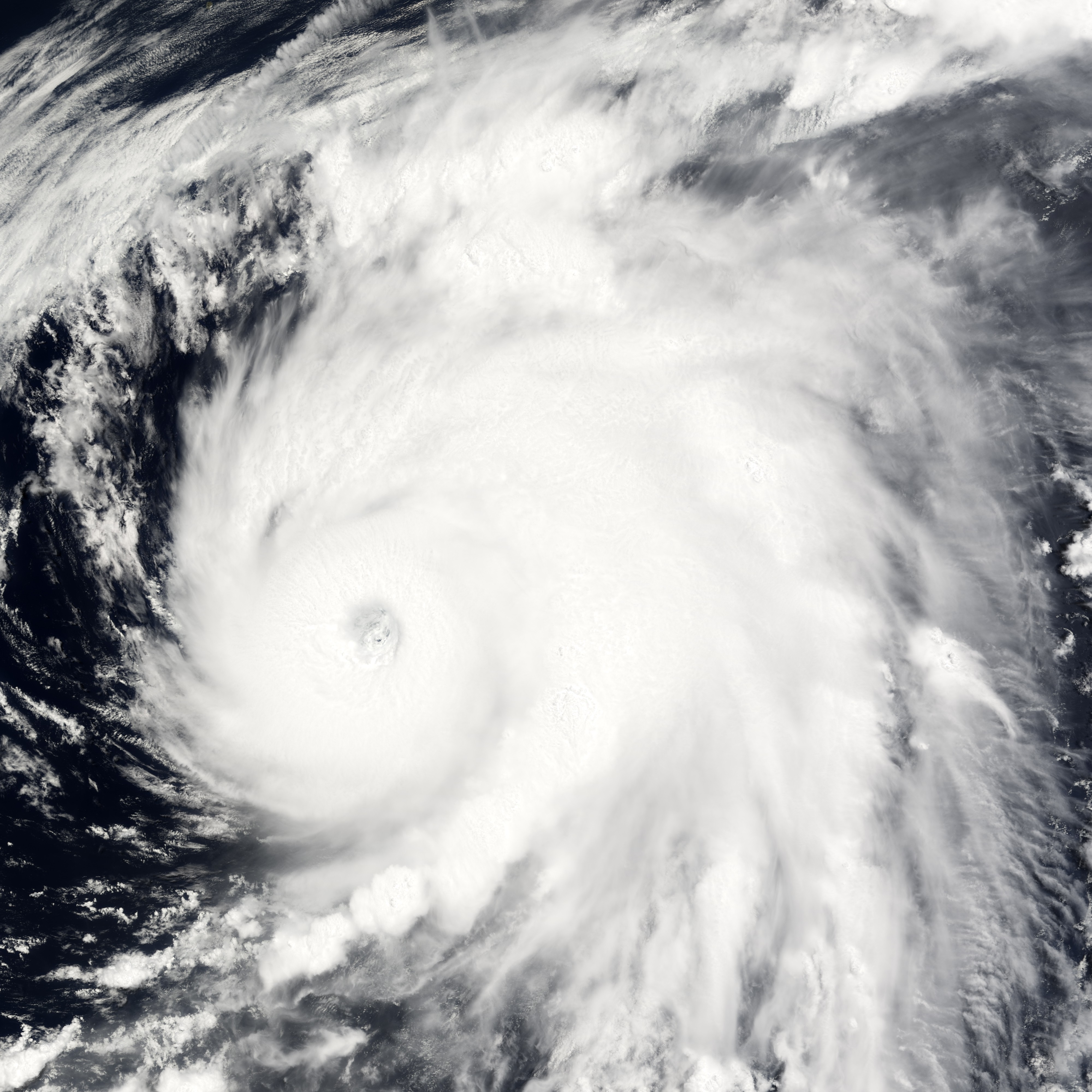
[edit]| Description | Typhoon Nesat was the equivalent of a strong Category 3 hurricane and was strengthening into a Category 4 storm when the Moderate Resolution Imaging Spectroradiometer (MODIS) on NASA’s Terra satellite captured this image on June 6, 2005, at 1:40 UTC. Nesat is moving north through the Philippine Sea towards Japan. It is expected to curve east over the North Pacific Ocean before it reaches the Japanese coast. In this image, tight bands of clouds spiral into a delicate eye. These clear, swirling patterns will disappear as the storm dissipates over the cool waters of the Pacific Ocean. | |||||
| Date | ||||||
| Source | http://earthobservatory.nasa.gov/NaturalHazards/natural_hazards_v2.php3?img_id=12896 | |||||
| Author | NASA image created by Jesse Allen, Earth Observatory, using data obtained from the Goddard Earth Sciences DAAC. | |||||
| Permission (Reusing this file) |
|

File history
Click on a date/time to view the file as it appeared at that time.
| Date/Time | Thumbnail | Dimensions | User | Comment | |
|---|---|---|---|---|---|
| current | 16:55, 19 November 2006 | | 4,000 × 4,000 (2.07 MB) | Good kitty (talk | contribs) | == Summary == {{Information |Description=Typhoon Nesat was the equivalent of a strong Category 3 hurricane and was strengthening into a Category 4 storm when the Moderate Resolution Imaging Spectroradiometer (MODIS) on NASA’s Terra satellite captured th |
You cannot overwrite this file.
File usage on Commons
There are no pages that use this file.