File:Typhoon Mawar 24 aug 2005 0405.jpg
Jump to navigation
Jump to search
Size of this preview: 600 × 600 pixels. Other resolutions: 240 × 240 pixels | 480 × 480 pixels | 768 × 768 pixels | 1,024 × 1,024 pixels | 2,048 × 2,048 pixels | 6,000 × 6,000 pixels.
Original file (6,000 × 6,000 pixels, file size: 4.88 MB, MIME type: image/jpeg)
Captions
Captions
Add a one-line explanation of what this file represents
Summary
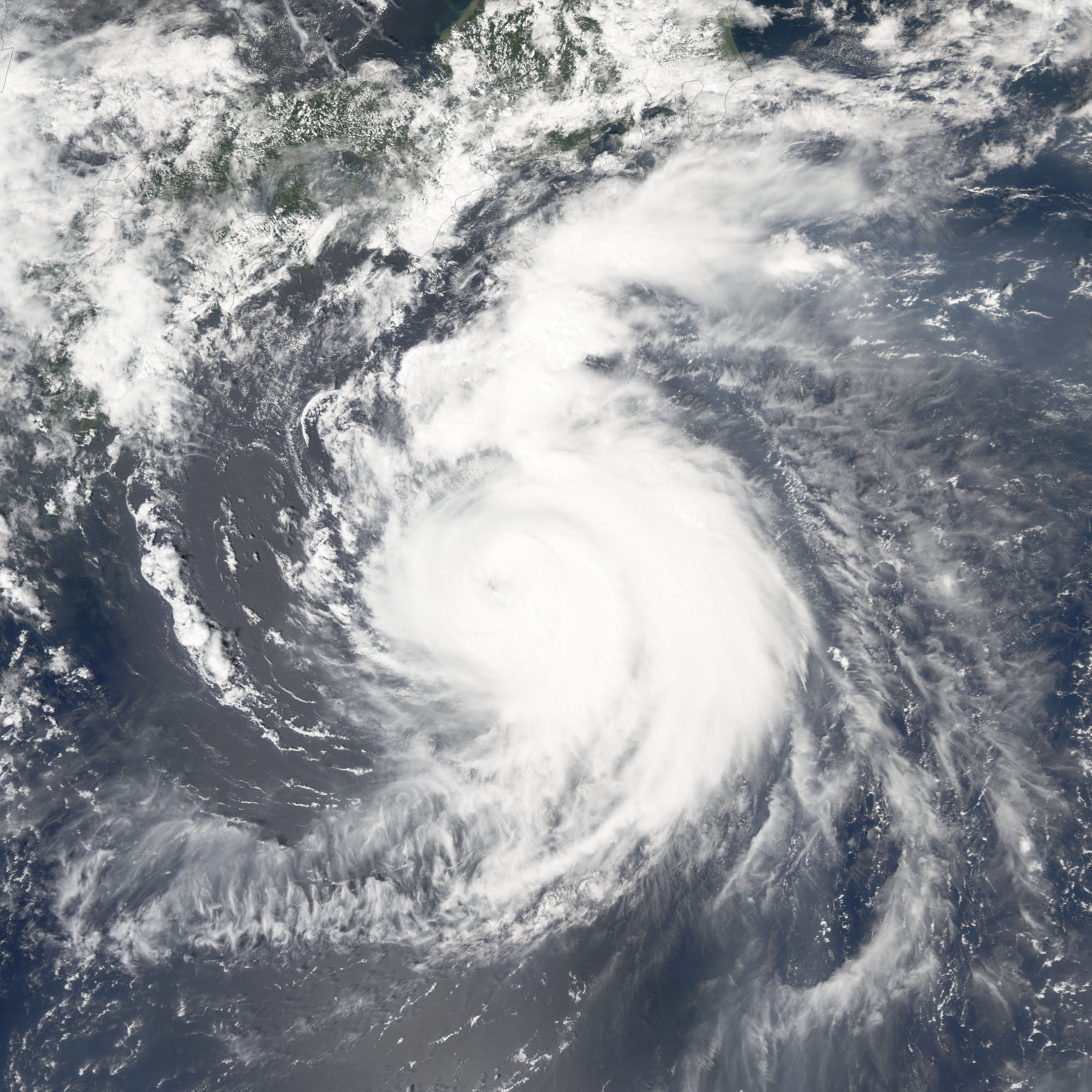
[edit]| Description | Typhoon Mawar was approaching the coast of Japan on the afternoon of August 24, 2005. The Moderate Resolution Imaging Spectroradiometer (MODIS) on NASA’s Aqua satellite captured this image at 1:05 p.m. local time. At this time, Mawar had peak winds around 195 km/hr (120 mph). It is a few hundred kilometres south of Tokyo and heading north at around 12 mph. Forecasters call for it to come ashore in southern Honshu (the largest of the islands that make up Japan) in the afternoon of August 25, 2005. | |||||
| Date | ||||||
| Source | http://earthobservatory.nasa.gov/NaturalHazards/natural_hazards_v2.php3?img_id=13066 | |||||
| Author | NASA image created by Jesse Allen, Earth Observatory, using data obtained courtesy of the MODIS Rapid Response team. | |||||
| Permission (Reusing this file) |
|

File history
Click on a date/time to view the file as it appeared at that time.
| Date/Time | Thumbnail | Dimensions | User | Comment | |
|---|---|---|---|---|---|
| current | 16:51, 19 November 2006 | | 6,000 × 6,000 (4.88 MB) | Good kitty (talk | contribs) | == Summary == {{Information |Description=Typhoon Mawar was approaching the coast of Japan on the afternoon of August 24, 2005. The Moderate Resolution Imaging Spectroradiometer (MODIS) on NASA’s Aqua satellite captured this image at 1:05 p.m. local time |
You cannot overwrite this file.
File usage on Commons
There are no pages that use this file.