File:Typhoon Fanapi 2010 navy.jpg
Jump to navigation
Jump to search

Size of this preview: 600 × 600 pixels. Other resolutions: 240 × 240 pixels | 480 × 480 pixels | 768 × 768 pixels | 1,024 × 1,024 pixels.
Original file (1,024 × 1,024 pixels, file size: 203 KB, MIME type: image/jpeg)
Captions
Captions
Add a one-line explanation of what this file represents
Summary
[edit]
| Description |
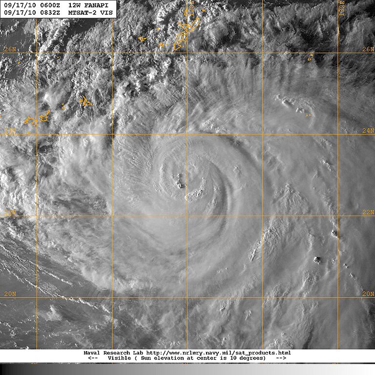
English: Typhoon Fanapi |
| Date | |
| Source | http://www.nrlmry.navy.mil/tcdat/tc10/WPAC/12W.FANAPI/vis/geo/1km_zoom/20100917.0832.mtsat2.x.vis1km_high.12WFANAPI.75kts-967mb-227N-1280E.100pc.jpg |
| Author | NAVY |
| Other versions | File:Fanapi_Sept_16_2010_0230Z.jpg |
| Camera location | | View this and other nearby images on: OpenStreetMap |
|---|
Licensing
[edit]
This file is a work of a sailor or employee of the U.S. Navy, taken or made as part of that person's official duties. As a work of the U.S. federal government, it is in the public domain in the United States.
|
 | |
| This file has been identified as being free of known restrictions under copyright law, including all related and neighboring rights. | ||
File history
Click on a date/time to view the file as it appeared at that time.
| Date/Time | Thumbnail | Dimensions | User | Comment | |
|---|---|---|---|---|---|
| current | 12:25, 17 September 2010 | | 1,024 × 1,024 (203 KB) | Waihorace (talk | contribs) | {{Information |Description={{en|1=Typhoon Fanapi}} |Source=http://www.nrlmry.navy.mil/tcdat/tc10/WPAC/12W.FANAPI/vis/geo/1km_zoom/20100917.0832.mtsat2.x.vis1km_high.12WFANAPI.75kts-967mb-227N-1280E.100pc.jpg |Author=NAVY |Date=2010-09-17 |Permission= |oth |
You cannot overwrite this file.
File usage on Commons
There are no pages that use this file.