File:Txu-oclc-6614190-ng44-11.jpg
Jump to navigation
Jump to search
Size of this preview: 800 × 599 pixels. Other resolutions: 320 × 239 pixels | 640 × 479 pixels | 1,024 × 766 pixels | 1,280 × 958 pixels | 2,560 × 1,916 pixels | 5,000 × 3,742 pixels.
Original file (5,000 × 3,742 pixels, file size: 5.51 MB, MIME type: image/jpeg)
Captions
Captions
Add a one-line explanation of what this file represents
Summary
[edit]| Description |
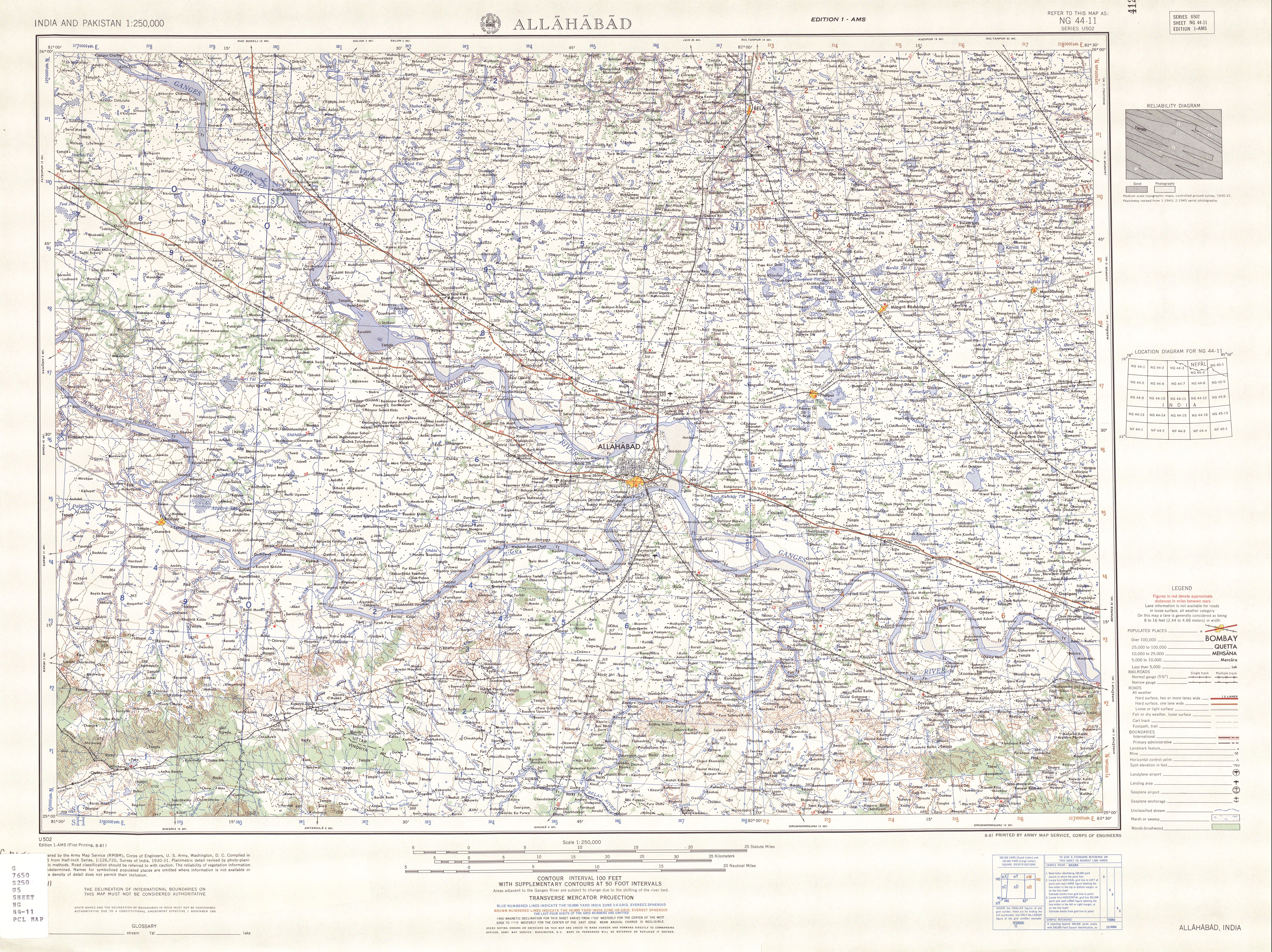
English: Map of Allahabad and surroundings, part of: India and Pakistan 1:250,000. Series U502, U.S. Army Map Service, 1955-. Map NG 44-11 Allahabad. |
| Date | |
| Source | http://www.lib.utexas.edu/maps/ams/india/txu-oclc-6614190-ng44-11.jpg |
| Creator |
U. S. Army Map Service |
| Georeferencing | If inappropriate please set warp_status = skip to hide. |
| Other versions |
File:Txu-oclc-6614190-ng44-11 cropped.jpg (cropped)
|

Licensing
[edit]
This file is a work of a U.S. Army soldier or employee, taken or made as part of that person's official duties. As a work of the U.S. federal government, it is in the public domain in the United States.
|
 |
File history
Click on a date/time to view the file as it appeared at that time.
| Date/Time | Thumbnail | Dimensions | User | Comment | |
|---|---|---|---|---|---|
| current | 16:15, 27 December 2010 | | 5,000 × 3,742 (5.51 MB) | BishkekRocks (talk | contribs) | {{Information |Description={{en|1=Map of Allahabad and surroundings, part of: [http://www.lib.utexas.edu/maps/ams/india/ India and Pakistan 1:250,000. Series U502, U.S. Army Map Service, 1955-.] Map NG 44-11 Allahabad.}} |Source=Map Allahabad and surround |
You cannot overwrite this file.
File usage on Commons
The following page uses this file: